Luxor Temple Luxor Temple is a large Ancient Egyptian temple complex located on the east bank of the Nile River in the city today known as Luxor (ancient Thebes) and was founded in 1400 BCE. Known in the Egyptian language as ipet resyt, or "the southern sanctuary." In Luxor there are six great temples, the four on the left bank are known to travellers and readers of travels as Goornah, Deir-el-Bahri, the Ramesseum, and Medinet Habu; and the two temples on the right bank are known as the Karnak and Luxor.[1]
To the rear of the temple are chapels built by Tuthmosis III, and Alexander. During the Roman era, the temple and its surroundings were a legionary fortress and the home of the Roman government in the area
Posts: 5374 | From: sepedat/sirius | Registered: Jul 2012
| IP: Logged |
The Karnak Temple Complex, commonly known as Karnak (/kɑːr.næk/[1]), comprises a vast mix of decayed temples, chapels, pylons, and other buildings. Building at the complex began during the reign of Senusret I in the Middle Kingdom and continued into the Ptolemaic period, although most of the extant buildings date from the New Kingdom. The area around Karnak was the ancient Egyptian Ipet-isut ("The Most Selected of Places") and the main place of worship of the eighteenth dynasty Theban Triad with the god Amun as its head. It is part of the monumental city of Thebes. The Karnak complex gives its name to the nearby, and partly surrounded, modern village of El-Karnak, 2.5 kilometres (1.6 miles) north of Luxor.
The complex is a vast open-air museum, and the second largest ancient religious site in the world, after the Angkor Wat Temple of Cambodia. It is believed to be the second most visited historical site in Egypt; only the Giza Pyramids near Cairo receive more visits. It consists of four main parts, of which only the largest is currently open to the general public. The term Karnak often is understood as being the Precinct of Amun-Re only, because this is the only part most visitors see. The three other parts, the Precinct of Mut, the Precinct of Montu, and the dismantled Temple of Amenhotep IV, are closed to the public. There also are a few smaller temples and sanctuaries connecting the Precinct of Mut, the Precinct of Amun-Re, and the Luxor Temple.
The Precinct of Mut is very ancient, being dedicated to an Earth and creation deity, but not yet restored. The original temple was destroyed and partially restored by Hatshepsut, although another pharaoh built around it in order to change the focus or orientation of the sacred area. Many portions of it may have been carried away for use in other buildings.
The key difference between Karnak and most of the other temples and sites in Egypt is the length of time over which it was developed and used. Construction of temples started in the Middle Kingdom and continued through to Ptolemaic times. Approximately thirty pharaohs contributed to the buildings, enabling it to reach a size, complexity, and diversity not seen elsewhere. Few of the individual features of Karnak are unique, but the size and number of features are overwhelming. The deities represented range from some of the earliest worshiped to those worshiped much later in the history of the Ancient Egyptian culture. Although destroyed, it also contained an early temple built by Amenhotep IV (Akhenaten), the pharaoh who later would celebrate a near monotheistic religion he established that prompted him to move his court and religious center away from Thebes. It also contains evidence of adaptations, using buildings of the Ancient Egyptians by later cultures for their own religious purposes.
One famous aspect of Karnak is the Hypostyle Hall in the Precinct of Amun-Re, a hall area of 50,000 sq ft (5,000 m2) with 134 massive columns arranged in 16 rows. 122 of these columns are 10 meters tall, and the other 12 are 21 meters tall with a diameter of over three meters.
The architraves on top of these columns are estimated to weigh 70 tons. These architraves may have been lifted to these heights using levers. This would be an extremely time-consuming process and also would require great balance to get to such great heights. A common alternative theory regarding how they were moved is that large ramps were constructed of sand, mud, brick or stone and that the stones were then towed up the ramps. If stone had been used for the ramps, they would have been able to use much less material. The top of the ramps presumably would have employed either wooden tracks or cobblestones for towing the megaliths.
There is an unfinished pillar in an out-of-the-way location that indicates how it would have been finished. Final carving was executed after the drums were put in place so that it was not damaged while being placed.[2][3] Several experiments moving megaliths with ancient technology were made at other locations some of them are listed here.
In 2009 UCLA launched a website dedicated to virtual reality digital reconstructions of the Karnak complex and other resources.[4]
History
Main article: History of the Karnak Temple complex
The history of the Karnak complex is largely the history of Thebes and its changing role in the culture. Religious centers varied by region and with the establishment of the current capital of the unified culture that changed several times. The city of Thebes does not appear to have been of great significance before the Eleventh Dynasty and previous temple building here would have been relatively small, with shrines being dedicated to the early deities of Thebes, the Earth goddess Mut and Montu. Early building was destroyed by invaders. The earliest known artifact found in the area of the temple is a small, eight-sided temple from the Eleventh Dynasty, which mentions Amun-Re. Amun (sometimes called Amen) was long the local tutelary deity of Thebes. He was identified with the Ram and the Goose. The Egyptian meaning of Amun is, "hidden" or, the "hidden god".[5]
Major construction work in the Precinct of Amun-Re took place during the Eighteenth dynasty when Thebes became the capital of the unified Ancient Egypt.
Thutmose I erected an enclosure wall connecting the Fourth and Fifth pylons, which comprise the earliest part of the temple still standing in situ. Construction of the Hypostyle Hall also may have begun during the eighteenth dynasty, although most new building was undertaken under Seti I and Ramesses II.
Almost every pharaoh of that dynasty has added something to the temple site. Merneptah commemorated his victories over the Sea Peoples on the walls of the Cachette Court, the start of the processional route to the Luxor Temple.
Hatshepsut had monuments constructed and also restored the original Precinct of Mut, the ancient great goddess of Egypt, that had been ravaged by the foreign rulers during the Hyksos occupation. She had twin obelisks, at the time the tallest in the world, erected at the entrance to the temple. One still stands, as the tallest surviving ancient obelisk on Earth; the other has broken in two and toppled. Another of her projects at the site, Karnak's Red Chapel, or Chapelle Rouge, was intended as a barque shrine and originally, may have stood between her two obelisks. She later ordered the construction of two more obelisks to celebrate her sixteenth year as pharaoh; one of the obelisks broke during construction, and thus, a third was constructed to replace it. The broken obelisk was left at its quarrying site in Aswan, where it still remains. Known as The Unfinished Obelisk, it demonstrates how obelisks were quarried.[6]
The last major change to Precinct of Amun-Re's layout was the addition of the first pylon and the massive enclosure walls that surround the whole Precinct, both constructed by Nectanebo I.
In 323 AD, Constantine the Great recognised the Christian religion, and in 356 Constantius II ordered the closing of pagan temples throughout the empire. Karnak was by this time mostly abandoned, and Christian churches were founded among the ruins, the most famous example of this is the reuse of the Festival Hall of Thutmose III's central hall, where painted decorations of saints and Coptic inscriptions can still be seen.
Posts: 5374 | From: sepedat/sirius | Registered: Jul 2012
| IP: Logged |
quote:Originally posted by Mike111: ^By now we should all have learned to be suspicious of Black artifacts which look Albino-like.
Once again the Albinos have sought to falsify Races and History.
I don't understand why so less is know about a person of such "magnitude and importance"? The odd thing is, the statue was "discovered" during the 1st "Nazi impulse"
Where are the depictions of the northers and sisters, "he" supposedly had?
Depiction of the father and mother.
Posts: 22234 | From: האם אינכם כילדי הכרית אלי בני ישראל | Registered: Nov 2010
| IP: Logged |
quote:Originally posted by Troll Patrol # Ish Gebor:
quote:Originally posted by Mike111: [qb] ^By now we should all have learned to be suspicious of Black artifacts which look Albino-like.
Once again the Albinos have sought to falsify Races and History.
I don't understand why so less is know about a person of such "magnitude and importance"? The odd thing is, the statue was "discovered" during the 1st "Nazi impulse"
Where are the depictions of the northers and sisters, "he" supposedly had?
They found the head broken off and reattached it
Do you agree with Mike that he looks like an albino?
Posts: 42921 | From: , | Registered: Jan 2010
| IP: Logged |
The Mortuary Temple of Queen Hatshepsut, the Djeser-Djeseru ("Holy of Holies"), is located beneath the cliffs at Deir el Bahari on the west bank of the Nile near the Valley of the Kings in Egypt. The mortuary temple is dedicated to the sun god Amon-Ra and is located next to the mortuary temple of Mentuhotep II, which served both as an inspiration, and later, a quarry. It is considered one of the "incomparable monuments of ancient Egypt." [1] The temple was the site of the massacre of 62 people, mostly tourists, by Islamist extremists that took place on 17 November 1997
Hatshepsut's chancellor, royal architect Senenmut oversaw construction.[2] Although the adjacent, earlier mortuary temple of Mentuhotep was used as a model, the two structures are nevertheless significantly different in many ways. Hatshepsut's temple employs a lengthy, colonnaded terrace that deviates from the centralised structure of Mentuhoteps model an anomaly that may be caused by the decentralized location of her burial chamber.[1] There are three layered terraces reaching 97 feet tall. Each story is articulated by a double colonnade of square piers, with the exception of the northwest corner of the central terrace, which employs Proto Doric columns to house the chapel. These terraces are connected by long ramps which were once surrounded by gardens with foreign plants including frankincense and myrrh trees.[2] The layering of Hatshepsut's temple corresponds with the classical Theban form, employing pylons, courts, hypostyle hall, sun court, chapel and sanctuary
The relief sculpture within Hatshepsuts temple recites the tale of the divine birth of a female pharaoh the first of its kind. The text and pictorial cycle also tell of an expedition to the Land of Punt, an exotic country on the Red Sea coast. While the statues and ornamentation have since been stolen or destroyed, the temple once was home to two statues of Osiris, a sphinx avenue as well as many sculptures of the Queen in different attitudes standing, sitting, or kneeling. Many of these portraits were destroyed at the order of her stepson Thutmose III after her death.
The main and axis of the temple is set to an azimuth of about 116½° and is aligned to the winter solstice sunrise,[3] which in our modern era occurs around the 21st or 22 December each year. The sunlight penetrates through to the rear wall of the chapel, before moving to the right to highlight one of the Osiris statutes that stand on either side of the doorway to the 2nd chamber.[3] A further subtlety to this main alignment is created by a light-box, which shows a block of sunlight that slowly moves from the central axis of the temple to first illuminate the god Amen-Ra to then shining on the kneeling figure of Thutmose III before finally illuminating the Nile god Hapi.[3] Additionally, because of the heightened angle of the sun, around 41 days on either side of the solstice, sunlight is able to penetrate via a secondary light-box through to the innermost chamber.[3] This inner-most chapel was renewed and expanded in the Ptolemaic era and has cult references to Imhotep the builder of Djoser's Step Pyramid and Amenhotep son of Hapu - the overseer of the works of Amenhotep III.[4]
Posts: 5374 | From: sepedat/sirius | Registered: Jul 2012
| IP: Logged |
Abydos /əˈbaɪdɒs/ is one of the oldest cities of ancient Egypt, and also of the eighth nome in Upper Egypt, of which it was the capital city. It is located about 11 kilometres (6.8 miles) west of the Nile at latitude 26° 10' N, near the modern Egyptian towns of el-'Araba el Madfuna and al-Balyana. The city was called Abdju in the ancient Egyptian language (ꜣbdw or AbDw as technically transcribed from hieroglyphs) meaning "the hill of the symbol or reliquary", a reference to a reliquary in which the sacred head of Osiris was preserved.
Considered one of the most important archaeological sites in Egypt, the sacred city of Abydos was the site of many ancient temples, including Umm el-Qa'ab, a royal necropolis where early pharaohs were entombed.[1] These tombs began to be seen as extremely significant burials and in later times it became desirable to be buried in the area, leading to the growth of the town's importance as a cult site.
Today, Abydos is notable for the memorial temple of Seti I, which contains an inscription from the nineteenth dynasty known to the modern world as the Abydos King List. It is a chronological list showing cartouches of most dynastic pharaohs of Egypt from Menes until Ramesses I, Seti's father.[2] The Great Temple and most of the ancient town are buried under the modern buildings to the north of the Seti temple.[3] Many of the original structures and the artifacts within them are considered irretrievable and lost; many may have been destroyed by the new construction.
The English name comes from the Greek Ἄβυδος, a name borrowed by Greek geographers from the unrelated city of Abydos on the
Abydos was occupied by the rulers of the Predynastic period,[4] whose town, temple and tombs have been found there. The temple and town continued to be rebuilt at intervals down to the times of the thirtieth dynasty, and the cemetery was used continuously.
The pharaohs of the first dynasty were buried in Abydos, including Narmer, who is regarded as founder of the first dynasty, and his successor, Aha.[5] It was in this time period that the Abydos boats were constructed. Some pharaohs of the second dynasty were also buried in Abydos. The temple was renewed and enlarged by these pharaohs as well. Funerary enclosures, misinterpreted in modern times as great 'forts', were built on the desert behind the town by three kings of the second dynasty; the most complete is that of Khasekhemwy.[6]
Part of the Abydos King List
Tomb relief depicting the vizier Nespeqashuty and his wife, KetjKetj, making the journey of the dead to the holy city of Abydos from Deir el-Bahri, Late Period, twenty-sixth dynasty of Egypt, reign of Psammetichus I
Panel from the Osiris temple: Horus presents royal regalia to a worshipping pharaoh.
The Osireion
Temple of Seti I, Abydos From the fifth dynasty, the deity Khentiamentiu, foremost of the Westerners, came to be seen as a manifestation of the dead pharaoh in the underworld. Pepi I (sixth dynasty) constructed a funerary chapel which evolved over the years into the Great Temple of Osiris, the ruins of which still exist within the town enclosure. Abydos became the centre of the worship of the Isis and Osiris cult.
During the First Intermediate Period, the principal deity of the area, Khentiamentiu, began to be seen as an aspect of Osiris, and the deities gradually merged and came to be regarded as one. Khentiamentiu's name became an epithet of Osiris. In the twelfth dynasty a gigantic tomb was cut into the rock by Senusret III. Associated with this tomb was a cenotaph, a cult temple and a small town known as Wah-Sut, that was used by the workers for these structures.[7]
The building during the eighteenth dynasty began with a large chapel of Ahmose I. Pyramid of Ahmose I was also constructed at Abydos -- the only pyramid in the area; very little of it remains today.
Thutmose III built a far larger temple, about 130 ft × 200 ft (40 m × 61 m). He also made a processional way leading past the side of the temple to the cemetery beyond, featuring a great gateway of granite.
Seti I, in the nineteenth dynasty, founded a temple to the south of the town in honor of the ancestral pharaohs of the early dynasties; this was finished by Ramesses II, who also built a lesser temple of his own. Merneptah added the Osireion just to the north of the temple of Seti.[7]
Ahmose II in the twenty-sixth dynasty rebuilt the temple again, and placed in it a large monolith shrine of red granite, finely wrought. The foundations of the successive temples were comprised within approximately 18 ft (5.5 m). depth of the ruins discovered in modern times; these needed the closest examination to discriminate the various buildings, and were recorded by more than 4000 measurements and 1000 levellings.[8]
The latest building was a new temple of Nectanebo I, built in the thirtieth dynasty. From the Ptolemaic times of the Greek occupancy of Egypt, that began three hundred years before the Roman occupancy that followed, the structure began to decay and no later works are known.[9]
Cult centre[edit]
From earliest times, Abydos was a cult centre, first of the local deity, Khentiamentiu, and from the end of the Old Kingdom, the rising cult of Osiris and Isis.
A tradition developed that the Early Dynastic cemetery was the burial place of Osiris and the tomb of Djer was reinterpreted as that of Osiris.
Decorations in tombs throughout Egypt, such as the one displayed to the right, record journeys to and from Abydos, as important pilgrimages made by individuals who were proud to have been able to make the vital trip.
Major constructions[edit]
Great Osiris Temple[edit]
Successively from the first dynasty to the twenty-sixth dynasty, nine or ten temples were built on one site at Abydos. The first was an enclosure, about 30 ft × 50 ft (9.1 m × 15.2 m), surrounded by a thin wall of unbaked bricks. Incorporating one wall of this first structure, the second temple of about 40 ft (12 m) square was built within a wall about 10 ft (3.0 m) thick. An outer temenos (enclosure) wall surrounded the grounds. This outer wall was thickened about the second or third dynasty. The old temple entirely vanished in the fourth dynasty, and a smaller building was erected behind it, enclosing a wide hearth of black ashes.
Pottery models of offerings are found in these ashes and probably were the substitutes for live sacrifices decreed by Khufu (or Cheops) in his temple reforms.
At an undetermined date, a great clearance of temple offerings had been made and a modern discovery of a chamber into which they were gathered has yielded the fine ivory carvings and the glazed figures and tiles that show the splendid work of the first dynasty. A vase of Menes with purple hieroglyphs inlaid into a green glaze and tiles with relief figures are the most important pieces found. The noble statuette of Cheops in ivory, found in the stone chamber of the temple, gives the only portrait of this great pharaoh.
The temple was rebuilt entirely on a larger scale by Pepi I in the sixth dynasty. He placed a great stone gateway to the temenos, an outer temenos wall and gateway, with a colonnade between the gates. His temple was about 40 ft × 50 ft (12 m × 15 m) inside, with stone gateways front and back, showing that it was of the processional type. In the eleventh dynasty Mentuhotep I added a colonnade and altars. Soon after, Mentuhotep II entirely rebuilt the temple, laying a stone pavement over the area, about 45 ft (14 m) square, and added subsidiary chambers. Soon thereafter in the twelfth dynasty, Senusret I laid massive foundations of stone over the pavement of his predecessor. A great temenos was laid out enclosing a much larger area and the new temple itself was about three times the earlier size.
Temple of Seti I[edit]
Egypt - Temple of Seti I, Abydus. Brooklyn Museum Archives, Goodyear Archival Collection
Views, Objects: Egypt. Abydos [selected images]. View 01: Egypt - Memnonium of Seti I. Wall Inscriptions, Abydos., n.d., New York. Brooklyn Museum Archives
Egypt - Abydos. Brooklyn Museum Archives, Goodyear Archival Collection The temple of Seti I was built on entirely new ground half a mile to the south of the long series of temples just described. This surviving building is best known as the Great Temple of Abydos, being nearly complete and an impressive sight. A principal purpose of the temple was that of a memorial temple to the king Seti I, as well as reverence of the early pharaohs, which is incorporated within as part of the "Rite of the Ancestors". The long list of the pharaohs of the principal dynastiesrecognized by Setiare carved on a wall and known as the "Abydos King List" (showing the cartouche name of many dynastic pharaohs of Egypt from the first, Narmer or Menes, until his time)- with the exception of those noted above. There were significant names deliberately left out of the list. So rare as an almost complete list of pharaoh names, the Table of Abydos, re-discovered by William John Bankes, has been called the "Rosetta Stone" of Egyptian archaeology, analogous to the Rosetta Stone for Egyptian writing, beyond the Narmer Palette.[10]
There also were seven chapels built for the worship of the pharaoh and principal deities, being the "state" deities Ptah, Re-Horakhty, and (centrally positioned) Amun-Re; the remaining three chapels are dedicated to the Abydos triad of Osiris, Isis and Horus. The rites recorded in the deity chapels represent the first complete form of the Daily Ritual, which was performed throughout temples daily in Egypt throughout the pharaonic period. At the back of the temple is an enigmatic structure known as the Osireion, which served as a cenotaph for Seti-Osiris, and is thought to be connected with the worship of Osiris as an "Osiris tomb" (Caulfield, Temple of the Kings). It is possible that from those chambers led out the great Hypogeum for the celebration of the Osiris mysteries, built by Merenptah (Murray, The Osireion at Abydos). The temple was originally 550 ft (170 m) long, but the forecourts are scarcely recognizable, and the part still in good condition is about 250 ft (76 m) long and 350 ft (110 m) wide, including the wing at the side. Magazines for food and offerings storage were built to either side of the forecourts, as well as a small palace for the king and his retinue, to the southeast of the first forecourt (Ghazouli, The Palace and Magazines Attached to the Temple of Sety I at Abydos and the Facade of This Temple. ASAE 58 (1959)).
Except for the list of pharaohs and a panegyric on Ramesses II, the subjects are not historical, but religious in nature, dedicated to the transformation of the king after his death. The temple reliefs are celebrated for their delicacy and artistic refinement, utilizing both the archaism of earlier dynasties with the vibrancy of late 18th Dynasty reliefs. The sculptures had been published mostly in hand copy, not facsimile, by Auguste Mariette in his Abydos, I. The temple has been partially recorded epigraphically by Amice Calverley and Myrtle Broome in their 4 volume publication of The Temple of King Sethos I at Abydos (1933-1958).
Ramesses II temple[edit]
The adjacent temple of Ramesses II was much smaller and simpler in plan; but it had a fine historical series of scenes around the outside that lauded his achievements, of which the lower parts remain. The outside of the temple was decorated with scenes of the Battle of Kadesh. His list of pharaohs, similar to that of Seti I, formerly stood here; but the fragments were removed by the French consul and sold to the British Museum
Posts: 5374 | From: sepedat/sirius | Registered: Jul 2012
| IP: Logged |
The Temple of Edfu is an ancient Egyptian temple located on the west bank of the Nile in the city of Edfu which was known in Greco-Roman times as Apollonopolis Magna, after the chief god Horus-Apollo.[1] It is one of the best preserved temples in Egypt. The temple, dedicated to the falcon god Horus, was built in the Ptolemaic period between 237 and 57 BC. The inscriptions on its walls provide important information on language, myth and religion during the Greco-Roman period in ancient Egypt. In particular, the Temple's inscribed building texts "provide details [both] of its construction, and also preserve information about the mythical interpretation of this and all other temples as the Island of Creation."[2] There are also "important scenes and inscriptions of the Sacred Drama which related the age-old conflict between Horus and Seth."[3] They are translated by the German Edfu-Project
Edfu was one of several temples built during the Ptolemaic period, including Dendera, Esna, Kom Ombo and Philae. Its size reflects the relative prosperity of the time.[4] The present temple, which was begun "on 23 August 237 BC, initially consisted of a pillared hall, two transverse halls, and a barque sanctuary surrounded by chapels."[5] The building was started during the reign of Ptolemy III and completed in 57 BC under Ptolemy XII. It was built on the site of an earlier, smaller temple also dedicated to Horus, although the previous structure was oriented east-west rather than north-south as in the present site. A ruined pylon lies just to the east of the current temple; inscriptional evidence has been found indicating a building program under the New Kingdom rulers Ramesses I, Seti I and Ramesses II
The temple of Edfu fell into disuse as a religious monument following Theodosius I's edict banning non-Christian worship within the Roman Empire in 391. As elsewhere, many of the temple's carved reliefs were razed by followers of the Christian faith which came to dominate Egypt. The blackened ceiling of the hypostyle hall, visible today, is believed to be the result of arson intended to destroy religious imagery that was then considered pagan.
Over the centuries, the temple became buried to a depth of 12 metres (39 ft) beneath drifting desert sand and layers of river silt deposited by the Nile. Local inhabitants built homes directly over the former temple grounds. Only the upper reaches of the temple pylons were visible by 1798, when the temple was identified by a French expedition. In 1860 Auguste Mariette, a French Egyptologist, began the work of freeing Edfu temple from the sands.
The Temple of Edfu is nearly intact and a very good example of an ancient Egyptian temple.[7] The Temple of Edfu's archaeological significance and high state of preservation has made it a centre for tourism in Egypt and a frequent stop for the many riverboats that cruise the Nile. In 2005, access to the temple was revamped with the addition of a visitor center and paved carpark.[8] A sophisticated lighting system was added in late 2006 to allow night visits
Religious significance
The temple of Edfu is the largest temple dedicated to Horus and Hathor of Dendera.[10] It was the center of several festivals sacred to Horus. Each year, "Hathor travelled south from her temple at Denderah to visit Horus at Edfu, and this event marking their sacred marriage was the occasion of a great festival and pilgrimage
Posts: 5374 | From: sepedat/sirius | Registered: Jul 2012
| IP: Logged |
Dendera Temple complex, (Ancient Egyptian: Iunet or Tantere; the 19th-century English spelling in most sources, including Belzoni, was Tentyra) is located about 2.5 km south-east of Dendera, Egypt. It is one of the best-preserved temple complexes in Egypt. The area was used as the sixth Nome of Upper Egypt, south of Abydos
Description
The massive mudbrick compound walls seen from the temple roof. The whole complex covers some 40,000 square meters and is surrounded by a hefty mud brick enclosed wall. Dendera was a site for chapels or shrines from the beginning of history of ancient Egypt. It seems that pharaoh Pepi I (ca. 2250 BC) built on this site and evidence exists of a temple in the eighteenth dynasty (ca 1500 BC). But the earliest extant building in the compound today is the Mammisi raised by Nectanebo II last of the native pharaohs (360343 BC). The features in the complex include Hathor temple (the main temple), Temple of the birth of Isis, Sacred Lake, Sanatorium, Mammisi of Nectanebo II, Christian Basilica, Roman Mammisi, a Bark shine, Gateways of Domitian & Trajan and the Roman Kiosk
Hathor temple
Reliefs of Cleopatra VII and her son by Julius Caesar, Caesarion at the Dendera Temple The all overshadowing building in the Complex is the main temple, namely Hathor temple (historically, called the Temple of Tentyra). The temple has been modified on the same site starting as far back as the Middle Kingdom, and continuing right up until the time of the Roman emperor Trajan.[1] The existing structure was built no later than the late Ptolemaic period. The temple, dedicated to Hathor, is one of the best preserved temples in all Egypt. Subsequent additions were added in Roman times. Layout elements of the Temple1.Large Hypostyle Hall 2.Small Hypostyle Hall 3.Laboratory 4.Storage Magazine 5.Offering Entry 6.Treasury 7.Exit to Well 8.Access to Stairwell 9.Offering Hall 10.Hall of the Ennead 11.Great Seat and Main Sanctuary 12.Shrine of the Nome of Dendera 13.Shrine of Isis 14.Shrine of Sokar 15.Shrine of Harsomtus 16.Shrine of Hathor's Sistrum 17.Shrine of gods of Lower Egypt 18.Shrine of Hathor 19.Shrine of the Throne of Rê 20.Shrine of Rê 21.Shrine of Menat collar 22.Shrine of Ihy 23.The Pure Place 24.Court of the First Feast 25.Passage 26.Staircase to Roof
Depictions of Cleopatra VI which appear on temple walls are good examples Ptolemaic Egyptian art.[2] One depicts Cleopatra and her son, Caesarion.[3] On the rear of the temple exterior is a carving of Cleopatra VII Philopator and her son, Ptolemy XV Philopator Philometor Caesar, fathered by Julius Caesar.
The sculptured Dendera zodiac (or Denderah zodiac) is a widely known relief found in a late Greco-Roman temple, containing images of Taurus (the bull) and the Libra (the balance). A sketch was made of it during the Napoleonic campaign in Egypt. In 1820 it was removed from the temple ceiling and is now in the Louvre. Champollion's guess that it was Ptolemaic proved correct and Egyptologists now date it to the first century BC.[4]
Necropolis and crypts
The Dendera necropolis is a series of mastaba tombs. The necropolis dates from the Early Dynastic Period of the Old Kingdom to the First Intermediate Period of Egypt.[5] The necropolis runs the eastern edge of the western hill and over the northern plain. The subterranean Hathor temple tombs total 12 chambers. Some reliefs are dated to as late as Ptolemy XII Neos Dionysos reign. The crypts reportedly were used for storing vessels and divine iconography. An opening in the "Flame Room" floor leads to a narrow chamber with representations on the walls of the objects which were kept in them. In the second chamber, a relief depicts Phiops of the Sixth Dynasty. He holds a statuette of the Ihi to four images of Hathor. In the crypt, reached from the "Throne room", Ptolemy XII has jewelry and offerings for the gods.
The Dendera light
Dendera light, showing the single representation on the left wall of the right wing in one of the crypts Hathor Temple has a relief sometimes known as the Dendera light because of a controversial fringe thesis about its nature. The Dendera light images comprise five stone reliefs (two of which contain a pair of what fringe authors refer to as lights) in the Hathor temple at the Dendera Temple complex located in Egypt. The view of Egyptologists is that the relief is a mythological depiction of a djed pillar and a lotus flower, spawning a snake within, representing aspects of Egyptian mythology.[6][7]
In contrast to this interpretation, there is a fringe science suggestion that it is actually a representation of an Ancient Egyptian lightbulb
Posts: 5374 | From: sepedat/sirius | Registered: Jul 2012
| IP: Logged |
Philae /ˈfaɪliː/ (Greek: Φιλαί Philai; Ancient Egyptian: Pilak, P'aaleq; Arabic: فيله [fiːlɐ]) is an island in Lake Nasser, Egypt. It was formerly an island in the First Cataract of the Nile River and the previous site of an Ancient Egyptian temple complex in southern Egypt. The complex was dismantled and relocated to nearby Agilkia Island during a UNESCO project started because of the construction of the Aswan Dam, after the site was partly flooded by the earlier Aswan Low Dam for half a century
Philae is mentioned by numerous ancient writers, including Strabo,[2] Diodorus,[3] Ptolemy,[4] Seneca,[5] Pliny the Elder.[6] It was, as the plural name indicates, the appellation of two small islands situated in latitude 24° north, just above the First Cataract near Aswan (Ancient Egyptian: Swenet, "Trade;" Ancient Greek: Συήνη - Syene). Groskurd[7] computes the distance between these islands and Aswan at about 100 km (62 mi).
Despite being the smaller island, Philae proper was, from the numerous and picturesque ruins formerly there, the more interesting of the two. Prior to the inundation, it was not more than 380 metres (1,250 ft) long and about 120 metres (390 ft) broad. It is composed of Syenite stone: its sides are steep and on their summits a lofty wall was built encompassing the island.
Philae, being accounted one of the burying-places of Osiris, was held in high reverence both by the Egyptians to the north and the Nubians (often referred to as Ethiopians in Greek) to the south. It was deemed profane for any but priests to dwell there and was accordingly sequestered and denominated "the Unapproachable" (Ancient Greek: ̓́αβατος).[8] It was reported too that neither birds flew over it nor fish approached its shores.[9] These indeed were the traditions of a remote period; since in the time of the Ptolemies of Egypt, Philae was so much resorted to, partly by pilgrims to the tomb of Osiris, partly by persons on secular errands, that the priests petitioned Ptolemy Physcon (170-117 BC) to prohibit public functionaries at least from coming there and living at their expense. In the 19th century AD, William John Bankes took the Philae obelisk on which this petition was engraved to England. When its Egyptian hieroglyphs were compared with those of the Rosetta stone, it threw great light upon the Egyptian consonantal alphabet.
The islands of Philae were not, however, merely sacerdotal abodes; they were the centres of commerce also between Meroë and Memphis. For the rapids of the cataracts were at most seasons impracticable, and the commodities exchanged between Egypt and Nubia were reciprocally landed and re-embarked at Syene and Philae.
The neighbouring granite quarries also attracted a numerous population of miners and stonemasons; and, for the convenience of this traffic, a gallery or road was formed in the rocks along the east bank of the Nile, portions of which are still extant.
Philae also was remarkable for the singular effects of light and shade resulting from its position near the Tropic of Cancer. As the sun approached its northern limit the shadows from the projecting cornices and moldings of the temples sink lower and lower down the plain surfaces of the walls, until, the sun having reached its highest altitude, the vertical walls are overspread with dark shadows, forming a striking contrast with the fierce light which illuminates all surrounding objects
The most conspicuous feature of both islands was their architectural wealth. Monuments of various eras, extending from the Pharaohs to the Caesars, occupy nearly their whole area. The principal structures, however, lay at the south end of the smaller island.
The most ancient were the remains of a temple for Isis built in the reign of Nectanebo I during 380-362 BC, was approached from the river through a double colonnade. Nekhtnebef is his nomen and he became the founding pharaoh of the thirtieth and last dynasty of native rulers when he deposed and killed Nefaarud II. Isis was the goddess to whom the initial buildings were dedicated. See Gerhart Haeny's 'A Short Architectural History of Philae' (BIFAO 1985) and numerous other articles which incontrovertibly identify Isis (not Hathor) as the primary goddess of the sacred isle.
For the most part, the other ruins date from the Ptolemaic times, more especially with the reigns of Ptolemy Philadelphus, Ptolemy Epiphanes, and Ptolemy Philometor (282-145 BC), with many traces of Roman work in Philae dedicated to Ammon-Osiris.
In front of the propyla were two colossal lions in granite, behind which stood a pair of obelisks, each 13 metres (43 ft) high. The propyla were pyramidal in form and colossal in dimensions. One stood between the dromos and pronaos, another between the pronaos and the portico, while a smaller one led into the sekos or adytum. At each corner of the adytum stood a monolithic shrine, the cage of a sacred hawk. Of these shrines one is now in the Louvre, the other in the Museum at Florence.
Beyond the entrance into the principal court are small temples, one of which, dedicated to Isis, Hathor, and a wide range of deities related to midwifery, is covered with sculptures representing the birth of Ptolemy Philometor, under the figure of the god Horus. The story of Osiris is everywhere represented on the walls of this temple, and two of its inner chambers are particularly rich in symbolic imagery. Upon the two great propyla are Greek inscriptions intersected and partially destroyed by Egyptian figures cut across them.
The inscriptions do not at all belong to the Macedonian era, and are of earlier date than the sculptures,[citation needed] which were probably inserted during that interval of renaissance for the native religion which followed the extinction of the Greek dynasty in Egypt in 30 BC by the Romans.[citation needed]
The monuments in both islands indeed attested, beyond any others in the Nile valley, the survival of pure Egyptian art centuries after the last of the Pharaohs had ceased to reign. Great pains have been taken to mutilate the sculptures of this temple. The work of demolition is attributable, in the first instance, to the zeal of the early Christians, and afterward, to the policy of the Iconoclasts, who curried favour for themselves with the Byzantine court by the destruction of heathen images as well as Christian ones.[citation needed] It's notable that images/icons of Horus are often less mutilated than the other carvings. In some wall scenes, every figure and hieroglyphic text except that of Horus and his winged solar-disk representation have been meticulously scratched out by early Christians. This is presumably because the early Christians had some degree of respect for Horus or the legend of Horus - it may be because they saw parallels between the stories of Jesus and Horus (see Jesus Christ in comparative mythology).
The soil of Philae had been prepared carefully for the reception of its buildingsbeing leveled where it was uneven, and supported by masonry where it was crumbling or insecure. For example, the western wall of the Great Temple, and the corresponding wall of the dromos, were supported by very strong foundations, built below the pre-inundation level of the water, and rested on the granite which in this region forms the bed of the Nile. Here and there steps were hewn out from the wall to facilitate the communication between the temple and the river.
At the southern extremity of the dromos of the Great Temple was a smaller temple, apparently dedicated to Hathor; at least the few columns that remained of it are surmounted with the head of that goddess. Its portico consisted of twelve columns, four in front and three deep. Their capitals represented various forms and combinations of the palm branch, the doum-palm branch, and the lotus flower. These, as well as the sculptures on the columns, the ceilings, and the walls were painted with the most vivid colors, which, owing to the dryness of the climate, have lost little of their original brilliance.
Posts: 5374 | From: sepedat/sirius | Registered: Jul 2012
| IP: Logged |
The Abu Simbel temples are two massive rock temples in Abu Simbel (أبو سمبل in Arabic), a small village in Nubia, southern Egypt, near the border with Sudan. They are situated on the western bank of Lake Nasser, about 230 km southwest of Aswan (about 300 km by road). The complex is part of the UNESCO World Heritage Site known as the "Nubian Monuments,"[1] which run from Abu Simbel downriver to Philae (near Aswan). The twin temples were originally carved out of the mountainside during the reign of Pharaoh Ramesses II in the 13th century BC, as a lasting monument to himself and his queen Nefertari, to commemorate his alleged victory at the Battle of Kadesh. However, the complex was relocated in its entirety in 1968, on an artificial hill made from a domed structure, high above the Aswan High Dam reservoir.
The relocation of the temples was necessary to avoid their being submerged during the creation of Lake Nasser, the massive artificial water reservoir formed after the building of the Aswan High Dam on the Nile River
Construction
Construction of the temple complex started in approximately 1264 BC and lasted for about 20 years, until 1244 BC. Known as the "Temple of Ramesses, beloved by Amun" it was one of six rock temples erected in Nubia during the long reign of Ramesses II. Their purpose was to impress Egypt's southern neighbours, and also to reinforce the status of Egyptian religion in the region. Historians say that the design of Abu Simbel expresses a measure of ego and pride in Ramesses II.
Rediscovery
With the passage of time, the temples fell into disuse and eventually became covered by sand. Already in the 6th century BC, the sand covered the statues of the main temple up to their knees. The temple was forgotten until 1813, when Swiss orientalist Jean-Louis Burckhardt found the top frieze of the main temple. Burckhardt talked about his discovery with Italian explorer Giovanni Belzoni, who travelled to the site, but was unable to dig out an entry to the temple. Belzoni returned in 1817, this time succeeding in his attempt to enter the complex. A detailed early description of the temples, together with contemporaneous line drawings, can be found in Edward William Lane's Description of Egypt (1825-1828).[2]
Tour guides at the site relate the legend that "Abu Simbel" was a young local boy who guided these early re-discoverers to the site of the buried temple which he had seen from time to time in the shifting sands. Eventually, they named the complex after him
In 1959 an international donations campaign to save the monuments of Nubia began: the southernmost relics of this ancient human civilization were under threat from the rising waters of the Nile that were about to result from the construction of the Aswan High Dam.
One scheme to save the temples was based on an idea by William MacQuitty to build a clear fresh water dam around the temples, with the water inside kept at the same height as the Nile. There were to be underwater viewing chambers. In 1962 the idea was made into a proposal by architects Jane Drew and Maxwell Fry and civil engineer Ove Arup.[3] They considered that raising the temples ignored the effect of erosion of the sandstone by desert winds. However the proposal, though acknowledged to be extremely elegant, was rejected.
The salvage of the Abu Simbel temples began in 1964 by a multinational team of archeologists, engineers and skilled heavy equipment operators working together under the UNESCO banner; it cost some $40 million at the time. Between 1964 and 1968, the entire site was carefully cut into large blocks (up to 30 tons, averaging 20 tons), dismantled, lifted and reassembled in a new location 65 meters higher and 200 meters back from the river, in one of the greatest challenges of archaeological engineering in history.[4] Some structures were even saved from under the waters of Lake Nasser. Today, thousands of tourists visit the temples daily. Guarded convoys of buses and cars depart twice a day from Aswan, the nearest city. Many visitors also arrive by plane, at an airfield that was specially constructed for the temple complex.
The complex consists of two temples. The larger one is dedicated to Ra-Harakhty, Ptah and Amun, Egypt's three state deities of the time, and features four large statues of Ramesses II in the facade. The smaller temple is dedicated to the goddess Hathor, personified by Nefertari, Ramesses's most beloved of his many wives.[5] The temple is now open to the public
Posts: 5374 | From: sepedat/sirius | Registered: Jul 2012
| IP: Logged |
The Temple of Kom Ombo is an unusual double temple built during the Ptolemaic dynasty in the Egyptian town of Kom Ombo.[1] Some additions to it were later made during the Roman period. The building is unique because its 'double' design meant that there were courts, halls, sanctuaries and rooms duplicated for two sets of gods.[2] The southern half of the temple was dedicated to the crocodile god Sobek, god of fertility and creator of the world with Hathor and Khonsu.[2] Meanwhile, the northern part of the temple was dedicated to the falcon god Haroeris, also known as Horus the Elder, along "with Tasenetnofret (the Good Sister, a special form of Hathor) and Panebtawy (Lord of the Two Lands)."[2] The temple is atypical because everything is perfectly symmetrical along the main axis.
The temple was started by Ptolemy VI Philometor (180-145 BC) at the beginning of his reign and added to by other Ptolemys, most notably Ptolemy XIII (51-47 BC), who built the inner and outer hypostyle halls. The scene on the inner face of the rear wall of the temple is of particular interest, and "probably represents a set of surgical instruments."[2]
Much of the temple has been destroyed by the Nile, earthquakes, and later builders who used its stones for other projects. Some of the reliefs inside were defaced by Copts who once used the temple as a church. All the temples buildings in the southern part of the plateau were cleared of debris and restored by Jacques de Morgan in 1893.[2]
A few of the three-hundred crocodile mummies discovered in the vicinity are displayed in The Crocodile Museum
Posts: 5374 | From: sepedat/sirius | Registered: Jul 2012
| IP: Logged |
Medinet Habu is the name commonly given to the Mortuary Temple of Ramesses III, an important New Kingdom period structure in the location of the same name on the West Bank of Luxor in Egypt. Aside from its intrinsic size and architectural and artistic importance, the temple is probably best known as the source of inscribed reliefs depicting the advent and defeat of the Sea Peoples during the reign of Ramesses III.
The temple, some 150 m long, is of orthodox design, and resembles closely the nearby mortuary temple of Ramesses II (the Ramesseum). The temple precinct measures approximately 210 m (690 ft). by 300 m (1,000 ft) and contains more than 7,000 m2 (75,347 sq ft) of decorated wall reliefs.[1] Its walls are relatively well preserved and it is surrounded by a massive mudbrick enclosure, which may have been fortified. The original entrance is through a fortified gate-house, known as a migdol (a common architectural feature of Asiatic fortresses of the time).
Just inside the enclosure, to the south, are chapels of Amenirdis I, Shepenupet II and Nitiqret, all of whom had the title of Divine Adoratrice of Amun.
The first pylon leads into an open courtyard, lined with colossal statues of Ramesses III as Osiris on one side, and uncarved columns on the other. The second pylon leads into a peristyle hall, again featuring columns in the shape of Ramesses. This leads up a ramp that leads (through a columned portico) to the third pylon and then into the large hypostyle hall (which has lost its roof). Reliefs and actual heads of foreign captives were also found placed within the temple perhaps in an attempt to symbolise the king's control over Syria and Nubia.
In Coptic times, there was a church inside the temple structure, which has since been removed. Some of the carvings in the main wall of the temple have been altered by coptic carvings.
The Royal Palace was directly connected with the first courtyard of the Temple via the "Window of Appearances".[2][3]
Excavation
Initial excavation of the temple took place sporadically between 1859 and 1899, under the auspices of the Department of Antiquities. During these decades the main temple was cleared, a large number of Coptic period buildings removed and the site made accessible to visitors.
The further excavation, recording and conservation of the temple has been facilitated in chief part by the Architectural and Epigraphic Surveys of University of Chicago's Oriental Institute, almost continuously since 1924
Posts: 5374 | From: sepedat/sirius | Registered: Jul 2012
| IP: Logged |
Angkor Wat (Khmer: អង្គរវត្ត) was first a Hindu, later a Buddhist, temple complex in Cambodia and the largest religious monument in the world. The temple was built by the Khmer King Suryavarman II in the early 12th century in Yaśodharapura (Khmer: យសោធរបុរៈ, present-day Angkor), the capital of the Khmer Empire, as his state temple and eventual mausoleum. Breaking from the Shaiva tradition of previous kings, Angkor Wat was instead dedicated to Vishnu. As the best-preserved temple at the site, it is the only one to have remained a significant religious center since its foundation. The temple is at the top of the high classical style of Khmer architecture. It has become a symbol of Cambodia,[1] appearing on its national flag, and it is the country's prime attraction for visitors.
Angkor Wat combines two basic plans of Khmer temple architecture: the temple-mountain and the later galleried temple, based on early Dravidian architecture, with key features such as the Jagati. It is designed to represent Mount Meru, home of the devas in Hindu mythology: within a moat and an outer wall 3.6 kilometres (2.2 mi) long are three rectangular galleries, each raised above the next. At the centre of the temple stands a quincunx of towers. Unlike most Angkorian temples, Angkor Wat is oriented to the west; scholars are divided as to the significance of this. The temple is admired for the grandeur and harmony of the architecture, its extensive bas-reliefs, and for the numerous devatas adorning its walls.
The modern name, Angkor Wat, means "Temple City" or "City of Temples" in Khmer; Angkor, meaning "city" or "capital city", is a vernacular form of the word nokor (នគរ), which comes from the Sanskrit word nagara (नगर).[2] Wat is the Khmer word for "temple grounds" (Sanskrit: वाट vāṭa ""enclosure").[
Angkor Wat lies 5.5 kilometres (3.4 mi) north of the modern town of Siem Reap, and a short distance south and slightly east of the previous capital, which was centred at Baphuon. It is in an area of Cambodia where there is an important group of ancient structures. It is the southernmost of Angkor's main sites.
According to one legend, the construction of Angkor Wat was ordered by Indra to act as a palace for his son Precha Ket Mealea.[4] According to the 13th century Chinese traveler Daguan Zhou, it was believed by some that the temple was constructed in a single night by a divine architect.[5]
The initial design and construction of the temple took place in the first half of the 12th century, during the reign of Suryavarman II (ruled 1113 c. 1150). Dedicated to Vishnu, it was built as the king's state temple and capital city. As neither the foundation stela nor any contemporary inscriptions referring to the temple have been found, its original name is unknown, but it may have been known as "Varah Vishnu-lok" after the presiding deity. Work seems to have ended shortly after the king's death, leaving some of the bas-relief decoration unfinished.[6] In 1177, approximately 27 years after the death of Suryavarman II, Angkor was sacked by the Chams, the traditional enemies of the Khmer. Thereafter the empire was restored by a new king, Jayavarman VII, who established a new capital and state temple (Angkor Thom and the Bayon respectively) a few kilometers to the north.
In the late 13th century, Angkor Wat gradually moved from Hindu to Theravada Buddhist use, which continues to the present day. Angkor Wat is unusual among the Angkor temples in that although it was somewhat neglected after the 16th century it was never completely abandoned, its preservation being due in part to the fact that its moat also provided some protection from encroachment by the jungle.[7]
One of the first Western visitors to the temple was António da Madalena, a Portuguese monk who visited in 1586 and said that it "is of such extraordinary construction that it is not possible to describe it with a pen, particularly since it is like no other building in the world. It has towers and decoration and all the refinements which the human genius can conceive of."[8] In the mid-19th century, the temple was visited by the French naturalist and explorer, Henri Mouhot, who popularised the site in the West through the publication of travel notes, in which he wrote:
"One of these templesa rival to that of Solomon, and erected by some ancient Michelangelomight take an honorable place beside our most beautiful buildings. It is grander than anything left to us by Greece or Rome, and presents a sad contrast to the state of barbarism in which the nation is now plunged."[9]
Mouhot, like other early Western visitors, found it difficult to believe that the Khmers could have built the temple, and mistakenly dated it to around the same era as Rome. The true history of Angkor Wat was pieced together only from stylistic and epigraphic evidence accumulated during the subsequent clearing and restoration work carried out across the whole Angkor site. There were no ordinary dwellings or houses or other signs of settlement including cooking utensils, weapons, or items of clothing usually found at ancient sites. Instead there is the evidence of the monuments themselves.[10]
Facade of Angkor Wat, a drawing by Henri Mouhot
1870 by Émile Gsell
French postcard about Angkor Wat in 1911
Angkor Wat required considerable restoration in the 20th century, mainly the removal of accumulated earth and vegetation.[11] Work was interrupted by the civil war and Khmer Rouge control of the country during the 1970s and 1980s, but relatively little damage was done during this period other than the theft and destruction of mostly post-Angkorian statues.[12]
The temple is a powerful symbol of Cambodia, and is a source of great national pride that has factored into Cambodia's diplomatic relations with France, the United States and its neighbor Thailand. A depiction of Angkor Wat has been a part of Cambodian national flags since the introduction of the first version circa 1863.[13] From a larger historical and even transcultural perspective, however, the temple of Angkor Wat did not become a symbol of national pride sui generis but had been inscribed into a larger politico-cultural process of French-colonial heritage production in which the original temple site was presented in French colonial and universal exhibitions in Paris and Marseille between 1889 and 1937.[14] Angkor Wat's aesthetics were also on display in the plaster cast museum of Louis Delaporte called musée Indo-chinois which existed in the Parisian Trocadero Palace from c.1880 to the mid-1920s.[15]
The splendid artistic legacy of Angkor Wat and other Khmer monuments in the Angkor region led directly to France adopting Cambodia as a protectorate on 11 August 1863 and invading Siam to take control of the ruins. This quickly led to Cambodia reclaiming lands in the northwestern corner of the country that had been under Siamese (Thai) control since 1351 AD (Manich Jumsai 2001), or by some accounts, 1431 AD.[16] Cambodia gained independence from France on 9 November 1953 and has controlled Angkor Wat since that time
Posts: 5374 | From: sepedat/sirius | Registered: Jul 2012
| IP: Logged |
Hall of 1000 pillars with sculptures of riding horses
Srirangam Temple
Srirangam Temple Kiosk
Srirangam Temple
Srirangam Temple
The Sri Ranganathaswamy Temple or Thiruvarangam Tamil : திருவரங்கம் is a Hindu temple dedicated to Ranganatha, a reclining form of Hindu deity, Vishnu located in Srirangam, Tiruchirapalli, Tamil Nadu, India . Constructed in the Dravidian style of architecture,[1] this temple is glorified in the Thiviya Pirabandham, the early medieval Tamil literature canon of the Alvar saints from the 6th to 9th centuries AD and is counted among the 108 Divya Desams dedicated to Vishnu. The temple follows Thenkalai tradition of worship.[2]
It is one of the most illustrious Vaishnava temples in South India rich in legend and history. Its location, on an island in Cauvery river, has rendered it vulnerable to natural disasters as well as the rampaging of invading armies Muslim and European which repeatedly commandeered the site for military encampment.[3] The main entrance, known as the Rajagopuram (the royal temple tower), rises from the base area of around 13 cents (around 5720 sq ft) and goes up to 237 feet (72 m), moving up in eleven progressively smaller tiers. The annual 21 day festival conducted during the Tamil month of Margazhi (DecemberJanuary) attracts 1 million visitors. Srirangam temple is often listed as the largest functioning Hindu temple in the world, the still larger Angkor Wat being the largest existing temple.[4][5] The temple occupies an area of 156 acres (631,000 m²) with a perimeter of 4,116m (10,710 feet) making it the largest temple in India and one of the largest religious complexes in the world
Posts: 5374 | From: sepedat/sirius | Registered: Jul 2012
| IP: Logged |
Akshardham (Gujarati: સ્વામિનારાયણ અક્ષરધામ, Devnagari: स्वामिनारायण अक्षरधाम) is a Swaminarayan temple complex in Delhi, India.[1] Also referred to as Delhi Akshardham or Swaminarayan Akshardham, the complex displays millennia of traditional Hindu and Indian culture, spirituality, and architecture. The building is the second monument inspired and developed by Pramukh Swami Maharaj, the spiritual head of the Bochasanwasi Shri Akshar Purushottam Swaminarayan Sanstha, whose 3,000 volunteers helped 7,000 artisans construct Akshardham.[2][3]
The temple, which attracts approximately 70 percent of all tourists who visit Delhi,[4][5] was officially opened on 6 November 2005.[2] It sits near the banks of the Yamuna adjacent to the 2010 Commonwealth Games village in eastern New Delhi.[6] The temple, at the center of the complex, was built according to the Vastu Shastra and Pancharatra Shastra. In addition to the large central temple crafted entirely of stone, the complex features exhibitions on incidents from the life of Swaminarayan and the history of India, an IMAX feature on the early life of Swaminarayan as the teenage yogi, Nilkanth, a musical fountain on the message of the Upanishads, and large landscaped gardens. The temple is named after a belief in Swaminarayan Hinduism.[7]
The main monument, at the center of the complex, is 141-foot (43 m) high, 316-foot (96 m) wide, and 356-foot (109 m) long,[8] and is covered top to bottom with carved details of flora, fauna, dancers, musicians, and deities.
Designed in accordance with ancient Vedic text known as the Sthapatya Shastra, it features a blend of architectural styles from across India.[9][10] It is constructed entirely from Rajasthani pink sandstone and Italian Carrara marble, and has no support from steel or concrete.[11] The monument also consists of 234 ornately carved pillars, nine domes, and 20,000 murtis and statues of Hinduism's sadhus, devotees, and acharyas.[3] The monument also features the Gajendra Pith at its base, a plinth paying tribute to the elephant for its importance in Hindu culture and India's history. It contains 148 scale sized elephants in total and weighs a total of 3000 tons.[12]
Within the monument, under the central dome, lies a murti or statue of Swaminarayan which is 11-foot (3.4 m) high. The murti is surrounded by similar statues of the gurus of the sect.[13] Each murti is made of paanch dhaatu or five metals in accordance to Hindu tradition. Also within the central monument lie the murtis of other Hindu deities, including Sita Ram, Radha Krishna, Shiv Parvati, and Lakshmi Narayan
Posts: 5374 | From: sepedat/sirius | Registered: Jul 2012
| IP: Logged |
Thillai Natarajah Temple, Chidambaram or Chidambaram temple is a Hindu temple dedicated to Lord Shiva located in the town of Chidambaram, East-Central Tamil Nadu, South India. The temple is known as the foremost of all temples (Kovil) to Saivites and has influenced worship, architecture, sculpture and performance art for over two millennium. The Sangam classics list chief architect Viduvelvidugu Perumtaccan as directing an early renovation of the shrine.
A major shrine of Lord Shiva worship since the classical period, there have been several renovations and offerings to Chidambaram by the Pallava, Chola, Pandya, Vijayanagara and Chera royals in the ancient and pre-medieval periods. The temple as it stands now is mainly of the 12th and 13th centuries, with later additions in similar style.[1] Its bronze statues and stone sculptures depicting various deities and the famous Thillai trees (Excoecaria agallocha) of the surrounding forest reflect the highpoints of early Chola and Pallava art while its famed gold plated gopuram towers are medieval structural additions by the royals Aditya I, Parantaka Chola I, Kopperunchinga I, Krishnadevaraya and Jatavarman Sundara Pandyan. King Kocengannan Chola was born following prayers his parents offered at the temple and later in his life he refined its structure.[2][3][4] The shrine gave the town its name.
The deity that presides here is கூத்தன் - Thillai Koothan (Thillai Nataraja - Shiva, The Lord of Dance). Chidambaram is the birthplace of the sculpture and bronze image representation of Lord Shiva as the cosmic dancer, a Tamilian concept and motif in Chola art that has since become notable as a symbol of Hinduism. The shrine is the only Shiva temple to have its main deity represented in this anthropomorphic form, as the supreme being who performs all cosmic activities.[5][6] The consort deity here is Sivakami Amman (form of Amman - mother goddess and female energy). Two other forms of Lord Shiva are represented close to this in the vimana (inner sanctum) of the temple - as a crystallised lingam - the most common representation of Lord Shiva in temples, and as the aether space classical element, represented with empty space and a garland of fifty one hanging golden vilvam leaves (Aegle marmelos). Lord Shiva is captured in pose as Nataraja performing the Ananda Tandava ("Dance of Delight") in the golden hall of the shrine Pon Ambalam (பொன் அம்பலம்). The sculptures of Chidambaram inspired the postures of Bharatha Natyam. The Chidambaram complex is admired for its five famous halls (ambalam or sabhai), several grand smaller shrines to the Hindu deities Ganesh, Murugan, Vishnu and Sivakami Amman which contain Pandyan and Nayak architectural styles, and for its endowment from many water tanks, one of which links it to the Thillai Kali temple.[7]
Chidambaram is one of the five Pancha Bootha Sthalams, the holiest Shiva temples each representing one of the five classical elements; Chidambaram represents akasha (aether). Chidambaram is glorified in Tirumular's Tirumandhiram and was visited by Patañjali and Pulikaal Munivar.[8] It is the primary shrine of the 275 Paadal Petra Sthalams - Shiva Sthalams glorified in the early medieval Tevaram poems by Tamil Saivite Nayanar saints Tirunavukkarasar, Thirugnana Sambandar and Sundarar. Hailed in the Tiruvacakam series by Manikkavacakar, these very volumes of the Tirumurai literature canon were themselves found in secret chambers of the temple. The Periya Puranam, a biography of these Nayanar saints by Sekkizhar commissioned by emperor Kulothunga Chola II, was written in the shrine's Thousand Pillared Hall. In Kanda Puranam, the epic authored by Kachiyappa Sivachariar of Kanchipuram, the Chidambaram shrine is venerated as one of the three foremost Shiva abodes in the world, alongside Koneswaram temple of Trincomalee and Mount Kailash.
Posts: 5374 | From: sepedat/sirius | Registered: Jul 2012
| IP: Logged |
quote:Originally posted by Troll Patrol # Ish Gebor:
quote:Originally posted by Mike111: [qb] ^By now we should all have learned to be suspicious of Black artifacts which look Albino-like.
Once again the Albinos have sought to falsify Races and History.
I don't understand why so less is know about a person of such "magnitude and importance"? The odd thing is, the statue was "discovered" during the 1st "Nazi impulse"
Where are the depictions of the northers and sisters, "he" supposedly had?
They found the head broken off and reattached it
Do you agree with Mike that he looks like an albino?
He does look kinda' pale in limestone, if that is what you're asking me? But I find the question not nearly as important, as to know who actually "discovered" the statues do head? All I find on it is: "German/Austrian Expedition".
Which I find kind of odd, for a person with supposed great statue and presence.
The site has two heads found market as MFA 27.1123 and 27.296 Hemiunu
quote:It is thus clear that this minor squabble, contrary CO Dows Dunham's assumptions, and my own incorrect summaty of the situation in a previous publication," had nothing to do with the tomb of Hemiunu,or the Boston relief MFA27.296. The boundary dispute occurred in late 1912: the Boston Hemiunu reliefwas not discovered until December 1925.
Highlighting this correspondence hardly arnishes the exemplary collahoration hetween the German Austrian and the Americm expeditions to Giza in the first half of the twentieth century. In fact, there were severai minor "Grenzüberschrei- tungen" over the years. Fot example Georg Steindorff excavated G 2005, which lay clearly in the American portion of die Western Cemetery.4OAnd in 1938, Junker wrote:
Im Jahre 1912 hatte G. Reisner den anschließenden Teil seiner Konzession in Angriff genommen und dabei gebeten, daß das Südende der ansroßenden Mastaba, das auf unserem Gebier leg, ihm überlassen werde. Er fand hier die Kulrkammer des Sjf, 11, deren Zugang in einem Vorraum lag. (Boston Bulletin XI, 20):'
--herausgegeben (republished) von Antje Spiekermann
Zur Zierde gereicht ...LL Festschrift Bettina Schmitz zum GO. Geburtstag am 24. Juli 2008
Posts: 22234 | From: האם אינכם כילדי הכרית אלי בני ישראל | Registered: Nov 2010
| IP: Logged |
quote:Limestone relief fragment depicting portion of a man's head, facing right wearing curled wig.
Provenance
From Giza, Tomb G 4000 (Tomb of Hemiunu). 1925: excavated by the Harvard UniversityBoston Museum of Fine Arts Expedition; assigned to the MFA in the division of finds by the government of Egypt. (Accession date: January 1, 1927)
Credit Line Harvard UniversityBoston Museum of Fine Arts Expedition
posted
Magnificent African (Moors)Palace Fort in Spain
Alhambra (/ælˈhæmbrə/; Spanish: [aˈlambɾa]; Arabic: الْحَمْرَاء, [ʔælħæmˈɾˠɑːʔ], Al-Ḥamrā', lit. "the red one"),[a] the complete form of which was Calat Alhamra,[b] is a palace and fortress complex located in Granada, Andalusia, Spain. It was originally constructed as a small fortress in 889 and then largely ignored until its ruins were renovated and rebuilt in the mid-11th century by the Moorish emir Mohammed ben Al-Ahmar of the Emirate of Granada, who built its current palace and walls. It was converted into a royal palace in 1333 by Yusuf I, Sultan of Granada.[1]
Alhambra's Islamic palaces, as we know them today, were built for the last Muslim emirs in Spain and the court of the Nasrid dynasty. After the conquest of Granada by the Reyes Católicos ("Catholic Monarchs") in 1492, some portions were used by Christian rulers. The Palace of Charles V, built by Charles V, Holy Roman Emperor in 1527, was inserted in the Alhambra within the Nasrid fortifications. After being allowed to fall into disrepair for centuries, the buildings being occupied by squatters, Alhambra was rediscovered in the 19th century by European scholars and travelers, with restorations commencing. It is now one of Spain's major tourist attractions, exhibiting the country's most significant and well known Islamic architecture, together with 16th-century and later Christian building and garden interventions. Alhambra is a UNESCO World Heritage Site and the inspiration for many songs and stories.[2]
Moorish poets described it as "a pearl set in emeralds," an allusion to the colour of its buildings and the woods around them.[3] The palace complex was designed with the mountainous site in mind and many forms of technology were considered. The park (Alameda de la Alhambra), which is overgrown with wildflowers and grass in the spring, was planted by the Moors with roses, oranges, and myrtles; its most characteristic feature, however, is the dense wood of English elms brought by the Duke of Wellington in 1812. The park has a multitude of nightingales and is usually filled with the sound of running water from several fountains and cascades. These are supplied through a conduit 8 km (5.0 mi) long, which is connected with the Darro at the monastery of Jesus del Valle above Granada. [4]
Despite long neglect, willful vandalism, and some ill-judged restoration, Alhambra endures as an atypical example of Muslim art in its final European stages, relatively uninfluenced by the direct Byzantine influences found in the Mezquita of Córdoba. The majority of the palace buildings are quadrangular in plan, with all the rooms opening on to a central court, and the whole reached its present size simply by the gradual addition of new quadrangles, designed on the same principle, though varying in dimensions, and connected with each other by smaller rooms and passages. Alhambra was extended by the different Muslim rulers who lived in the complex. However, each new section that was added followed the consistent theme of "paradise on earth". Column arcades, fountains with running water, and reflecting pools were used to add to the aesthetic and functional complexity. In every case, the exterior was left plain and austere. Sun and wind were freely admitted. Blue, red, and a golden yellow, all somewhat faded through lapse of time and exposure, are the colors chiefly employed.[4]
The decoration consists, as a rule, of Arabic inscriptions that are manipulated into geometrical patterns wrought into arabesques. Painted tiles are largely used as panelling for the walls.[4] The palace complex is designed in the Mudéjar style, which is characteristic of western elements reinterpreted into Islamic forms and widely popular during the Reconquista, the reconquest of the Iberian Peninsula from the Muslims by the Christian kingdoms
Posts: 5374 | From: sepedat/sirius | Registered: Jul 2012
| IP: Logged |
posted
The Palace and Mosque of the African or Moor Kings of Spain.
The MosqueCathedral of Córdoba (Spanish: Mezquitacatedral de Córdoba), also known as the Great Mosque of Córdoba (Spanish: Mezquita de Córdoba),[2] whose ecclesiastical name is the Cathedral of Our Lady of the Assumption (Spanish: Catedral de Nuestra Señora de la Asunción),[3] is the Catholic cathedral of the Diocese of Córdoba dedicated to the Assumption of the Virgin Mary and located in the Spanish region of Andalusia.[4] The structure is regarded as one of the most accomplished monuments of Moorish architecture.
It originally was a Catholic church built by the Visigoths.[5][6] When Muslims conquered Spain in 711, the church was first divided into Muslim and Christian halves. This sharing arrangement of the site lasted until 784, when the Christian half was purchased by the Emir 'Abd al-Rahman I, who then proceeded to demolish the entire structure and build the grand mosque of Cordoba on its ground.[5][7] After the Reconquista, it was converted to a Roman Catholic church, culminating in the insertion of a Renaissance cathedral nave in the 16th century.[5][6]
Since the early 2000s, Spanish Muslims have lobbied the Roman Catholic Church to allow them to pray in the cathedral.[8][9] This Muslim campaign has been rejected on multiple occasions, both by the church authorities in Spain and by the Vatican
The Pyramid of the Sun is the largest building in Teotihuacan and one of the largest in Mesoamerica. Found along the Avenue of the Dead, in between the Pyramid of the Moon and the Ciudadela, and in the shadow of the massive mountain Cerro Gordo, the pyramid is part of a large complex in the heart of the city.
The name Pyramid of the Sun comes from the Aztecs, who visited the city of Teotihuacan centuries after it was abandoned; the name given to the pyramid by the Teotihuacanos is unknown. It was constructed in two phases. The first construction stage, around 100 A.D., brought the pyramid to nearly the size it is today. The second round of construction resulted in its completed size of 738 feet (224.942 meters) across and 246 feet (75 meters) high, making it the third largest pyramid in the world,[6] though still just over half the height of the Great Pyramid of Giza (146 metres). The second phase also saw the construction of an altar atop of the pyramid, which has not survived into modern times. The Adosada platform was added to the pyramid in the early third century, at around the same time that the Ciudadela and Temple of the Feathered Serpent, Teotihuacan Pyramid of the Feathered Serpent were constructed.
Over the structure the ancient Teotihuacanos finished their pyramid with lime plaster imported from surrounding areas, on which they painted brilliantly colored murals. While the pyramid has endured for centuries, the paint and plaster have not and are no longer visible. Jaguar heads and paws, stars, and snake rattles are among the few images associated with the pyramids.
It is thought that the pyramid venerated a deity within Teotihuacan society, however, little evidence exists to support this hypothesis. The destruction of the temple on top of the pyramid, by both deliberate and natural forces prior to the archaeological study of the site, has so far prevented identification of the pyramid with any particular deity
The Olmec were the first major civilization in Mexico following a progressive development in Soconusco.[1] They lived in the tropical lowlands of south-central Mexico, in the present-day states of Veracruz and Tabasco. It has been speculated that Olmec derive in part from neighboring Mokaya and/or MixeZoque.
The Olmec flourished during Mesoamerica's formative period, dating roughly from as early as 1500 BCE to about 400 BCE. Pre-Olmec cultures had flourished in the area since about 2500 BCE, but by 16001500 BCE, Early Olmec culture had emerged, centered on the San Lorenzo Tenochtitlán site near the coast in southeast Veracruz.[2] They were the first Mesoamerican civilization and laid many of the foundations for the civilizations that followed.[3] Among other "firsts", the Olmec appeared to practice ritual bloodletting and played the Mesoamerican ballgame, hallmarks of nearly all subsequent Mesoamerican societies.
The aspect of the Olmecs most familiar now is their artwork, particularly the aptly named "colossal heads".[4] The Olmec civilization was first defined through artifacts which collectors purchased on the pre-Columbian art market in the late 19th century and early 20th century. Olmec artworks are considered among ancient America's most striking
Posts: 5374 | From: sepedat/sirius | Registered: Jul 2012
| IP: Logged |
The Great Pyramid of Giza (also known as the Pyramid of Khufu or the Pyramid of Cheops) is the oldest and largest of the three pyramids in the Giza Necropolis bordering what is now El Giza, Egypt. It is the oldest of the Seven Wonders of the Ancient World, and the only one to remain largely intact.
Based on a mark in an interior chamber naming the work gang and a reference to fourth dynasty Egyptian Pharaoh Khufu,[1][2] Egyptologists believe that the pyramid was built as a tomb over a 10 to 20-year period concluding around 2560 BC. Initially at 146.5 metres (481 feet), the Great Pyramid was the tallest man-made structure in the world for over 3,800 years. Originally, the Great Pyramid was covered by casing stones that formed a smooth outer surface; what is seen today is the underlying core structure. Some of the casing stones that once covered the structure can still be seen around the base. There have been varying scientific and alternative theories about the Great Pyramid's construction techniques. Most accepted construction hypotheses are based on the idea that it was built by moving huge stones from a quarry and dragging and lifting them into place.
There are three known chambers inside the Great Pyramid. The lowest chamber is cut into the bedrock upon which the pyramid was built and was unfinished. The so-called[3] Queen's Chamber and King's Chamber are higher up within the pyramid structure. The main part of the Giza complex is a setting of buildings that included two mortuary temples in honour of Khufu (one close to the pyramid and one near the Nile), three smaller pyramids for Khufu's wives, an even smaller "satellite" pyramid, a raised causeway connecting the two temples, and small mastaba tombs surrounding the pyramid for nobles
Great Pyramid [Credit: Will & Deni McIntyreStone/Getty Images] The designations of the pyramidsKhufu, Khafre, and Menkaurecorrespond to the kings for whom they were built. The northernmost and oldest pyramid of the group was built for Khufu (Greek: Cheops), the second king of the 4th dynasty. Called the Great Pyramid, it is the largest of the three, the length of each side at the base averaging 755.75 feet (230 metres) and its original height being 481.4 feet (147 metres). The middle pyramid was built for Khafre (Greek: Chephren), the fourth of the eight kings of the 4th dynasty; the structure measures 707.75 feet (216 metres) on each side and was originally 471 feet (143 metres) high. The southernmost and last pyramid to be built was that of Menkaure (Greek: Mykerinus), the fifth king of the 4th dynasty; each side measures 356.5 feet (109 metres), and the structures completed height was 218 feet (66 metres). All three pyramids were plundered both internally and externally in ancient and medieval times. Thus, the grave goods originally deposited in the burial chambers are missing, and the pyramids no longer reach their original heights because they have been almost entirely stripped of their outer casings of smooth white limestone; the Great Pyramid, for example, is now only 451.4 feet (138 metres) high. That of Khafre retains the outer limestone casing only at its topmost portion. Constructed near each pyramid was a mortuary temple, which was linked via a sloping causeway to a valley temple on the edge of the Nile floodplain. Also nearby were subsidiary pyramids used for the burials of other members of the royal family.
The entrance to the Great Pyramid is on the north side, about 59 feet (18 metres) above ground level. A sloping corridor descends from it through the pyramids interior masonry, penetrates the rocky soil on which the structure rests, and ends in an unfinished underground chamber. From the descending corridor branches an ascending passageway that leads to a room known as the Queens Chamber and to a great slanting gallery that is 151 feet (46 metres) long. At the upper end of this gallery, a long and narrow passage gives access to the burial room proper, usually termed the Kings Chamber. This room is entirely lined and roofed with granite. From the chamber two narrow shafts run obliquely through the masonry to the exterior of the pyramid; it is not known whether they were designed for a religious purpose or were meant for ventilation. Above the Kings Chamber are five compartments separated by massive horizontal granite slabs; the likely purpose of these slabs was to shield the ceiling of the burial chamber by diverting the immense thrust exerted by the overlying masses of masonry.
The question of how the pyramids were built has not received a wholly satisfactory answer. The most plausible one is that the Egyptians employed a sloping and encircling embankment of brick, earth, and sand, which was increased in height and in length as the pyramid rose; stone blocks were hauled up the ramp by means of sledges, rollers, and levers. According to the ancient Greek historian Herodotus, the Great Pyramid took 20 years to construct and demanded the labour of 100,000 men. This figure is believable given the assumption that these men, who were agricultural labourers, worked on the pyramids only (or primarily) while there was little work to be done in the fieldsi.e., when the Nile River was in flood. By the late 20th century, however, archaeologists found evidence that a more limited workforce may have occupied the site on a permanent rather than a seasonal basis. It was suggested that as few as 20,000 workers, with accompanying support personnel (bakers, physicians, priests, etc.), would have been adequate for the task.
Great Sphinx [Credit: Art Media/Heritage-Images] To the south of the Great Pyramid near Khafres valley temple lies the Great Sphinx. Carved out of limestone, the Sphinx has the facial features of a man but the body of a recumbent lion; it is approximately 240 feet (73 metres) long and 66 feet (20 metres) high. (See sphinx.)
In 1925 a pit tomb containing the transferred burial equipment of Khufus mother, Queen Hetepheres, was discovered near the upper end of the causeway of Khufu. At the bottom of a deep stone-filled shaft was found the queens empty sarcophagus, surrounded by furniture and articles of jewelry attesting to the high artistic ability and technical perfection of the 4th-dynasty craftsmen.
Surrounding the three pyramids are extensive fields of flat-topped funerary structures called mastabas; arranged in a grid pattern, the mastabas were used for the burials of relatives or officials of the kings. Besides the core mastabas of the 4th dynasty, numerous mastabas from the 5th and 6th dynasties (c. 2465c. 2150 bce) have been found around and among the earlier structures.
In the late 1980s and 90s, excavations in the environs of the pyramids revealed labourers districts that included bakeries, storage areas, workshops, and the small tombs of workers and artisans. Mud sealings seem to date the workshop areas to the late 4th dynasty. The tombs range from simple mud-brick domes to more-elaborate stone monuments. Statuettes were found within some of the structures; hieroglyphic inscriptions on tomb walls occasionally identify the deceased
Posts: 5374 | From: sepedat/sirius | Registered: Jul 2012
| IP: Logged |
The Great Sphinx of Giza (Arabic: أبو الهول Abū al-Haul, English: The Terrifying One; literally: Father of Dread), commonly referred to as the Sphinx, is a limestone statue of a reclining or couchant sphinx (a mythical creature with a lion's body and a human head) that stands on the Giza Plateau on the west bank of the Nile in Giza, Egypt. The face of the Sphinx is generally believed to represent the face of the Pharaoh Khafra.
It is the largest monolith statue in the world, standing 73.5 metres (241 ft) long, 19.3 metres (63 ft) wide, and 20.22 m (66.34 ft) high.[1] It is the oldest known monumental sculpture, and is commonly believed to have been built by ancient Egyptians of the Old Kingdom during the reign of the Pharaoh Khafra (c. 25582532 BC).[1][2]
Priest Imhotep
(Ἰμούθης) by the Greeks; fl. 27th century BC (c. 26502600 BC); Egyptian: ỉỉ-m-ḥtp *jā-im-ḥātap meaning "the one who comes in peace, is with peace") was an Egyptian polymath[2] who served under the Third Dynasty king Djoser as chancellor to the pharaoh and high priest of the sun god Ra (or Re) at Heliopolis. He is considered by some to be the earliest known architect[3] and engineer[4] and physician in early history,[5] though two other physicians, Hesy-Ra and Merit-Ptah, lived around the same time. The full list of his titles is: Chancellor of the King of Egypt, Doctor, First in line after the King of Upper Egypt, Administrator of the Great Palace, Hereditary nobleman, High Priest of Heliopolis, Builder, Chief Carpenter, Chief Sculptor, and Maker of Vases in Chief.[6] He was one of only a few commoners ever to be accorded divine status after death. The center of his cult was Memphis. From the First Intermediate Period onward Imhotep was also revered as a poet and philosopher. His sayings were famously referenced in poems: "I have heard the words of Imhotep and Hordedef with whose discourses men speak so much."[7]
The location of Imhotep's self-constructed tomb was well hidden from the beginning and it remains unknown, despite efforts to find it.[8] The consensus is that it is hidden somewhere at Saqqara. Imhotep's historicity is confirmed by two contemporary inscriptions made during his lifetime on the base or pedestal of one of Djoser's statues (Cairo JE 49889) and also by a graffito on the enclosure wall surrounding Sekhemkhet's unfinished step-pyramid.[9][10] The latter inscription suggests that Imhotep outlived Djoser by a few years and went on to serve in the construction of King Sekhemkhet's pyramid, which was abandoned due to this ruler's brief reign.[11]
Posts: 5374 | From: sepedat/sirius | Registered: Jul 2012
| IP: Logged |
Lalibela is a town in northern Ethiopia famous for monolithic rock-cut churches. Lalibela is one of Ethiopia's holiest cities, second only to Aksum, and a center of pilgrimage. Unlike Aksum, the population of Lalibela is almost completely Ethiopian Orthodox Christian. Ethiopia is one of the earliest nations to adopt Christianity in the first half of the fourth century, and its historical roots date to the time of the Apostles.
The layout and names of the major buildings in Lalibela are widely accepted, especially by local clergy, to be a symbolic representation of Jerusalem.[1] This has led some experts to date the current church forms to the years following the capture of Jerusalem in 1187 by Muslim leader, Saladin.[2]
Lalibela is located in the Semien Wollo Zone of the Amhara ethnic division (or kilil), at roughly 2,500 meters above sea level. It is the main town in Lasta woreda, which was formerly part of Bugna woreda
Posts: 5374 | From: sepedat/sirius | Registered: Jul 2012
| IP: Logged |
ziggurat "to build on a raised area" is a temple tower of the ancient Mesopotamian valley and Iran, having the form of a terraced pyramid of successively receding stories.
Ziggurats were a form of temple common to the Sumerians, Babylonians and Assyrians of ancient Mesopotamia.The earliest examples of the ziggurat date from the end of the third millennium BCE and the latest date from the 6th century BCE.
Built in receding tiers upon a rectangular, oval, or square platform, the ziggurat was a pyramidal structure. Sun-baked bricks made up the core of the ziggurat with facings of fired bricks on the outside. The facings were often glazed in different colors and may have had astrological significance.
The number of tiers ranged from two to seven, with a shrine or temple at the summit. Access to the shrine was provided by a series of ramps on one side of the ziggurat or by a spiral ramp from base to summit.
Notable examples of this structure include the Great Ziggurat of Ur and Khorsabad in Mesopotamia.
The Mesopotamian ziggurats were not places for public worship or ceremonies. They were believed to be dwelling places for the gods. Through the ziggurat the gods could be close to mankind and each city had its own patron god.
Only priests were permitted inside the ziggurat and it was their responsibility to care for the gods and attend to their needs. As a result the priests were very powerful members of Sumerian society.
There are 32 known ziggurats near Mesopotamia. Four of them are in Iran, and the rest are mostly in Iraq. The most recent to be discovered was Sialk, in central Iran.
One of the best preserved ziggurats is Choqa Zanbil in western Iran, which has survived despite the devastating eight year Iran-Iraq war of the 1980's in which many archeological sites were destroyed.
The Sialk, in Kashan, Iran, is the oldest known zigurrat, dating to the early 3rd millennium BCE.
Ziggurat designs ranged from simple bases upon which a temple sat, to marvels of mathematics and construction which spanned several terraced stories and were topped with a temple.
An example of a simple ziggurat is the White Temple of Uruk, in ancient Sumer. The ziggurat itself is the base on which the White Temple is set. Its purpose is to get the temple closer to the heavens, and provide access from the ground to it via steps.
An example of an extensive and massive ziggurat is the Marduk ziggurat, or Etemenanki, of ancient Babylon.
Unfortunately, not much of even the base is left of this massive structure, yet archeological findings and historical accounts put this tower at seven multicolored tiers, topped with a temple of exquisite proportions. The temple is thought to have been painted and maintained an indigo color, matching the tops of the tiers. It is known that there were three staircases leading to the temple, two of which (side flanked) were thought to have only ascended half the ziggurat's height.
Etemenanki, the name for the structure, is Sumerian and means "The Foundation of Heaven and Earth." Most likely being built by Hammurabi, the ziggurat's core was found to have contained the remains of earlier ziggurats and structures. The final stage consisted of a 15 meter hardened brick encasement constructed by King Nebuchadnezzar.
It has been suggested that the ziggurat was a symbolic representation of the primeval mound upon which the universe was thought to have been created. The ziggurat may have been built as a bridge between heaven and earth. The temples of the Sumerians were believed to be a cosmic axis, a vertical bond between heaven and earth, and the earth and the underworld, and a horizontal bond between the lands. Built on seven levels the ziggurat represented seven heavens and planes of existence, the seven planets and the seven metals associated with them and their corresponding colors.
Joseph Campbell in his Masks of God books says that there is archaelogical evidence supporting a direct link between Mesopotamian ziggurats and the pyramids of Egypt. Campbell also states that from Egypt, the Mesopotamian culture was passed on almost simultaneously on two separate fronts to Crete and India. From India it reached China and from there it crossed the ocean to the pre-columbian societies of Central and South America, which could explain the similarities between ziggurats and Mayan pyramids.
Campbell further explores the geometry of the ziggurat and its philosophical and spiritual repercussions. According to Campbell, ziggurats first appeared during a sudden scientific and philosophical golden age where such other discoveries were made such as the invention of the wheel, the discovery of the calendar and astronomy, as well as the invention of the written word. For Campbell these are all related.
The Earth needs 365 days to make a single revolution around the Sun, which is also an approximation of the number of degrees in a circle. Ziggurats, like all pyramidal structures, have a square base which could be encompassed within a circular area. The square base theoretically represents the additional five days. The five days can be seen in the four points of the square as well as the fifth point in the middle, which is the point of the square's equilibrium as well as the point of equilibrium of whatever circle that encompasses it.
The fifth point represents the bridge to heaven represented by the circle, a universally considered symbol for infinity and perfection, and the terrestrial world in turn represented by the square. The highest point of a pyramid is a projection of the square's center point. This can be interpreted as the earth's highest point being heaven's lowest.
There are examples of the philosophies surrounding the ziggurat in all major ancient civilizations of the world, which Campbell has affirmed is no accident. Examples can be observed in the seven leveled Chakra system of India as well as the dualistic Yin-Yang of China.
The Biblical account of the Tower of Babel may be based on Mesopotamian ziggurats.
The ziggurat style of architecture continues to be used and copied today in many places of the world. One example would be the University of Tennessee central library, in Knoxville, Tennessee.
University of Tennessee Central Library Another would be the ziggurat by the river, near downtown Sacramento, California, used as corporate office space.
Reference - Wikipedia
Archaeologists dig up some of Nebuchadnezzar's legacy
Boraippa, Iraq - December 3, 1998 - Associated Press
After 20 years of digging, Austrian archaeologists say they have determined the design of a Mesopotamian ziggurat - a temple tower - built by King Nebuchadnezzar some 2,500 years ago. The temple tower consisted of seven terraces built of millions of mud bricks and rose 231 feet, the scientists say. It probably was similar to the many ziggurats built by Nebuchadnezzar, the ruler who ordered the destruction of the ancient Jewish temple in Jerusalem, they add.
The temple of Borsippa, 75 miles south of Baghdad, was constructed atop the ruins of a smaller tower from the second millennium B.C. Nebuchadnezzar's temple was dedicated to Nabu, the god of science and learning in Mesopotamia and the king's protector. Wilfrid Allinger-Csollich of the University of Innsbruck said that of all the temple towers built during the Nebuchadnezzar's 40-year reign, the Borsippa ziggurat has best survived the ravages of time.
The Austrians removed thousands of tons of debris from the mound that gradually built up around the tower over the ages and uncovered most of the ziggurat's remains, which still rise to 172 feet. The work revealed the tower's exact dimensions, Allinger-Csollich said. "We did not use high-tech, but rudimentary means. We just counted the number of bricks," he said.
The square bricks used by Nebuchadnezzar had standard dimensions -- 13 1/4 inches on each side and 3 1/4 inches in depth. The Austrians used mechanical shovels to reach the foundation, which they measured at 297 by 297 feet.
More than 1 million fired bricks were used for the first level's 3.3-foot-tall outer wall, Allinger-Csollich said. Given the Borsippa tower's height of 231 feet. The builders filled the inside of each level with tens of millions of unfired bricks held in place with cedar beams brought from Lebanon.
The Austrians determined the tower had three staircases and are in the process of calculating how many steps each had. Their picture of the temple's exterior is almost complete. The first two levels were covered with bitumen and were black. The third, fourth and fifth were decorated with blue-glazed bricks and possibly adorned with bulls and lions. The sixth and seventh terraces, close to the sanctuary, were wholly made of mud brick. For cultic purposes the Mesopotamians thought mud to be the purest of substances. On top was Nabu's residence with rooms for servants and priests and wings for his wife, Tachmitum, his children and daughters.
There must have been a big library of cuneiform tablets. Among the finds are several tablets and a foundation stone with inscriptions detailing why and how Nebuchadnezzar constructed the tower in Borsippa. One text says the king wanted the Borsippa built on the same design as that of the Tower of Babel, of which only the foundation survives in Babylon seven miles to the north. Another text quotes Nebuchadnezzar as declaring that Nabu's tower should reach the skies and be no less in grandeur than that of Babel, which was dedicated to the god Marduk.
Great Mosque[edit] The Great Mosque of Kilwa is a congregational mosque on the island of Kilwa Kisiwani, in Tanzania. It was likely founded in the tenth century, but the two major stages of construction date to the eleventh or twelfth and thirteenth century, respectively. It is one of the earliest surviving mosques on the Swahili Coast.
The smaller northern prayer hall dates to the first phase of construction. It contained a total of 16 bays supported by nine pillars, which were originally carved from coral but later replaced by timber. The structure was entirely roofed, and was perhaps one of the first mosques in the area to have been built without a courtyard.
In the early fourteenth century, Sultan al-Hasan ibn Sulaiman, who also built the nearby Palace of Husuni Kubwa, added a southern extension which included a great dome. This dome was described by Ibn Battuta after he visited Kilwa in 1331.
Palace of Husuni Kubwa[edit] Husuni Kubwa (the "Great Fort"), situated outside the town, was an early 14th century sultan's palace and emporium. Other defining features include causeways and platforms at the entrance of the Harbour made from blocks of reef and coral nearly a meter high. These act as breakwaters, allowing mangroves to grow which is one of the ways the breakwater can be spotted from a distance. Some parts of the causeway are made from the bedrock, but usually the bedrock was used as a base. Coral stone was used to build up the causeways with sand and lime being used to cement the cobbles together. Some of the stones were left loose.[8]
The Palace of Husuni Kubwa is a ruined structure on the island of Kilwa Kisiwani, in Tanzania. The majority of the palace was erected in the 14th century by Sultan al-Hasan ibn Sulaiman, who also built an extension to the nearby Great Mosque of Kilwa, although portions may date back to the 13th century. The palace was inhabited only for a brief period of time, and abandoned before its completion.
The structure was built out of coral stone on a high bluff overlooking the Indian Ocean. It consists of three major elements: a south court, used primarily for commerce; a residential complex including over one hundred individual rooms; and a wide stairway leading down a mosque that was situated on the beach. Other notable features include pavilion, which likely served as a reception hall, and an octagonal swimming pool. All of Husuni Kubwa spans across approximately two acres. The coral rag was set in limestone mortar and cut stone was used for decorative pieces, door jams, and vaults. The rooms were are about 3 meters tall. The roof was made from cut limestone blocks laid across cut timbers and the floors were white plaster. The main entrance to Husuni Kubwa is from the shore.Most of the imported glazed pottery recovered at the site was Chinese celadon, though there were a few Ying Ch'ing stoneware sherds present. A Yuan dynasty flask dated to about A.D. 1300. It is interesting to note that neither the Kilwa Chronicle nor any Portuguese accounts describe a building comparable to Husuni Kubwa.[9]
Husuni Ndogo[edit] Husuni Ndogo ("Little Fort") is built from coral rubble and limestone mortar. The rectangular enclosure wall surrounds the complex and at each corner stands a tower. The foundations extend two meters below ground level. It appears to have been built as a fort, but the exact purposes and uses are somewhat unknown. There is some evidence that it, for at least a time, was used as a mosque. Architecturally, it appears to be different from other buildings along the coast, resembling buildings constructed under the Caliphs of the Umayyad at around A.D. 661-750. However, whether or not the structure is related or even dates to the Arabic buildings remains uncertain, though it seems unlikely.[9
The Great Mosque of Kilwa is a congregational mosque on the island of Kilwa Kisiwani, in Tanzania. It was likely founded in the tenth century, but the two major stages of construction date to the eleventh or twelfth and thirteenth century, respectively. It is one of the earliest surviving mosques on the east African coast.
The smaller northern prayer hall dates to the first phase of construction. It contained a total of 16 bays, supported by nine pillars, originally carved from coral but later replaced by timber. The structure, which was entirely roofed, was perhaps one of the first mosques to have been built without a courtyard.
In the early fourteenth century, Sultan al-Hasan ibn Sulaiman, who also built the nearby Palace of Husuni Kubwa, added a southern extension which included a great dome. This dome was described by Ibn Battuta after he visited Kilwa in 1331.
Inca Road: The ancient highway that created an empire By Jane O'Brien BBC News, Washington 2 July 2015 From the section Magazine Share Inka roadImage copyrightDOUG MCMAINS Do long-dead builders have the answer to more sustainable road development? A new exhibit at the Smithsonian Institution in Washington DC shows why the Incan kingdom built a lasting infrastructure. The Inca Road is one of the most extraordinary feats of engineering in the world. By the 16th Century it had helped transform a tiny kingdom into the largest empire in the Western hemisphere. And to the envy of modern engineers, substantial parts of the 24,000-mile (39,000-km) network survive today, linking hundreds of communities throughout Argentina, Bolivia, Chile, Colombia, Ecuador and Peru. Incredibly, it was constructed entirely by hand, without iron or wheeled transportation. Peru terraced fieldsImage copyrightDOUG MCMAINS An exhibition at the National Museum of the American Indian is the result of six years of research that concludes the ancient Incas knew a thing or two about water. "When you look at Machu Picchu in Peru - that wonderful structure on top of the mountain that millions of tourists visit every year - what most people don't see and unfortunately don't know, is that the real marvel is underneath it all," says Jose Barreiro, co-curator of The Great Inka Road (the Smithsonian uses the Quechua spelling of Inca). The dry stone monument sits on top of a complex irrigation system of culverts and channels that control the flow of water into fountains that still work today. And while archaeologists have known that for some time, the exhibition reveals the extent of the Inca understanding of water and how they applied the same technology to road building. "Every year, water destroys many modern roads. But the Inca roads tend to stay," says Barreiro. Dr. Jose Barreiro (Taino) co-curator, describes a ceramic and painted Inka arybalos, ca. AD 1450-1523 on display at the Smithsonian National Museum of the American Indian press preview of Image copyrightAP/NMAI Image caption Dr Jose Barreiro says Inca roads are incredibly long-lasting "The constructions were built with seismic events in mind and that's what engineers today are excited to study - how we can benefit from that knowledge." Sustainability was the key to success. The Incas paid attention to local conditions, using local materials and working with the landscape. On steep terrain they built steps to dissipate the water's energy and counter erosion. At high altitudes they paved the way with local stone to protect the surface from ice and snowmelt, and when they needed supporting walls they left holes for the water to drain. "The Incas took care to preserve the environment and the road is a part of Mother Nature," says Ramiro Matos, the exhibition's lead curator and a native Quechua speaker. He grew up walking the Inca Road (also known as the Qhapaq Nan) in the central highlands of Peru and says he has a strong emotional connection. The Inka Road through the Argentinian desertImage copyrightSMITHSONIAN/MEGAN SON AND LAURENT GRANIER Image caption Unesco recognised the Inca Road as a World Heritage site in 2014 "The road is not just a physical road," he says. "It's a cosmological road, and modern people consider it a living road." "The Kallawaya (travelling doctors from Bolivia) still use the road to walk and recycle their energy. They say the road has a spirit." The empire's spiritual centre and capital was Cusco in southeastern Peru. All roads emanated from the city. Along the routes, sacred places were marked by wakas - stone outcroppings, buildings or even the confluence of rivers that served as altars to the Pachamama (Mother Earth) or Inti (the sun god). Many of those traditions continue today and part of the exhibition explores the way the road still binds people of different ethnicities across the vast Andean region. "We contacted the Inca descendents and talked to them about how they feel about the road and its meaning," says Matos. "We have had the historical investigation, now we have the oral history." Walking the Qhapaq Nan, jujuy ArgentinaImage copyright AXEL E. NIELSEN Image caption Two residents walk the road near Jujuy Argentina The research reveals a different side to the Incas, who are often better remembered for their notorious blood lust and predilection for human sacrifice. But portraying them as environmentalists does not negate their less attractive characteristics. "We're not projecting that there are perfect cultures," says Barreiro. "But our focus was to drop the macabre and look at the other 90% of life, how it was organised and the genius and the impetus of the Incas to carry out this particular task [of building the road]." He says Inca society was certainly "strict" but at its heart was a philosophy of reciprocity. The Incas gave back to nature and everybody knew their role in the community. "The entire environment was alive. Everything from the stones to the animals to the cosmos needed some kind of interaction with a human being in prayer, connectivity or appreciation. "Everything was organised and regulated by the state. You had the masters of the road, the masters of the bridges, thekhipu - a knotted device that kept track of people on the road, products, organised censuses of people and news from everywhere in the empire." Examples of the khipu and 140 other objects - some more than 2,000 years old - are included in the exhibition to help illustrate the development of the Inca Road and its spiritual concepts. Khipu were Inka recording devices made of wool or cotton strings knotted in various ways and sometimes dyed different colorsImage copyrightNMAI Image caption Khipu were record keeping devices But ironically, it was the Inca Road that hastened the demise of its creators. When the Spanish reached the Pacific coast in 1532 the empire was weakened by internal fighting and smallpox. And the same road that had given the Inca unprecedented access to every part of their kingdom now did the same for the conquistadors. Within a year they had consolidated their rule and stripped Cusco of its power, establishing Lima as the new colonial capital. The Qhapaq Nan fell into disrepair. Routes that had been vital to the Inca communities were disregarded by the Spanish who were more interested in accessing the fallen empire's gold and silver mines. But the Inca Road lives on, combining history with new purpose.
Posts: 5374 | From: sepedat/sirius | Registered: Jul 2012
| IP: Logged |
The Inca road system was the most extensive and advanced transportation system in pre-Columbian South America. It was about 39,900 kilometres (24,800 mi) long.[1]:242 The construction of the roads required a large expenditure of time and effort, and the quality of that construction is borne out by the fact that it is still in quite good condition after over 400 years of use.[2]:634 The network was based on two north-south roads with numerous branches.[3] The best known portion of the road system is the Inca Trail to Machu Picchu. Part of the road network was built by cultures that precede the Inca Empire, notably the Wari culture. During the Spanish colonial era, parts of the road system were given the status of Camino Real. In 2014 the road system became a UNESCO World Heritage Site.[4]
Maya Tikal temple
Tikal (/tiˈkäl/) (Tikal in modern Mayan orthography) is the ruins of an ancient city found in a rainforest in Guatemala.[2] Ambrosio Tut, a gum-sapper, reported the ruins to La Gaceta, a Guatemalan newspaper, which named the site Tikal. After the Berlin Academy of Sciences' magazine republished the report in 1853, archeologists and treasure hunters began visiting the forest. Today tourism to the site may help protect the rainforest.[3] It is one of the largest archaeological sites and urban centers of the pre-Columbian Maya civilization. It is located in the archaeological region of the Petén Basin in what is now northern Guatemala. Situated in the department of El Petén, the site is part of Guatemala's Tikal National Park and in 1979 it was declared a UNESCO World Heritage Site.[4]
Tikal was the capital of a conquest state that became one of the most powerful kingdoms of the ancient Maya.[5] Though monumental architecture at the site dates back as far as the 4th century BC, Tikal reached its apogee during the Classic Period, c. 200 to 900 AD. During this time, the city dominated much of the Maya region politically, economically, and militarily, while interacting with areas throughout Mesoamerica such as the great metropolis of Teotihuacan in the distant Valley of Mexico. There is evidence that Tikal was conquered by Teotihuacan in the 4th century AD.[6] Following the end of the Late Classic Period, no new major monuments were built at Tikal and there is evidence that elite palaces were burned. These events were coupled with a gradual population decline, culminating with the sites abandonment by the end of the 10th century.
Tikal is the best understood of any of the large lowland Maya cities, with a long dynastic ruler list, the discovery of the tombs of many of the rulers on this list and the investigation of their monuments, temples and palaces.[
Macchu Picu
Machu Picchu (in hispanicized spelling, Spanish pronunciation: [ˈmatʃu ˈpiktʃu]) or Machu Pikchu (Quechua machu old, old person, pikchu peak; mountain or prominence with a broad base that ends in sharp peaks,[1] "old peak", pronunciation [ˈmɑtʃu ˈpixtʃu]) is a 15th-century Inca citadel situated on a mountain ridge 2,430 metres (7,970 ft) above sea level.[2][3] It is located in the Cusco Region, Urubamba Province, Machupicchu District in Peru,[4] above the Sacred Valley, which is 80 kilometres (50 mi) northwest of Cuzco and through which the Urubamba River flows.
Most archaeologists believe that Machu Picchu was built as an estate for the Inca emperor Pachacuti (14381472). Often mistakenly referred to as the "Lost City of the Incas" (a title more accurately applied to Vilcabamba), it is the most familiar icon of Inca civilization. The Incas built the estate around 1450 but abandoned it a century later at the time of the Spanish Conquest. Although known locally, it was not known to the Spanish during the colonial period and remained unknown to the outside world until American historian Hiram Bingham brought it to international attention in 1911.
Machu Picchu was built in the classical Inca style, with polished dry-stone walls. Its three primary structures are the Inti Watana, the Temple of the Sun, and the Room of the Three Windows. Most of the outlying buildings have been reconstructed in order to give tourists a better idea of how they originally appeared.[5] By 1976, thirty percent of Machu Picchu had been restored[5] and restoration continues.[6]
Machu Picchu was declared a Peruvian Historical Sanctuary in 1981 and a UNESCO World Heritage Site in 1983.[3] In 2007, Machu Picchu was voted one of the New Seven Wonders of the World in a worldwide Internet poll.
One of the most famous pyramid sites can be found at Chichen Itza, its name meaning "At the mouth of the well of the Itza (people)". Although this was the name for the site in pre-Columbian times, it is also referred to in the ancient chronicles as Uucyabnal, meaning "Seven Great Rulers". It is a large pre-Columbian archaeological site built by the Maya civilization located in the northern center of the Yucatan Peninsula, in the Yucatan state, present-day Mexico. Chichen Itza contains many fine stone buildings in various states of preservation; the buildings were formerly used as temples, palaces, stages, markets, baths, and ball courts.
Dominating the center of Chichen is the Temple of Kukulkan (the Maya name for Quetzalcoatl), often referred to as "El Castillo" (the castle). This step pyramid has a ground plan of square terraces with stairways up each of the four sides to the temple on top.
By digging from the top, they found another temple buried below the current one. Inside the temple chamber was a Chac Mool - a human figure in a position of reclining with the head up and turned to one side, holding a tray over the stomach.
Stone Ring located 9 m (30 ft) above the floor of the Great Ballcourt, Chichen Itza
The 'Temple of the Warriors' and its adjacent 'Temple of the Jaguar' are very impressive ruins of the complex. A massive temple structure, surrounded by hundreds of columns is carved with reliefs. The columns continue on into the jungle, that part of the temple still has not been restored.
The Temple of the Warriors complex consists of a large stepped pyramid fronted and flanked by rows of carved columns depicting warriors. This complex is analogous to Temple B at the Toltec capital of Tula, and indicates some form of cultural contact between the two regions. The one at Chichen Itza, however, was constructed on a larger scale.
At the top of the stairway on the pyramid's summit (and leading towards the entrance of the pyramid's temple) is a Chac Mool. This temple encases or entombs a former structure called The Temple of the Chac Mool.
Along the south wall of the Temple of Warriors are a series of what are today exposed columns, although when the city was inhabited these would have supported an extensive roof system. The columns are in three distinct sections: an east group, that extends the lines of the front of the Temple of Warriors; a north group, which runs along the south wall of the Temple of Warriors and contains pillars with carvings of soldiers in bas-relief; and a northeast group, which was apparently formed a small temple at the southeast corner of the Temple of Warriors, which contains a rectangular decorated with carvings of people or gods, as well as animals and serpents. The northeast column temple also covers a small marvel of engineering, a channel that funnels all the rainwater from the complex some 40 metres (130 ft) away to a rejollada, a former cenote.
To the north of Las Monjas is a cockeyed, round building on a large square platform. It's nicknamed El Caracol ("the snail") because of the stone spiral staircase inside. The structure with its unusual placement on the platform and its round shape (the others are rectangular, in keeping with Maya practice), is theorized to have been a proto-observatory with doors and windows aligned to astronomical events, specifically around the path of Venus as it traverses the heavens.
Posts: 5374 | From: sepedat/sirius | Registered: Jul 2012
| IP: Logged |
posted
Mena: I think the Greek civilization, the Roman civilization, West Asian civilization and the Mediterranean world civilizations were composed of many races like the Black race, the White race and the Mulato Brown race. The Graeco Roman, Mediterranean World and West Asian history is part of Black African history.
The Temple of Saturn in Rome The Temple of Saturn of Rome
The Temple of Saturn in Rome
Temple of Saturn Roman Forum
The Temple of Saturn (Latin: Templum Saturni or Aedes Saturnus; Italian: Tempio di Saturno) is a temple to the god Saturn in ancient Rome. The original dedication of a temple to Saturn was traditionally dated to 497 BC,[1] but ancient writers disagreed greatly about the history of this site.[2] The ruins of the temple stand at the foot of the Capitoline Hill in the western end of the Forum Romanum.
Gradual collapse has left nothing but the remains of the front portico standing. The partially preserved pediment displays the inscription Senatus Populusque Romanus incendio consumptum restituit, meaning "The Senate and People of Rome have restored [the temple] consumed by fire". The pediment and eight surviving columns represent one of the iconic images of Rome's ancient architectural heritage.
Construction of the temple is thought to have begun in the later years of the Roman Kingdom under Tarquinius Superbus. Its inauguration by the Consul Titus Lartius took place in the early years of the Republic. The temple was completely reconstructed by Munatius Plancus in 42 BC.
The present ruins represent the third incarnation of the Temple of Saturn, replacing a second incarnation that had been destroyed by the fire of Carinus in 283 AD. The extant inscription on the frieze commemorates the restoration undertaken after the fire.
According to ancient sources, the statue of the god in the interior was veiled and equipped with a scythe. The image was made of wood and filled with oil. The legs were covered with bands of wool which were removed only on December 17, the day of the Saturnalia.
In Roman mythology, Saturn ruled during the Golden Age, and he continued to be associated with wealth. His temple housed the treasury (aerarium),[3] where the Roman Republic's reserves of gold and silver were stored. The state archives and the insignia and official scale for the weighing of metals were also housed there. Later, the aerarium was moved to another building, and the archives transferred to the nearby Tabularium. The temple's podium, in concrete covered with travertine, was used for posting bills.
Posts: 5374 | From: sepedat/sirius | Registered: Jul 2012
| IP: Logged |
Pergamon /ˈpɜːrɡəmən/ or /ˈpɜːrɡəmɒn/ or Pergamum /ˈpɜːrɡəməm/ (Ancient Greek: τὸ Πέργαμον or ἡ Πέργαμος) was a rich and powerful ancient Greek city in Aeolis. It is located 26 kilometres (16 mi) from the modern coastline of the Aegean Sea on a promontory on the north side of the river Caicus (modern-day Bakırçay) and northwest of the modern city of Bergama.
Many remains of its impressive monuments can still be seen and especially the outstanding masterpiece of the Pergamon Altar.[1]
It became the capital of the Kingdom of Pergamon during the Hellenistic period under the Attalid dynasty in 281133 BC.
Pergamon is cited in the Book of Revelation as one of the seven churches of Asia.
Antiquity Xenophon provides the earliest surviving documentary mention of Pergamon.[2] Captured by Xenophon in 399 BC and immediately recaptured by the Persians, it was severely punished in 362 BC after a revolt. It did not become important until Lysimachus, King of Thrace, took possession in 301 BC, but soon after his lieutenant Philetaerus enlarged the town, the kingdom of Thrace collapsed and it became the capital of the new kingdom of Pergamon which Philetaerus founded in 281 BC, beginning the Attalid dynasty. In 261 BC he bequeathed his possessions to his nephew Eumenes I (263241 BC), who increased them greatly, leaving as heir his cousin Attalus I (241197 BC).[3]
The Kingdom of Pergamon (colored olive), shown at its greatest extent in 188 BC The Attalids became some of the most loyal supporters of Rome in the Hellenistic world. Under Attalus I (241197 BC), they allied with Rome against Philip V of Macedon, during the first and second Macedonian Wars, and again under Eumenes II (197158 BC), against Perseus of Macedon, during the Third Macedonian War. For their support against the Seleucids, the Attalids were rewarded with all the former Seleucid domains in Asia Minor.
As a consequence of its rise to power, the city expanded greatly. Until 188 BC, it had not grown significantly since its founding by Philetaerus, and covered c. 21 hectares (52 acres). After this year, a massive new city wall was constructed, 4 kilometres (2.5 mi) long and enclosing an area of approximately 90 hectares (220 acres).[4]
The Attalids ruled with intelligence and generosity. Many documents survive showing how the Attalids supported the growth of towns by sending in skilled artisans and by remitting taxes. They allowed the Greek cities in their domains to maintain nominal independence. They sent gifts to Greek cultural sites like Delphi, Delos, and Athens. They defeated the invading Celts. They remodeled the Acropolis of Pergamon after the Acropolis in Athens. When Attalus III (138133 BC) died without an heir in 133 BC, he bequeathed the whole of Pergamon to Rome in order to prevent a civil war.
Roman Not everyone in Pergamon accepted Rome's rule. Aristonicus, who claimed to be Attalus' brother as well as the son of Eumenes II, an earlier king, led a revolt among the lower classes with the help of Blossius, a famous Stoic philosopher. Aristonicus took the regal name Eumenes III. For a period he enjoyed success, defeating and killing the Roman consul P. Licinius Crassus and his army. However, his revolt was put down in 129 BC by the consul M. Perperna, and Aristonicus was executed in Rome. After this, Pergamon was divided by Perperna's successor, M'. Aquillius, among Rome, Pontus, and Cappadocia.
Pergamon was briefly the capital of the Roman province of Asia, before the capital was transferred to Ephesus.
After a slow decline, the city was favoured by several imperial initiatives under Hadrian (117 - 138). It was granted the title of metropolis and as a result of this an ambitious building programme was carried out: massive temples, a stadium, a theatre, a huge forum and an amphitheatre were constructed. In addition, at the city limits the shrine to Asclepius (the god of healing) was expanded into a lavish spa. This sanctuary grew in fame and was considered one of the most famous therapeutic and healing centers of the Roman world. Galen, after Hippocrates the most famous physician of antiquity, was born at Pergamon and received his early training at the Asclepeion.
Pergamon reached the height of its greatness under Roman Imperial rule and was home to about 200,000 inhabitants. The city was an early seat of Christianity and was granted a bishopric by the 2nd century.
The city suffered badly during the third century and was badly damaged by an earthquake in 262 and was sacked by the Goths shortly after.
The Library of Pergamon was renowned, and second only to the Library of Alexandria, although not approaching Alexandria in scholarship.
Posts: 5374 | From: sepedat/sirius | Registered: Jul 2012
| IP: Logged |
posted
The Giant Black man statue named the Colossus of Rhode
The giant Black man statue called the Colossus of Rhodes
The Colossus of Rhode
[img] [IMG]https://c1.staticflickr.com/5/4015/4550289647_46c24fcbe2_z.jpg [/img] e[/IMG] The Colossus of Rhode
Colossus of Rhode
The Colossus of Rhodes: Ancient Greek Mega Statu
The Colossus of Rhodes was one of the Seven Wonders of the Ancient World, and the most ambitious and tallest statue of the Hellenistic period. The last of the seven wonders to be completed, it was a statue built to thank the gods for victory over an invading enemy. Bearing a striking resemblance to the Statue of Liberty in the United States, the Colossus of Rhodes stood for less than sixty years before being destroyed by an earthquake. Some mystery remains as to where it was really located and what happened after it was destroyed. Since ancient times, the small Greek island of Rhodes has been a main intersection between the Aegean and the Mediterranean seas, and was an important economic center in the ancient world. The capital city, also named Rhodes, was built in 408 BC and was designed to take advantage of the island's best natural harbor on the northern coast. In 357 BC the island was conquered by Mausolus of Halicarnassus but fell into Persian hands in 340 BC and was finally captured by Alexander the Great in 332 BC.
In the late fourth century BC, Rhodes allied with Ptolemy I of Egypt against their common enemy, Antigonus I Monophthalmus of Macedonia. In 305 BC, Antigonus sent his son Demetrius to capture and punish the city of Rhodes for its alliance with Egypt. He attacked the island with 40,000 men and weapons and started a war which lasted a year. A relief force of ships sent by Ptolemy arrived in 304 BC, and Antigonus army abandoned the siege, leaving behind most of their siege equipment. To celebrate their victory, the Rhodians sold the equipment and decided to use the money to build a huge statue, to their sun god, Helios, called the Colossus of Rhodes. Nearly as tall as the iconic Statue of Liberty built 2,000 years later, the Colossus was also erected as a celebration of freedom. Two colossal statues of Amenhotep III unveiled in Luxor The Grand and Sacred Temple of Artemis, A Wonder of the Ancient World The masterful works of ancient sculptor Phidias
The Colossus of Rhodes, depicted in this hand-colored engraving, was built about 280 BC. Standing 30 meters (100 feet) high, it was built to guard the entrance to the harbor at Rhodes. The ancient Greeks and Romans considered it to be one of the Seven Wonders of the World. Public Domain According to Pliny the Elder, a Greek historian who lived several centuries after the Colossus was built, its construction took 12 years and was completed in 280 BC. The pride of the city, the people thought the statue would stand forever. Charles of Lindos was its architect and was given the task of building a statue nearly twice as tall as any ever built. The base was made of white marble and the structure was gradually erected as bronze plates were fortified over an iron and stone framework. According to the book of Pilon of Byzantium , 15 tons of bronze was used, along with 9 tons of iron, though these numbers seem low to modern architects. Bronze came from another unlikely source. It was decided to fashion the colossus from the bronze weapons of their defeated invaders along with a captured giant enemy siege tower, some nine stories in height which served as the scaffolding of the project. When the statue was finally finished, it was dedicated with a poem: Preserved in Greek anthologies of poetry is what is believed to be genuine dedication text for the Colossus: To you, o Sun, the people of Dorian Rhodes set up this bronze statue reaching Olympus, When they had pacified the waves of war and crowned their city with the spoils taken from the enemy. Not only over the seas but also on land did they kindle the lovely torch of freedom and independence. For to the descendants of Herakles belongs dominion over seas and land. The Colossus of Rhodes was a statue of superhuman proportions. It stood over 107 feet (30 meters) high, making it one of the largest statues in the ancient world; the thigh alone was supposedly 11 feet (3 meters) in width, the ankle 5 feet (1.5 meters) in length.
Posts: 5374 | From: sepedat/sirius | Registered: Jul 2012
| IP: Logged |
posted
The Acropolis in Athen, Greece The Parthenon
The Acropolis of Athens (Ancient Greek: Ἀκρόπολις, tr. Akrópolis;[2] Modern Greek: Ακρόπολη Αθηνών, tr. Akrópoli Athenón [aˈkropoli aθiˈnon]) is an ancient citadel located on an extremely rocky outcrop above the city of Athens and contains the remains of several ancient buildings of great architectural and historic significance, the most famous being the Parthenon. The word acropolis comes from the Greek words ἄκρον (akron, "highest point, extremity") and πόλις (polis, "city").[3] Although there are many other acropoleis in Greece, the significance of the Acropolis of Athens is such that it is commonly known as "The Acropolis" without qualification.
While there is evidence that the hill was inhabited as far back as the fourth millennium BC, it was Pericles (c. 495 429 BC) in the fifth century BC who coordinated the construction of the site's most important buildings including the Parthenon, the Propylaia, the Erechtheion and the Temple of Athena Nike.[4][5] The Parthenon and the other buildings were seriously damaged during the 1687 siege by the Venetians in the Morean War when gunpowder being stored in the Parthenon was hit by a cannonball and exploded.[ Posts: 5374 | From: sepedat/sirius | Registered: Jul 2012
| IP: Logged |
The Pantheon is a building in Rome which was originally built as a temple to the seven deities of the seven planets in the Roman state religion, but which has been a Christian church since the 7th century. It is the best-preserved of all Roman buildings and the oldest important building in the world with its original roof intact. It has been in continuous use throughout its history.
History
The original Pantheon was built in 27-25 BC under the Roman Empire, during the third consulship of Marcus Vipsanius Agrippa, and his name is inscribed on the portico of the building. The inscription reads M·AGRIPPA·L·F·COS·TERTIUM·FECIT, "Marcus Agrippa, son of Lucius, consul for the third time, built this." It was originally built with adjoining baths and water gardens.
In fact, Agrippa's Pantheon was destroyed by fire in AD 80, and the Pantheon was completely rebuilt in about 125, during the reign of the Emperor Hadrian, as date-stamps on the bricks reveal. It was totally reconstructed, with the text of the original inscription (referring to Agrippa) added to the new facade, a common practice in Hadrian's rebuilding projects all over Rome. The building was later repaired by Septimius Severus and Caracalla.Hadrian was a cosmopolitan emperor who traveled widely in the east and was a great admirer of Greek culture. He seems to have intended the Pantheon, a temple to all the gods, to be a sort of ecumenical or syncretist gesture to the subjects of the Roman Empire who did not worship the old gods of Rome, or who (as was increasingly the case) worshipped them under other names.
In 609 the Byzantine emperor Phocas gave the building to Pope Boniface IV, who reconsecrated it as a Christian church, the Church of Mary and all the Martyr Saints (Santa Maria ad Martyres), which title it retains.
The building's consecration as a church saved it from the abandonment and spoliation which befell the majority of ancient Rome's buildings during the early mediaeval period. The only loss has been the external sculptures, which adorned the pediment above Agrippa's inscription. The marble interior and the great bronze doors have survived, although the latter have been restored several times.
During the reign of Pope Urban VIII, the Pope ordered the bronze ceiling of the Pantheon's portico melted down. Most of the bronze was used to make bombards for the fortification of Castel Sant'Angelo, with the remaining amount used by the Apostolic Chamber for various other works. It is also said that the bronze was used by Bernini in creating the baldachin above the main altar of St. Peter's Basilica, but according to at least one expert, the Pope's accounts state that about 90% of the bronze was used for the cannon, and that the bronze for the baldachin came from Venice.
This led to the Latin proverb, "Quod non fecerunt barbari, fecerunt Barberini" ("What the barbarians did not do, the Barberinis [family name of Urban VIII] did").In the 15th century, the Pantheon was adorned with paintings: the most famous is the "Annunciazione" by Melozzo da Forlì.
Since the Renaissance the Pantheon has been used as a tomb. Among those buried there are the painters Raphael and Annibale Caracci, the architect Baldassare Peruzzi and two kings of Italy: Vittorio Emanuele II and Umberto I, as well as Vittorio Emanuele's Queen, Margherita.
Although Italy has been a republic since 1946, volunteer members of Italian monarchist organisations maintain a vigil over the royal tombs in the Pantheon. This has aroused protests from time to time from republicans, but the Catholic authorities allow the practice to continue, although the Italian Ministry of Cultural Heritage is in charge of the security and maintenance. The Pantheon is still a church and Masses are still celebrated in the church, particularly for weddings.
Structure
The building is circular with a portico of three ranks of huge granite Corinthian columns (eight in the first rank and two groups of four behind) under a pediment opening into the rotunda, under a coffered, concrete dome, with a central opening (oculus), the Great Eye, open to the sky.
A rectangular structure links the portico with the rotunda. In the walls at the back of the portico were niches for statues of Caesar, Augustus and Agrippa. The large bronze doors to the cella, once plated with gold, still remain, but the gold has long since vanished. The pediment was decorated with a sculpture in bronze showing the Battle of the Titans - holes may still be seen where the clamps which held the sculpture in place were fixed.
The height to the oculus and the diameter of the interior circle are the same (43 metres, or 142 feet 6 inches), so the whole interior would fit exactly within a cube (alternatively, the interior could house a sphere 43 metres in diameter). The dome is the largest surviving from antiquity and was the largest dome in western Europe until Brunelleschi's dome of the Duomo of Florence was completed in 1436. It was covered with gilded bronze plates.
The interior of the roof is intended to symbolize the heavens. The Great Eye, 27 feet across, at the dome's apex is the source of all light and is symbolic of the sun. Its original circular bronze cornice remains in position. The interior features sunk panels (coffers), which originally contained bronze star ornaments. This coffering was not only decorative, however but reduced the weight of the roof, as did the elimination of the apex by means of the Great Eye.
The top of the rotunda wall features a series of brick-relieving arches, visible on the outside and built into the mass of the brickwork. The Pantheon is full of such devices - for example, there are relieving arches over the recesses inside - but all these arches were, of course, originally hidden by marble facing.It may well be noted that the proportions of the building are in discord with respect to the classical ideal.
Most evident is the rather large pediment, which appears far too "heavy" for the columns supporting it. The reason for this was the expectation that the building would be much taller than it actually is, which would affect larger columns. However, by the time the pediment was built, it was realised that the supply of imported stone for the columns were not enough to build to its anticipated height and thus the builders had to settle with a building that is somewhat out of proportion.
The composition of the Roman concrete used in the dome remains a mystery. An unreinforced dome in these proportions made of modern concrete would hardly stand the load of its own weight, since concrete has very low tensile strength, yet the Pantheon has stood for centuries. It is known from Roman sources that their concrete is made up of a pasty hydrate lime; pozzolanic ash from a nearby volcano; and fist-sized pieces of rock. In this, it is very similar to modern concrete. The high tensile strength appears to come from the way the concrete was applied in very small amounts and then was tamped down to remove excess water at all stages. This appears to have prevented the air bubbles that normally form in concrete as the material dries, thus increasing its strength enormously.
As the best preserved example of monumental Roman architecture, the Pantheon was enormously influential on European and American architects from the Renaissance to the 19th century. Numerous city halls, universities and public libraries echo its portico-and-dome structure. Examples of notable buildings influenced by the Pantheon include Thomas Jefferson's Rotunda at the University of Virginia, Low Library at Columbia University, New York, and the State Library of Victoria in Melbourne, Australia. Some changes have been made in the interior decoration, however. Much fine marble has been removed in the course of the centuries, and there are capitals from some of the pilasters in the British Museum.
Pantheon in Rome
In the News ...
Is the Roman Pantheon a colossal sundial? New Scientist - February 4, 2009
Has the grand Roman Pantheon been keeping a secret for nearly 2000 years? An expert in ancient timekeeping thinks so, arguing that it acts as a colossal sundial. The imposing temple in Rome, completed in AD 128, is one of the most impressive buildings that survives from antiquity. It consists of a cylindrical chamber topped by a domed roof with an oculus in the top which lets through a dramatic shaft of sunlight. It boasts a colonnaded courtyard at the front.
When Robert Hannah of the University of Otago in Dunedin, New Zealand, visited the Pantheon in 2005, researching for a book (see "Review: Time in Antiquity by Robert Hannah"), he realised that the Pantheon may have been more than just a temple. During the six months of winter, the light of the noon sun traces a path across the inside of the domed roof. During summer, with the sun higher in the sky, the shaft shines onto the lower walls and floor. At the two equinoxes, in March and September, the sunlight coming in through the hole strikes the junction between the roof and wall, above the Pantheon's grand northern doorway. A grille above the door allows a sliver of light through to the front courtyard - the only moment in the year that it sees sunlight if its main doors are closed. Hannah reckons this is no coincidence. A hollowed-out hemisphere with a hole in the top was a type of sundial used in Roman times, albeit on a much smaller scale, to show the time of year. While the Pantheon's dome is quite flat on the outside, it forms a perfect hemisphere inside. "This is quite a deliberate design feature," says Hannah.
Pantheon means "all of the gods" and the building's roof represented the dome of the sky, where Romans believed the gods resided. At equinox, the sun is on the celestial equator - where Earth's equator would lie if projected into space - which was seen as the most stable part of the sky, a perfect eternal home for the gods. Hannah thinks that by marking the equinoxes, the Pantheon was intended to elevate emperors who worshipped there into the realm of the gods. James Evans, a historian of astronomy at the University of Puget Sound in Washington state, is intrigued: "The architect of the Pantheon would certainly have been aware of the symbolic connections between the cosmos and the empire, and between the sun and the emperor." He doesn't believe the case is proven, however, as no markings survive in the Pantheon that relate to a sundial.
The Pantheon (/ˈpænθiən/ or US /ˈpænθiɒn/;[1] Latin: Pantheon,[nb 1] from Greek Πάνθειον Pantheion meaning "[temple] of every god") is a former Roman temple, now a church, in Rome, Italy, on the site of an earlier temple commissioned by Marcus Agrippa during the reign of Augustus (27 BC 14 AD). The present building was completed by the emperor Hadrian and probably dedicated about 126 AD. He retained Agrippa's original inscription, which has confused its date of construction as the original Pantheon burnt down so it is not certain when the present one was built.[2]
The building is circular with a portico of large granite Corinthian columns (eight in the first rank and two groups of four behind) under a pediment. A rectangular vestibule links the porch to the rotunda, which is under a coffered concrete dome, with a central opening (oculus) to the sky. Almost two thousand years after it was built, the Pantheon's dome is still the world's largest unreinforced concrete dome.[3] The height to the oculus and the diameter of the interior circle are the same, 142 feet (43 m).[4]
It is one of the best-preserved of all Ancient Roman buildings, in large part because it has been in continuous use throughout its history, and since the 7th century, the Pantheon has been used as a church dedicated to "St. Mary and the Martyrs" (Latin: Santa Maria ad Martyres) but informally known as "Santa Maria Rotonda".[5] The square in front of the Pantheon is called Piazza della Rotonda. The Pantheon is a state property, ruled by Italy's Ministry of Cultural Heritage and Activities and Tourism through the Polo Museale del Lazio; in 2013 it was visited by over 6 million people.
The Pantheon's large circular domed cella, with a conventional temple portico front, is unique in Roman architecture. Nevertheless, it became a standard exemplar when classical styles were revived, and has been copied many times by modern architects
Posts: 5374 | From: sepedat/sirius | Registered: Jul 2012
| IP: Logged |
his article introduces and discusses new discoveries made in the colossal ruins at Baalbek, Lebanon, and the possibility they are evidence of a past supercivilization or, at least, technically advanced civilization of prehistory.
Overview
Baalbek is the name of an archeological site in Lebanon. In Roman times it was known as Heliopolis or City of the Sun. An example of how ancient is the site can be found in that its holiest area (in pagan times) was the Temple of Baal-Jupiter a hybrid between the ancient Canaanite god Baal (lord) and the Roman Jupiter.
Moreover, this temple was built on a tel or ruin mound, indicating a place that had long been held sacred, though what had caused this area to be significant or sacred is unknown.
A panorama of ancient Baalbek, seen from a nearby hill. The ruins are the Roman temples of Bacchus (foreground) and Baal-Jupiter.
How old are the ruins?
Well, most date from Roman times. They, however, followed the pattern of building upon the sacred areas of cultures before them. This is also evident at Palmyra where the temple of Baal is also built upon a tel or ruin mound. The original Canaanite temples could be 2,000 years older than the Roman remains left today.
The question is, had the Canaanites done what the Romans did? In other words, did they build upon the site as well? If so, what caused the site to be considered sacred to them?
The oldest part of the ruins at Baalbek fit absolutely no known culture, and were originally employed for some mysterious purpose.
Back of the temple of Baal-Jupiter. Smaller stones of Roman date are haphazardly placed on top to form a medieval fortress. At the bottom of the picture, between the 2 trees, a man contemplates their size. Can you see how small he is compared?
Questions constantly crop up concerning these blocks. Baalbek may become a focal point for the dichotomy being uncovered throughout the world today between the prehistoric past we assume existed and our earliest cultures of history.
The massive and elegant Roman stonework and columns pale by comparison to the megaliths they were built upon. The temple very visibly incorporates into its foundation, stones of some 1,500 tons. They are some 68 x 14 x 14 feet! They are the largest worked stones on earth! It is a mystery how such stones could have been moved into place, even according to our science and engineering knowledge of today. It is also a fact the Romans did not use this type of stonework.
One stone left in the quarry, undressed yet. They are great, perfect rectangles. This is a picture of the largest worked stone on earth. Some have estimated it to be 2,000 tons.
To further increase their mysterious origin and original use, these megaliths are not foundation stones as they are always declared. They represent the top course of stones of the original edifice, whatever that may have been. Whatever its purpose, it was essential that the greatest stones had to be on top, not on the bottom. The whole edifice is inverted in concept, fact and layout. Below them at least 3 tiers of stones can be found, much smaller though still monumental in size.
Another example that they are separate to the Roman temple, is that while the Romans built the back of their temple wall flush with 3 of these stones, on one of the sides of the temple of Jupiter the perimeter clearly falls short of the width of the original megalithic structure, allowing a tier of megaliths to protrude obtrusively from the temple foundation incongruous if they were simply foundation stones for the Roman temple. But it seems the Romans could not extend the building far enough to cover the layout of megaliths.
What the original edifice must have looked likea massive platform
Another mystery is found in the stone wall on the far or backside of the temple, that side that is the most famous in pictures because it shows the remarkable proportion of the megaliths in contrast to other stones around them.
The great stones continue on this side as well, though their substructures are still buried. The Roman temple falls far short of these blocks, another indication they are not designed for the temple but predate it considerably.
This wall is made up of many ill-fitted stones, many of them reused from the ruined Roman temple by the Arabs, Crusaders, and Turks when the ruins were used as a fort. Some pieces of the Roman entablature can be seen, as well as slits cut into the rock for firing positions in the wall.
Because all these stones are piled one upon the other, it is clear to see an evolution of stone working. This reveals some of the stones piled upon the megaliths to be even older than Roman. These are also huge stones. Yet despite their size, they are still dwarfed by the megalithic blocks.
Extraordinary picture. This shows the famous backside of the temple. The stones of the ruined Roman temple were piled up to form a wall. There is even a column base. But see the huge stones next to the break in the wall. They are as big as the Bimini stones and cut flush with the other, rather than neat squares. This architecture, Cyclopean, is the oldest we know of, yet it appears sloppy and small compared to the great megaliths below them.
These cyclopean stones are certainly not Roman. The square cut Roman stones are heaped on top of them by the Arabs or Crusaders, whoever turned the ruins into a medieval fortress. Look at how small the two men are compared to the cyclopean stonework, let alone the megaliths upon which they are built.
The Funerary Temple of Kafre at Giza, 4th dynasty (about 2500 BC). Similar to the stonework seen above, noteworthy for economical cutting and fitting of imprecise angles in the blocks, unlike the precision seen in great megaliths here.
Left, the excavated walls of Kafres (Chefren) temple. It stands in the shadow of no less than the 2nd great pyramid at Giza, Egypt. Even this very ancient monumental wall seems later than the megaliths at Baalbek. They match some of the unascribed stones built thereon, however, possibly by later peoples or early Canaanites.
Their style is identical to the earliest cultures of monumental stone we know of like the Egyptian and the Pre-Incan Peru cultures, like those on Malta and, frankly, like those being encountered on the Bahamas Banks within the Triangle.
Excavating deeper, the other great mystery was found. Perfectly cut, though smaller, stones were found. The megaliths were not designed as the foundation of the original building, but were meant to be the top. Why? What for? The stones of the Roman temple can be seen built behind and on top of them.
This evolution in stonework is remarkable. From the small Roman and Turkish blocks, we go further down to monumental blocks identical with our earliest cultures. Yet lower than this, we come not to primitive mud bricks or shanty-hut foundations, but to the greatest stones worked by man.
They are not clumsy artifacts, crude and compromised cuts like Stonehenge. They are perfectly fitted 1,500 ton stones forming a foundation not even a huge Roman temple could encompass.
Our own science and engineering today cannot explain them, let alone what their function was. It would seem some unknown culture could move these great stones, place them on top of others, in perfect fit and alignment, before the dawn of our most ancient cultures.
What caused them to pass away without leaving a clue as to who they were and to what purpose they built such a stupefying platform?
Prehistory The hilltop of Tell Baalbek, part of a valley to the east of the northern Beqaa Valley[34] (Latin: Coelesyria),[35] shows signs of almost continual habitation over the last 89000 years.[36] It was well-watered both from a stream running from the Rās-el-ʿAin spring SE of the citadel[37] and, during the spring, from numerous rills formed by meltwater from the Anti-Lebanons.[38] Macrobius later credited the site's foundation to a colony of Egyptian or Assyrian priests.[38] The settlement's religious, commercial, and strategic importance was minor enough, however, that it is never mentioned in any known Assyrian or Egyptian record,[39] unless under another name.[4] Its enviable position in a fertile valley, major watershed, and along the route from Tyre to Palmyra should have made it a wealthy and splendid site from an early age.[4][30] During the Canaanite period, the local temples were largely devoted to the Heliopolitan Triad: a male god (Baʿal), his consort (Ashtart), and their son (Adon).[40] The site of the present Temple of Jupiter was probably the focus of earlier worship, as its altar was located at the hill's precise summit and the rest of the sanctuary raised to its level.
In Islamic mythology, the temple complex was said to have been a palace of Solomon's[41][c] which was put together by djinn[43][44][45] and given as a wedding gift to the Queen of Sheba;[19] its actual Roman origin remained obscured by the citadel's medieval fortifications as late as the 16th-century visit of the Polish prince Radziwiłł.[9][46]
Antiquity
Roman Heliopolis and its surroundings in the 2nd and 3rd centuries. Following Alexander the Great's conquest of Persia in the 330s bc, Baalbek (under its Hellenic name Heliopolis) formed part of the Diadochi kingdoms of Egypt & Syria. It was annexed by the Romans during their eastern wars. The settlers of the Roman colony Colonia Julia Augusta Felix Heliopolitana may have arrived as early as the time of Caesar[4][38] but were more probably the veterans of the 5th and 8th Legions under Augustus,[30][47][18] during which time it hosted a Roman garrison.[4] From 15 bc to ad 193, it formed part of the territory of Berytus. It is mentioned in Josephus,[48] Pliny,[49] Strabo,[50] and Ptolemy[51] and on coins of nearly every emperor from Nerva to Gallienus.[4] The 1st-century Pliny did not number it among the Decapolis, the "Ten Cities" of Coelesyria, while the 2nd-century Ptolemy did.[51] The population likely varied seasonally with market fairs and the schedules of the Indian monsoon and caravans to the coast and interior.[52]
During Classical Antiquity, the city's temple to Baʿal Haddu was conflated first with the worship of the Greek sun god Helios[18] and then with the Greek and Roman sky god under the name "Heliopolitan Zeus" or "Jupiter". The present Temple of Jupiter presumably replaced an earlier one using the same foundation;[d] it was constructed during the mid-1st century and probably completed around ad 60.[e][56] His idol was a beardless golden god in the pose of a charioteer, with a whip raised in his right hand and a thunderbolt and stalks of grain in his left;[59] its image appeared on local coinage and it was borne through the streets during several festivals throughout the year.[57] Macrobius compared the rituals to those for Diva Fortuna at Antium and says the bearers were the principal citizens of the town, who prepared for their role with abstinence, chastity, and shaved heads.[57] In bronze statuary attested from Byblos in Phoenicia and Tortosa in Spain, he was encased in a pillarlike term and surrounded (like the Greco-Persian Mithras) by busts representing the sun, moon, and five known planets.[60] In these statues, the bust of Mercury is made particularly prominent; a marble stela at Massilia in Transalpine Gaul shows a similar arrangement but enlarges Mercury into a full figure.[60] Local cults also revered the Baetylia, black conical stones considered sacred to Baʿal.[52] One of these was taken to Rome by the emperor Elagabalus, a former priest "of the sun" at nearby Emesa,[61] who erected a temple for it on the Palatine Hill.[52] Heliopolis was a noted oracle and pilgrimage site, whence the cult spread far afield, with inscriptions to the Heliopolitan god discovered in Athens, Rome, Pannonia, Venetia, Gaul, and near the Wall in Britain.[58] The Roman temple complex grew up from the early part of the reign of Augustus in the late 1st century bc until the rise of Christianity in the 4th century. (The 6th-century chronicles of John Malalas of Antioch, which claimed Baalbek as a "wonder of the world",[61] credited most of the complex to the 2nd-century Antoninus Pius, but it is uncertain how reliable his account is on the point.)[9] By that time, the complex housed three temples on Tell Baalbek: one to Jupiter Heliopolitanus (Baʿal), one to Venus Heliopolitana (Ashtart), and a third to Bacchus. On a nearby hill, a fourth temple was dedicated to the third figure of the Heliopolitan Triad, Mercury (Adon or Seimios[62]). Ultimately, the site vied with Praeneste in Italy as the two largest sanctuaries in the Western world.
The emperor Trajan consulted the site's oracle twice. The first time, he requested a written reply to his sealed and unopened question; he was favorably impressed by the god's blank reply as his own paper had been empty.[63] He then inquired whether he would return alive from his wars against Parthia and received in reply a centurion's vine staff, broken to pieces.[64] In ad 193, Septimius Severus granted the city ius Italicum rights.[65][f] His wife Julia Domna and son Caracalla toured Egypt and Syria in ad 215; inscriptions in their honour at the site may date from that occasion; Julia was a Syrian native whose father had been an Emesan priest "of the sun" like Elagabalus.[61]
The town became a battleground upon the rise of Christianity.[62][g] Early Christian writers such as Eusebius (from nearby Caesarea) repeatedly execrated the practices of the local pagans in their worship of the Heliopolitan Venus. In ad 297, the actor Gelasinus converted in the middle of a scene mocking baptism; his public profession of faith provoked the audience to drag him from the theater and stone him to death.[62][4] In the early 4th century, the deacon Cyril defaced many of the idols in Heliopolis; he was killed and (allegedly) cannibalised.[62] Around the same time, Constantine, though not yet a Christian, demolished the goddess's temple, raised a basilica in its place, and outlawed the locals' ancient custom of prostituting women before marriage.[62] Bar Hebraeus also credited him with ending the locals' continued practice of polygamy.[68] The enraged locals responded by raping and torturing Christian virgins.[62] They reäcted violently again under the freedom permitted to them by Julian the Apostate.[4] The city was so noted for its hostility to the Christians that Alexandrians were banished to it as a special punishment.[4] The Temple of Jupiter, already greatly damaged by earthquakes,[69] was demolished under Theodosius in 379 and replaced by another basilica (now lost), using stones scavenged from the pagan complex.[70] The Easter Chronicles states he was also responsible for destroying all the lesser temples and shrines of the city.[71] Around the year 400, Rabbula, the future bishop of Edessa, attempted to have himself martyred by disrupting the pagans of Baalbek but was only thrown down the temple stairs along with his companion.[70] It became the seat of its own bishop as well.[4] Under the reign of Justinian, eight of the complex's Corinthian columns were disassembled and shipped to Constantinople for incorporation in the rebuilt Hagia Sophia sometime between 532 and 537.[citation needed] Michael the Syrian claimed the golden idol of Heliopolitan Jupiter was still to be seen during the reign of Justin II (560s & 570s),[70] and, up to the time of its conquest by the Muslims, it was renowned for its palaces, monuments, and gardens.[72]
Posts: 5374 | From: sepedat/sirius | Registered: Jul 2012
| IP: Logged |
According to the Hebrew Bible, Solomon's Temple, also known as the First Temple, was the Holy Temple (Hebrew: בֵּית־הַמִּקְדָּשׁ: Beit HaMikdash) in ancient Jerusalem before its destruction by Nebuchadnezzar II after the Siege of Jerusalem of 587 BCE and its subsequent replacement with the Second Temple in the 6th century BCE.
The Hebrew Bible states that the temple was constructed under Solomon, king of the United Kingdom of Israel and Judah and that during the Kingdom of Judah, the temple was dedicated to Yahweh, and is said to have housed the Ark of the Covenant. Jewish historian Josephus says that "the temple was burnt four hundred and seventy years, six months, and ten days after it was built",[1] although rabbinic sources state that the First Temple stood for 410 years and, based on the 2nd-century work Seder Olam Rabbah, place construction in 832 BCE and destruction in 422 BCE, 165 years later than secular estimates.
Because of the religious sensitivities involved, and the politically volatile situation in Jerusalem, only limited archaeological surveys of the Temple Mount have been conducted. No archaeological excavations have been allowed on the Temple Mount during modern times. Therefore, there are very few pieces of archaeological evidence for the existence of Solomon's Temple.[2] An Ivory pomegranate which mentions priests in the house "of ---h", and an inscription recording the Temple's restoration under Jehoash have both appeared on the antiquities market, but their authenticity has been challenged and they are the subject of controversy.
Posts: 5374 | From: sepedat/sirius | Registered: Jul 2012
| IP: Logged |
posted
The Second Temple (Hebrew: בֵּית־הַמִּקְדָּשׁ הַשֵּׁנִי, Beit HaMikdash HaSheni) was the Jewish Holy Temple which stood on the Temple Mount in Jerusalem during the Second Temple period, between 516 BCE and 70 CE. According to Judeo-Christian tradition, it replaced Solomon's Temple (the First Temple), which was destroyed by the Babylonians in 586 BCE, when Jerusalem was conquered and part of the population of the Kingdom of Judah was taken into exile to Babylon.
Jewish eschatology includes a belief that the Second Temple will be replaced by a future Third Temple.
Hasmonean dynasty and Roman conquest[edit] There is some evidence from archaeology that further changes to the structure of the Temple and its surroundings were made during the Hasmonean rule. Salome Alexandra, the queen of Hasmonean Kingdom appointed her elder son Hyrcanus II as the high priest of Judaea. Her younger son Aristobulus II was determined to have the throne, and as soon as she died he seized the throne. Hyrcanus, who was in line to be the king, agreed to be contented with being the high priest. Antipater, the governor of Idumæa, encouraged Hyrcanus not to give up his throne. Eventually Hyrcanus fled to Aretas III, king of the Nabateans, and returned with an army to take back the throne. He defeated Aristobulus and besieged Jerusalem. The Roman general Pompey, who was in Syria fighting against the Armenians in the Third Mithridatic War, sent his lieutenant to investigate the conflict in Judaea. Both Hyrcanus and Aristobulus appealed to him for support. Pompey was not diligent in making a decision about this which caused Aristobulus to march off. He was pursued by Pompey and surrendered but his followers closed Jerusalem to Pompey's forces. The Romans besieged and took the city in 63 BCE. The priests continued with the religious practices inside the Temple during the siege. The temple was not looted or harmed by the Romans. Pompey himself, perhaps inadvertently, went into the Holy of Holies and the next day ordered the priests to repurify the Temple and resume the religious practices
Reconstruction of the temple under Herod began with a massive expansion of the Temple Mount. Religious worship and temple rituals continued during the construction process.[13] When the Roman emperor Caligula planned to place his own statue inside the temple, Herod's grandson Agrippa I was able to intervene and convince him against this
Herod's Temple was one of the larger construction projects of the 1st century BCE.[14] Josephus records that Herod was interested in perpetuating his name through building projects, that his construction programs were extensive and paid for by heavy taxes, but that his masterpiece was the Temple of Jerusalem.[14]
The old temple built by Zerubbabel was replaced by a magnificent edifice. An agreement was made between Herod and the Jewish religious authorities: the sacrificial rituals, called offerings, were to be continued unabated for the entire time of construction, and the Temple itself would be constructed by the priests. Later the Exodus 30:13 sanctuary shekel was reinstituted to support the temple as the temple tax.
Jews from distant parts of the Roman Empire would arrive by boat at the port of Jaffa (now part of Tel Aviv), where they would join a caravan for the three-day trek to the Holy City and would then find lodgings in one of the many hotels or hostelries. Then they changed some of their money from the profane standard Greek and Roman currency for Jewish and Tyrian money, the latter two considered religious.[26][27] The pilgrims would purchase sacrificial animals, usually a pigeon or a lamb, in preparation for the following day's events.
The first thing pilgrims would do would be to approach the public entrance on the south side of the Temple Mount complex. They would check their animals, then visit a mikveh, where they would ritually cleanse and purify themselves. The pilgrims would then retrieve their sacrificial animals, and head to the Huldah gates. After ascending a staircase three stories in height, and passing through the gate, the pilgrims would find themselves in the Court of the Gentiles.
In 66 CE the Jewish population rebelled against the Roman Empire. Four years later, in 70 CE, Roman legions under Titus retook and destroyed much of Jerusalem and the Second Temple. The Arch of Titus, located in Rome and built to commemorate Titus' victory in Judea, depicts a Roman victory procession with soldiers carrying spoils from the Temple, including the Menorah, which were used to fund the construction of the Colosseum. The sects of Judaism that had their base in the Temple dwindled in importance, including the priesthood and the Sadducees.[28]
The destruction date according to the Hebrew calendar was the 9th of Av, also known as Tisha B'Av.[29] The Temple itself was located on the site of what today is the Dome of the Rock. The gates let out close to Al-Aqsa Mosque.[13] The spoils of the Second Temple were taken to Rome and sculpture of the spoils appear on the Arch of Titus. According to an inscription on the Colosseum, Emperor Vespasian built the Collosseum with war spoils in 79 CE-possibly from the spoils of the Second Temple.[30]
Although Jews continued to inhabit the destroyed city, Emperor Hadrian established a new city called Aelia Capitolina. At the end of the Bar Kokhba revolt in 135 CE, many of the Jewish communities were massacred and Jews were banned from living inside Jerusalem. A pagan Roman temple was set up on the former site of Herod's Temple This picture shows the temple as imagined in 1966 in the Holyland Model of Jerusalem.
posted
Petra (Arabic: البتراء, Al-Batrāʾ; Ancient Greek: Πέτρα), originally known to the Nabataeans as Raqmu, is a historical and archaeological city in southern Jordan. The city is famous for its rock-cut architecture and water conduit system. Another name for Petra is the Rose City due to the color of the stone out of which it is carved. Petra is one of the New7Wonders of the World.
Established possibly as early as 312 BC as the capital city of the Arab Nabataeans,[3] it is a symbol of Jordan, as well as Jordan's most-visited tourist attraction.[4] The Nabataeans were nomadic Arabs who took advantage of Petra's proximity to regional trade routes to establish it as a major trading hub. The Nabataeans are also known for their great ability in constructing efficient water-collecting methods in the barren deserts and their talent in carving structures into solid rocks.[5] Petra lies on the slope of Jebel al-Madhbah (identified by some as the biblical Mount Hor[6]) in a basin among the mountains which form the eastern flank of Arabah (Wadi Araba), the large valley running from the Dead Sea to the Gulf of Aqaba. It has been a UNESCO World Heritage Site since 1985.
The site remained unknown to the Western world until 1812, when it was introduced by Swiss explorer Johann Ludwig Burckhardt. It was described as "a rose-red city half as old as time" in a Newdigate Prize-winning poem by John William Burgon. UNESCO has described it as "one of the most precious cultural properties of man's cultural heritage".[7] Petra was named amongst the New7Wonders of the World in 2007 and was also chosen by the Smithsonian Magazine as one of the "28 Places to See Before You Die".[8]
posted
Mena: Indian Temples are as beautiful as Ancient Egyptian Temples. Indian Temples have more decorations then Egyptian Temples
Kailash Temple
The Kailasa Temple is number 16 out of 32 cave temples and monasteries collectively known as the Ellora Caves in Maharashtra, India.
Kailash Temple
Kailash Temple
Kailash Temple
The Kailash (IAST: Kailāśa) or Kailasanatha temple (Kailāsanātha) is one of the largest Indian rock-cut ancient Hindu temples located in the Ellora Caves, Maharashtra, India. A megalith carved out of one single rock, it is considered one of the most remarkable cave temples in India because of its size, architecture and sculptural treatment.[1]
The Kailasa temple (Cave 16) is one of the 32 cave temples and monasteries known collectively as the Ellora Caves. Its construction is generally attributed to the eighth century Rashtrakuta king Krishna I in 756-773. The temple architecture shows traces of Pallava and Chalukya styles.
The Kailasa temple lacks a dedicatory inscription, but there is no doubt that it was commissioned by a Rashtrakuta ruler.[2] Its construction is generally attributed to the Rashtrakuta king Krishna I (r. 756-773 CE), based on two epigraphs that link the temple to "Krishnaraja" (IAST Kṛṣṇarāja):[2][3]
The Vadodara copper-plate inscription (c. 812-813 CE) of Karkaraja II (a ruler of a Rashtrakuta branch of Gujarat) records the grant of a village in present-day Gujarat. It mentions Krishnaraja as the patron of Kailasanatha, and also mentions a Shiva temple at Elapura (Ellora). It states that the king constructed a temple so wondrous that even the gods and the architect were astonished.[3] Most scholars believe that this is a reference to the Kailasa Shiva temple at Elora.[4] The Kadaba grant of Govinda Prabhutavarsha similarly appears to credit Krishnaraja with the construction of the temple.[2] However, the attribution of the temple to Krishna I is not completely certain because these epigraphs are not physically connected to the caves, and do not date Krishnaraja's reign.[3] Moreover, the land grants issued by Krishna's successors do not contain any references to the Kailsa temple.[4]
Kailasa temple features the use of multiple distinct architectural and sculptural styles. This, combined with its relatively large size, has led some scholars to believe that its construction spanned the reigns of multiple kings.[5][6] Some of the temple reliefs feature the same style as the one used in the Dashavatara cave, which is located next to the temple. The Dashavatara cave contains an inscription of Krishna's predecessor and nephew Dantidurga (c. 735756 CE).[7] Based on this, art historian Hermann Goetz (1952) theorized that the construction of the Kailasa temple began during the reign of Dantidurga. Krishna consecrated its first complete version, which was much smaller than the present-day temple.[8] According to Gotez, Dantidurga's role in the temple construction must have been deliberately suppressed, as Krishna sidelined Dantidurga's sons to claim the throne after his death.[9] Based on analysis of the different styles, Goetz further hypothesized that the later Rashtrakuta rulers also extended the temple. These rulers include Dhruva Dharavarsha, Govinda III, Amoghavarsha, and Krishna III. According to Goetz, the 11th century Paramara ruler Bhoja commissioned the elephant-lion frieze on the lower plinth during his invasion of Deccan, and added a new layer of paintings. Finally, Ahilyabai Holkar commissioned the last layer of paintings in the temple.[10]
M. K. Dhavalikar (1982) analyzed the architecture of the temple, and concluded that the major part of the temple was completed during the reign of Krishna I, although he agreed with Goetz that some other parts of the temple complex can be dated to the later rulers. According to Dhavalikar, the following components were completed by Krishna: the main shrine, its gateway, the nandi-mandapa, the lower-storey, the elephant-lion frieze, the court elephants and the victory pillars.[11] Dhavalikar admits that the most important sculpture of the temple, which depicts Ravana shaking the Kailasa mountain, appears to have been built after the main edifice. This sculpture is considered as one of the finest pieces of Indian art, and it is possible that the temple came to be known as Kailasa after it. Dhavalikar theorizes that this sculpture was carved around 3-4 decades after the completion of the main shrine, on the basis of its similarity to the tandava sculpture in the Lankeshvar cave.[12] H. Goetz dated this relief to the reign of Krishna III.[10] Like Goetz, Dhavalikar attributes some other structures in the temple complex to the later rulers. These include the Lankeshvar cave and the shrine of the river goddesses (possibly constructed during the reign of Govinda III).[13] Dhavalikar further theorizes that the excavation of the Dashavatara cave, which began during the reign of Dantidurga, was completed during the reign of Krishna I. This explains the similarities between the sculptures in the two caves
Brihadeeswarar Temple
Brihadeswarar Temple
Brihadeswar Temple
Brihadishvara Temple, also called Rajarajesvaram or Peruvudaiyar Koyil, is a Hindu temple dedicated to Shiva located in Thanjavur, Tamil Nadu, India.[1][3] It is one of the largest South Indian temples and an exemplary example of a fully realized Dravidian architecture.[4] It is called as Dhakshina Meru(Meru of south). Built by Raja Raja Chola I between 1003 and 1010 AD, the temple is a part of the UNESCO World Heritage Site known as the "Great Living Chola Temples", along with the Chola dynasty era Gangaikonda Cholapuram temple and Airavatesvara temple that are about 70 kilometres (43 mi) and 40 kilometres (25 mi) to its northeast respectively.[5]
The original monuments of this 11th century temple were built around a moat. It included gopura, the main temple, its massive tower, inscriptions, frescoes and sculptures predominantly related to Shaivism, but also of Vaishnvaism and Shaktism traditions of Hinduism. The temple was damaged in its history and some artwork is now missing. Additional mandapam and monuments were added in centuries that followed. The temple now stands amidst fortified walls that were added after the 16th century.[6][7]
Built out of granite, the vimana tower above the sanctum is one of the tallest in South India.[3] The temple has a massive colonnaded prakara (corridor) and one of the largest Shiva lingas in India.[3][5][8] It is also famed for the quality of its sculpture, as well as being the location that commissioned the brass Nataraja Shiva as the lord of dance, in 11th century. The complex includes shrines for Nandi, Parvati, Kartikeya, Ganesha, Sabhapati, Dakshinamurti, Chandeshvara, Varahi and others.[9][10] The temple is one of the most visited tourist attractions in Tamil Nadu.[
Sun temple, Konark, Orissa | the chariot of the Sun God, Surya | built from oxidized and weathered ferruginous sandstone | UNESCO designated world heritage site
Konark Sun Temple is a 13th-century CE sun temple at Konark about 35 kilometres (22 mi) northeast from Puri on the coastline of Odisha, India.[1][2] The temple is attributed to king Narasimhadeva I of the Eastern Ganga Dynasty about 1250 CE.[3][4]
Dedicated to the Hindu god Surya, what remains of the temple complex has the appearance of a 100-foot (30 m) high chariot with immense wheels and horses, all carved from stone. Once over 200 feet (61 m) high,[1][5] much of the temple is now in ruins, in particular the large shikara tower over the sanctuary; at one time this rose much higher than the mandapa that remains. The structures and elements that have survived are famed for their intricate artwork, iconography, and themes, including erotic kama and mithuna scenes. Also called the Surya Devalaya, it is a classic illustration of the Odisha style of Hindu temple architecture.[1][6]
The cause of the destruction of the Konark temple is unclear and remains a source of controversy.[7] Theories range from natural damage to deliberate destruction of the temple in the course of being sacked several times by Muslim armies between the 15th and 17th centuries.[1][7] This temple was called the "Black Pagoda" in European sailor accounts as early as 1676 because its great tower appeared black. [6][8] Similarly, the Jagannath Temple in Puri was called the "White Pagoda". Both temples served as important landmarks for sailors in the Bay of Bengal.[9][10] The temple that exists today was partially restored by the conservation efforts of British India-era archaeological teams. Declared a UNESCO world heritage site in 1984,[1][2] it remains a major pilgrimage site for Hindus, who gather here every year for the Chandrabhaga Mela around the month of February.[6]


 UBBFriend: Email this page to someone!


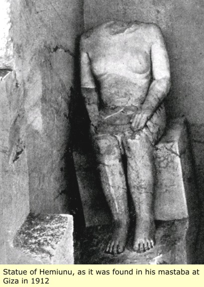
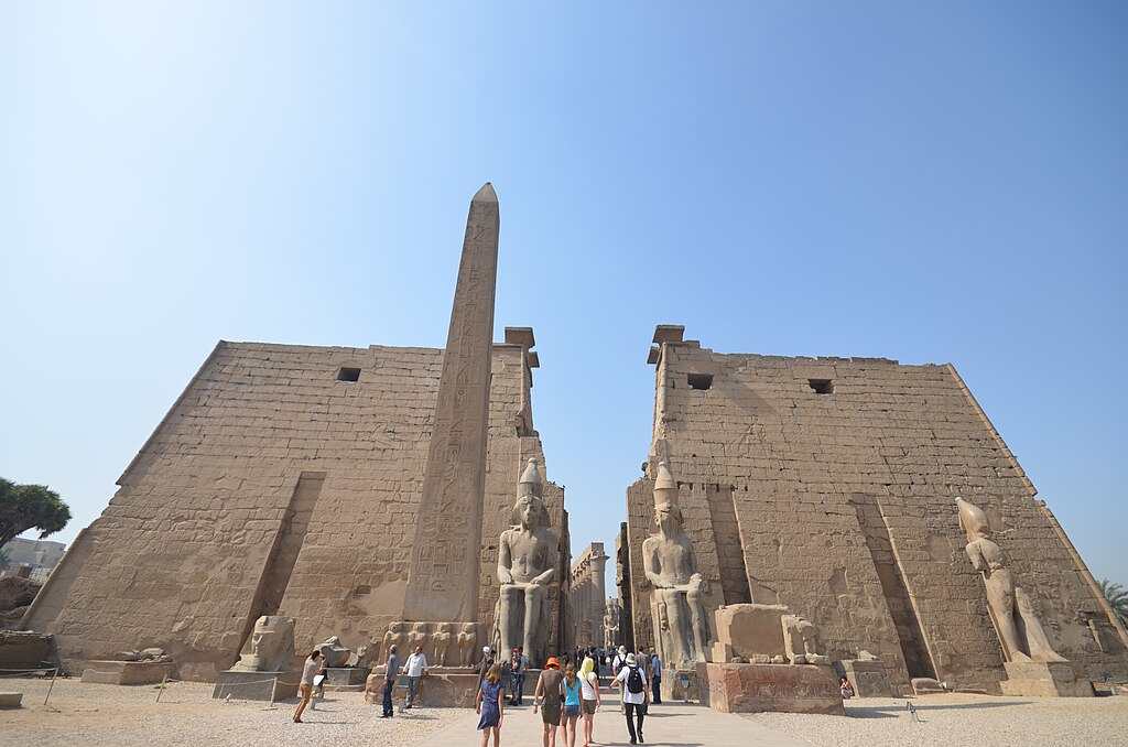


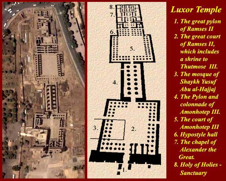

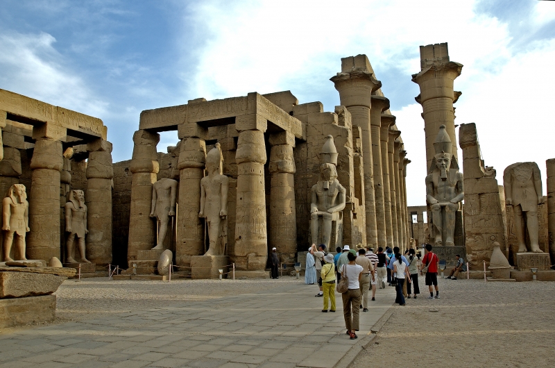
![[Cool]](cool.gif) Mena
Mena ![[Big Grin]](biggrin.gif)


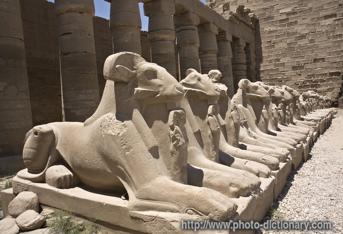


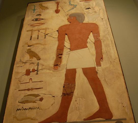
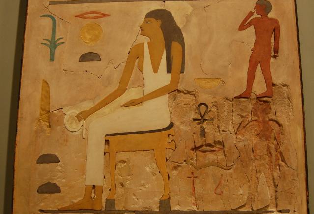


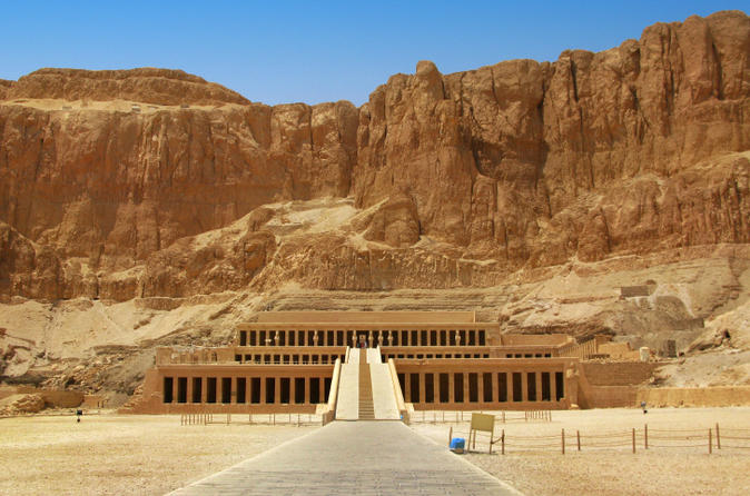


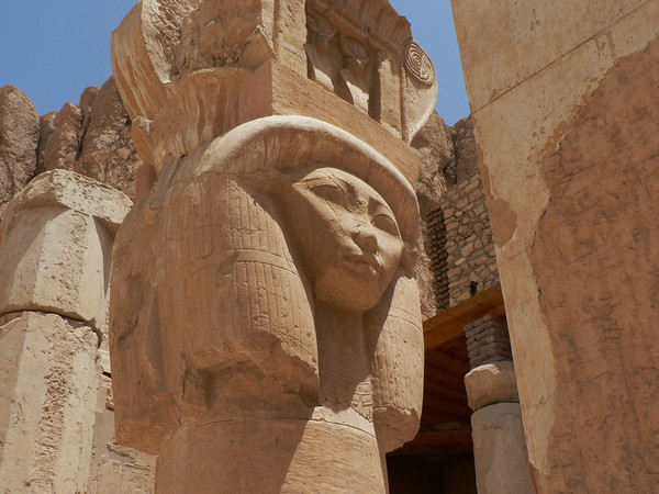
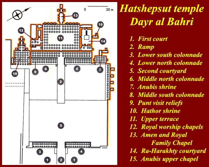


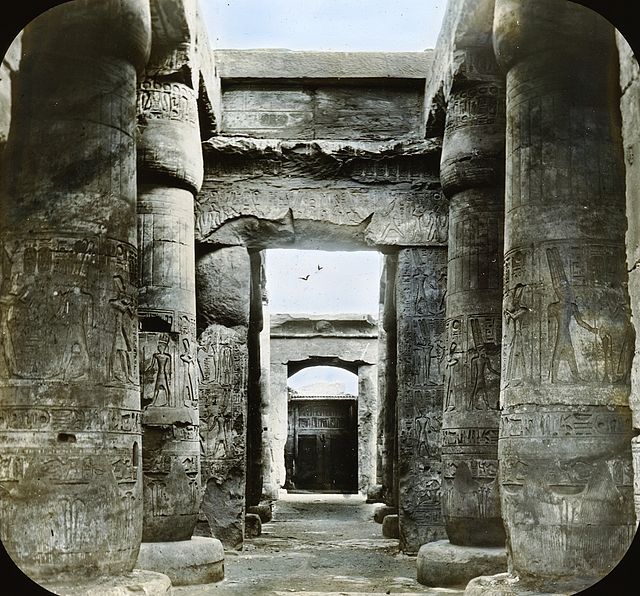


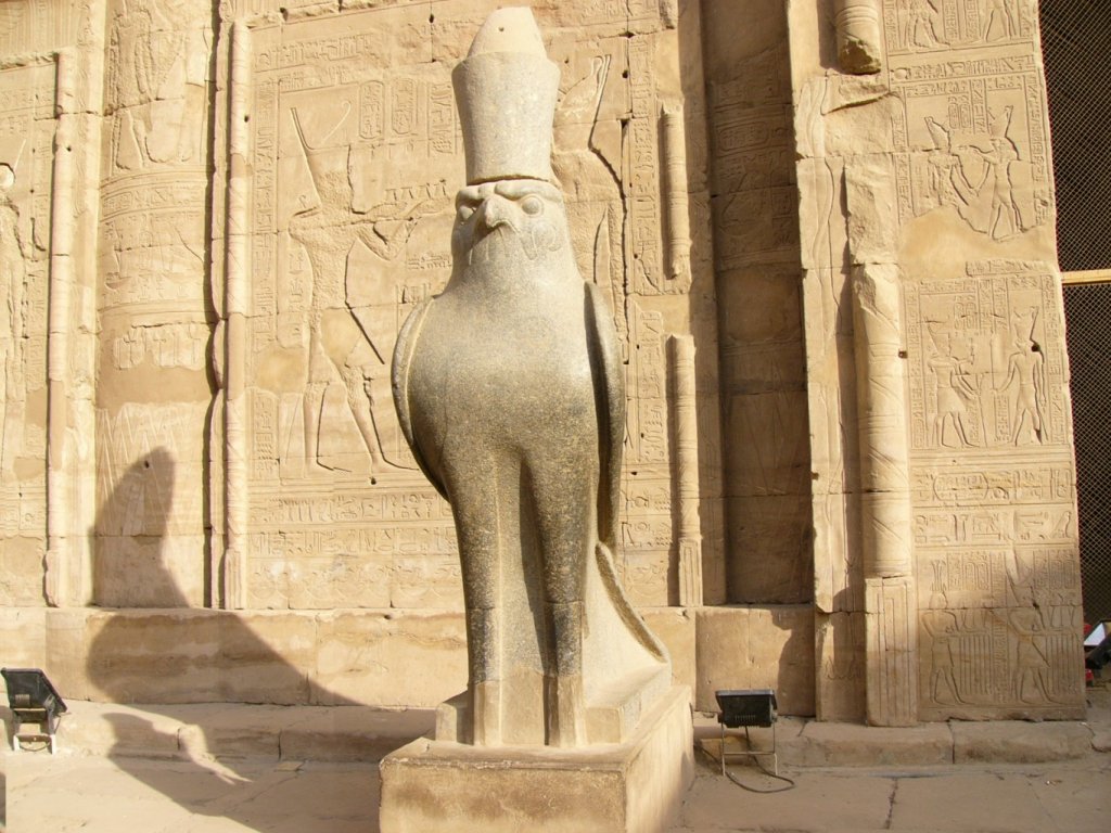


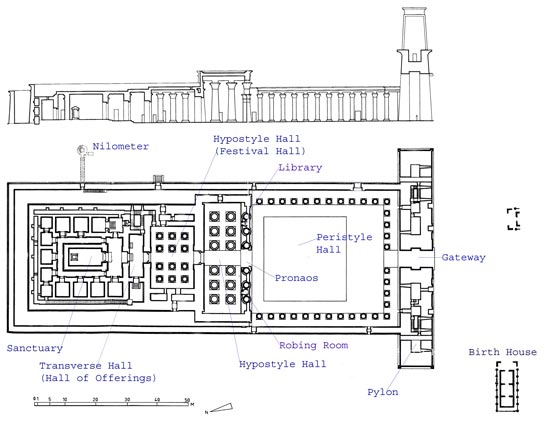
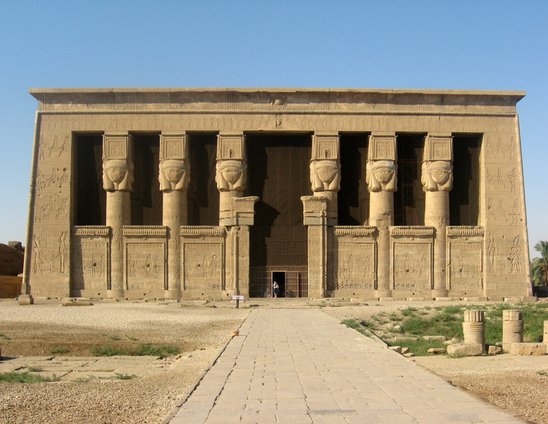


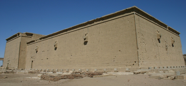


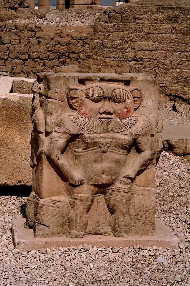


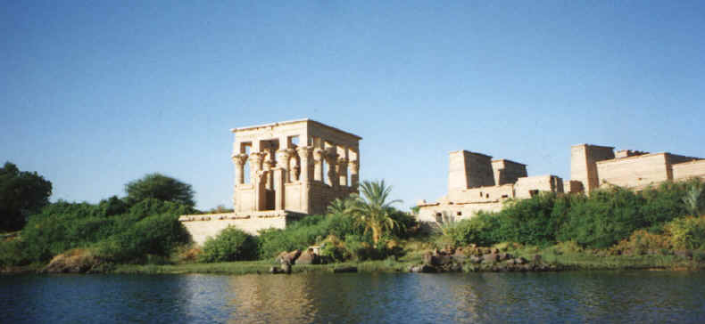


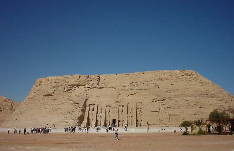


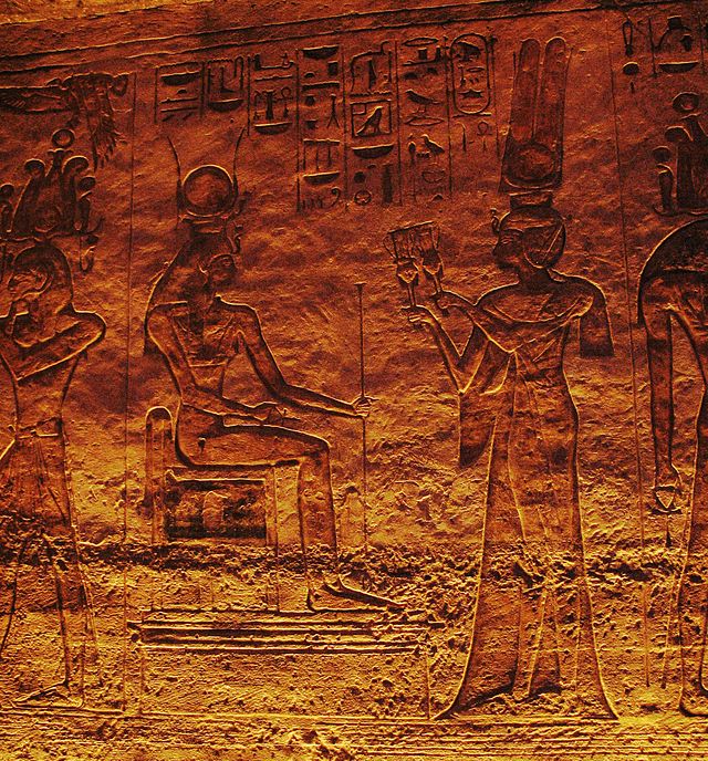

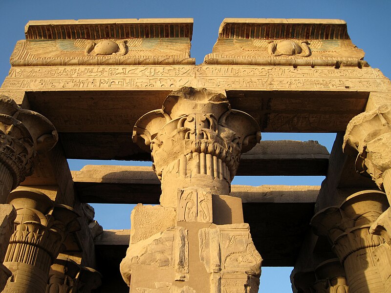


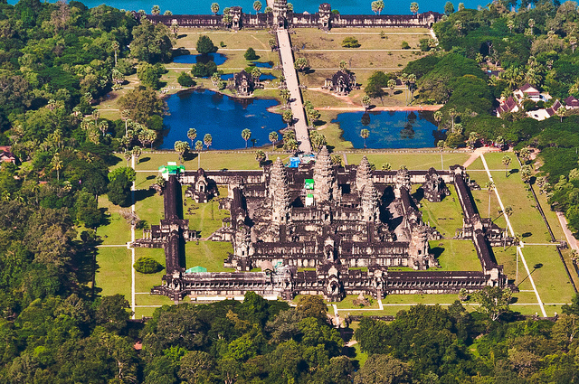

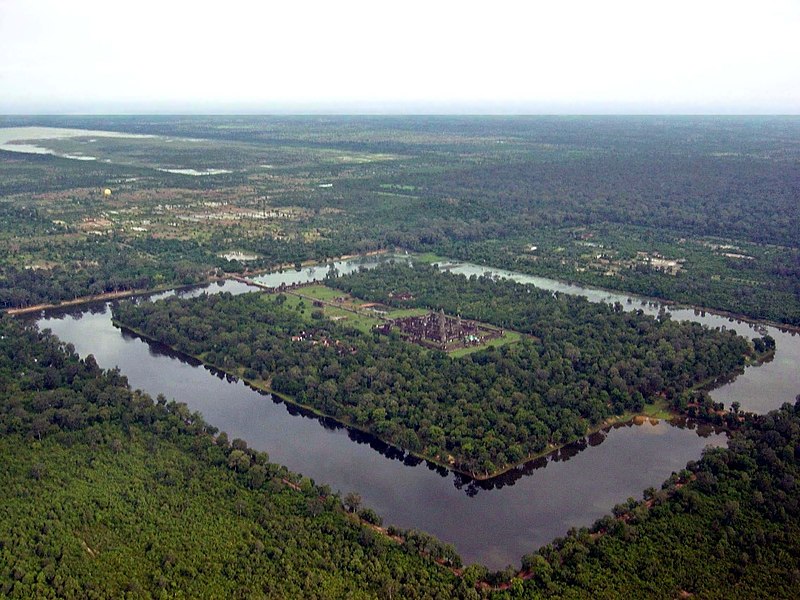
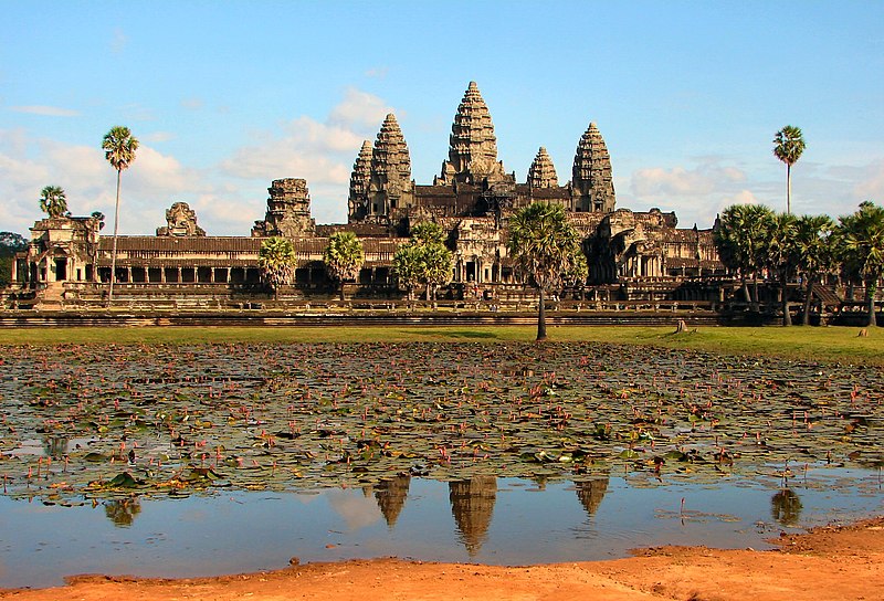


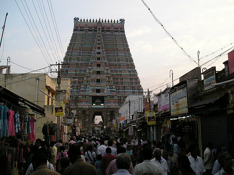


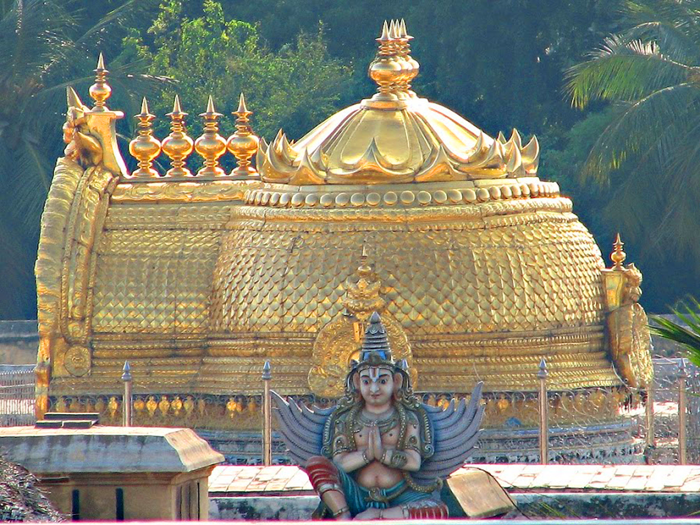

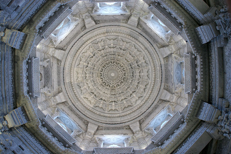

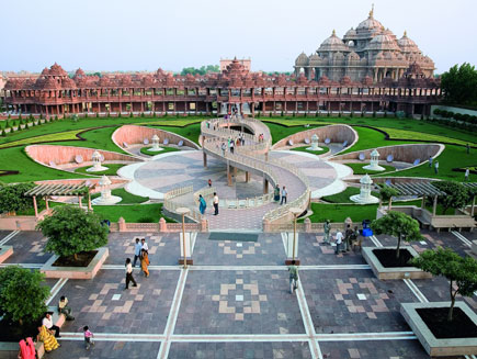


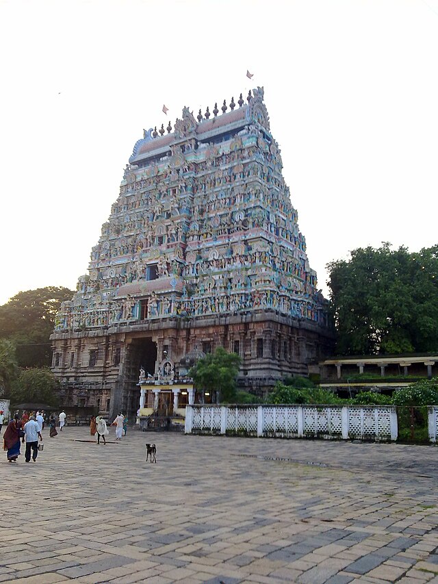
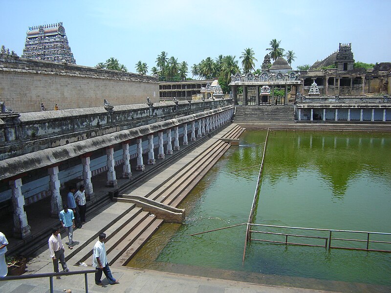


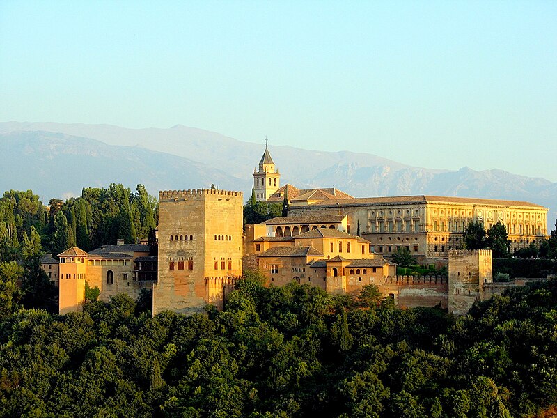

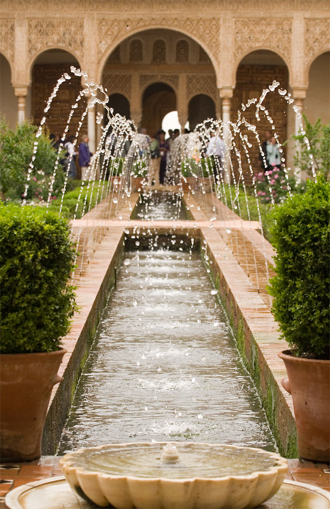


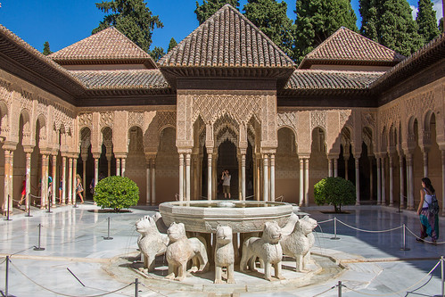

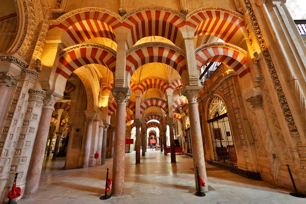
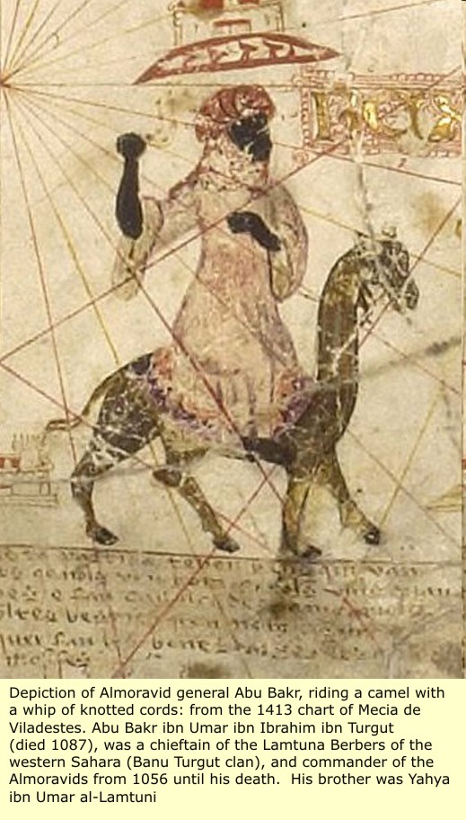
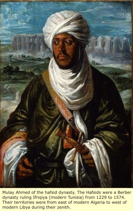
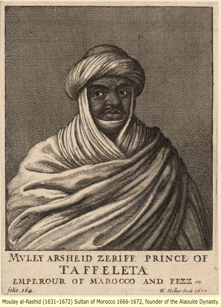
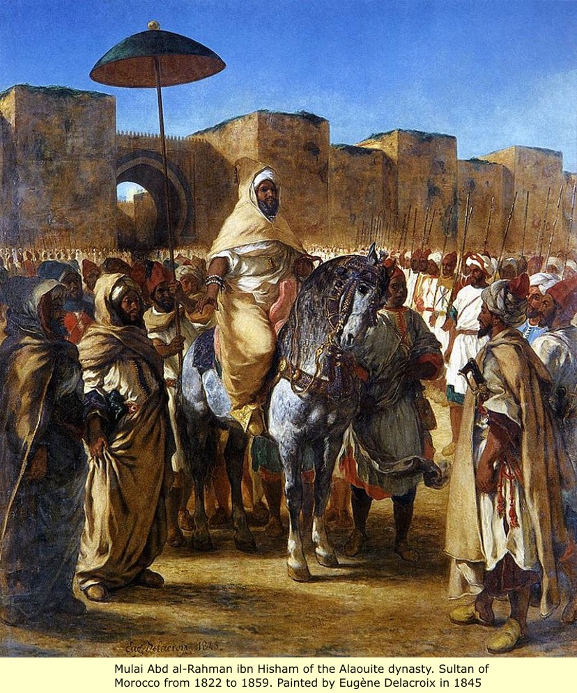


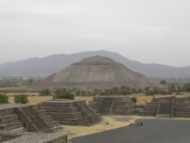

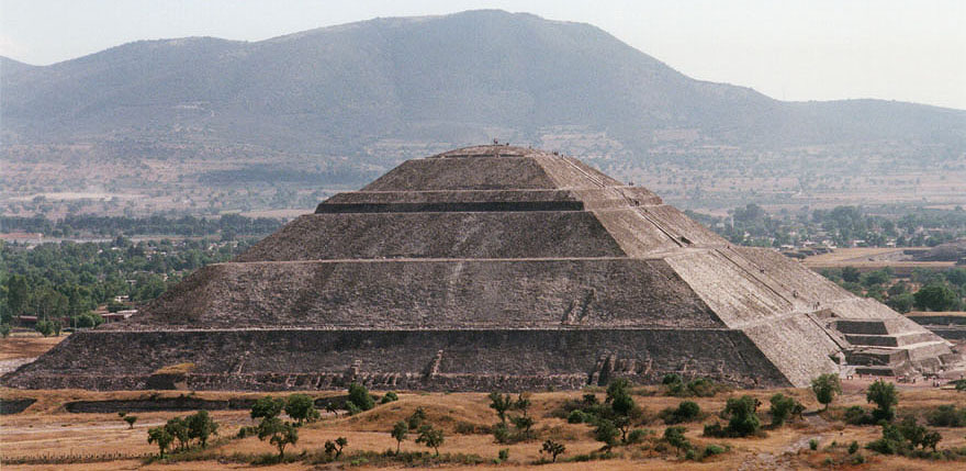

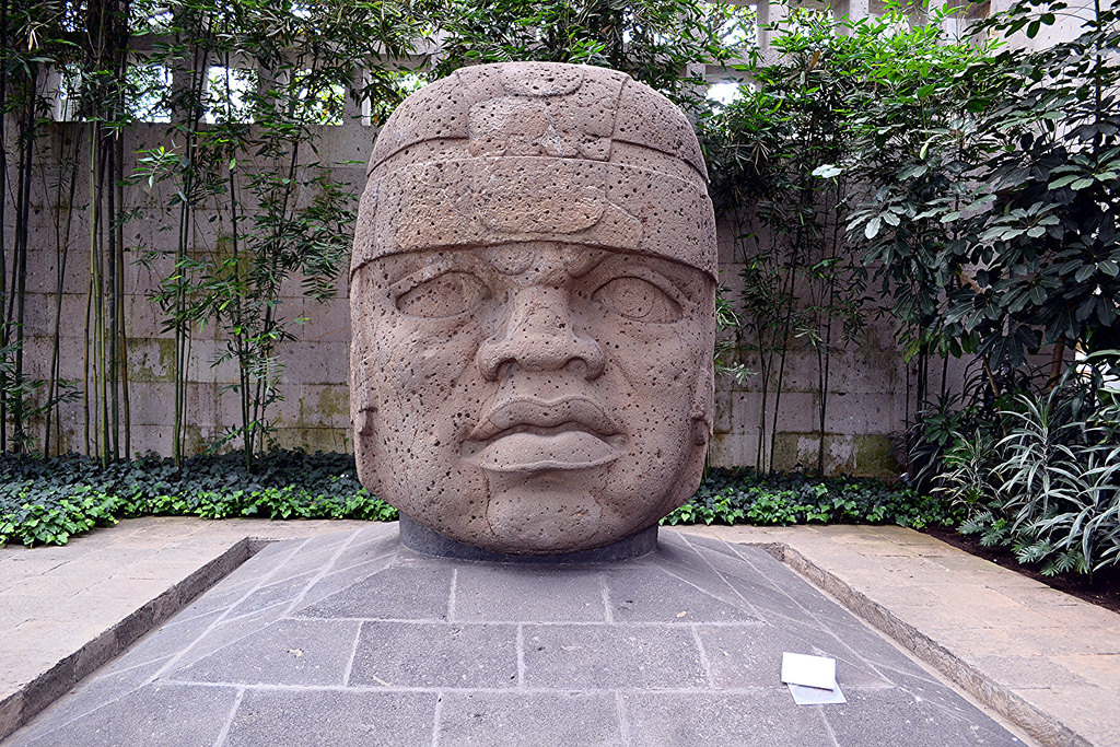


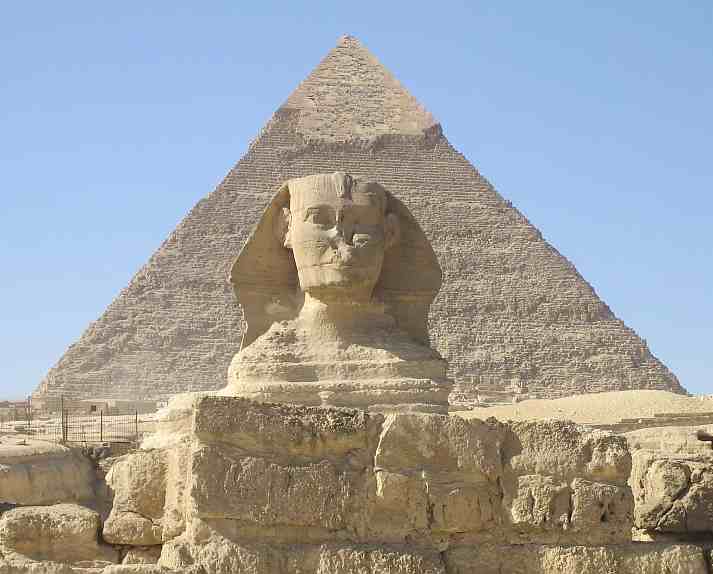


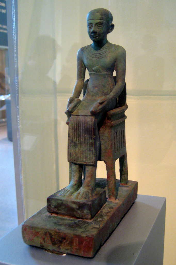

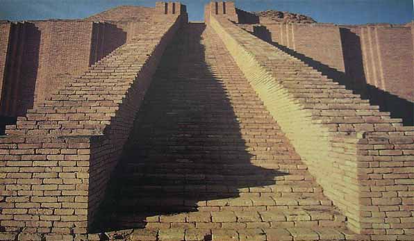
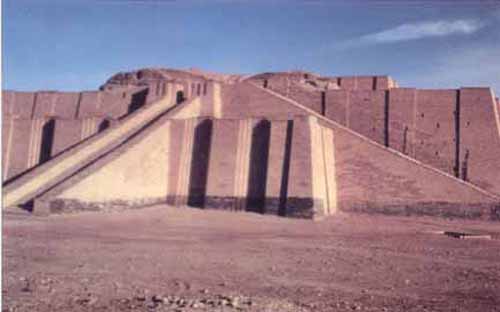
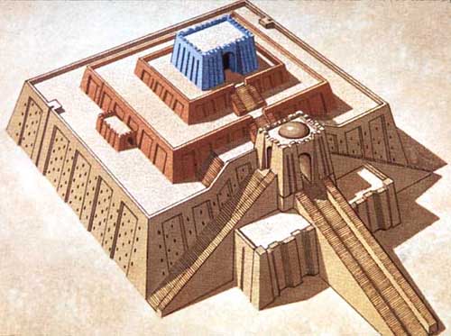
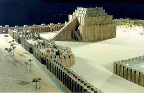


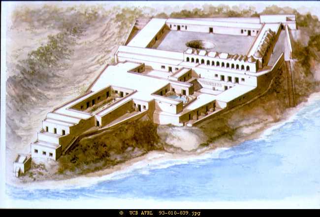


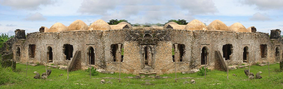 Great Mosque of Kilwa
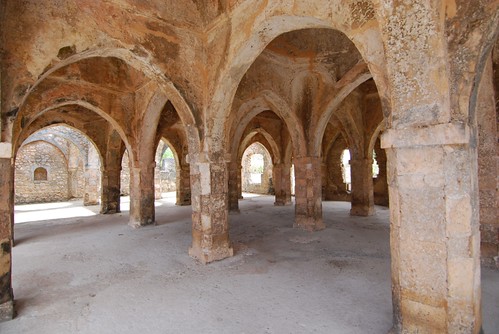


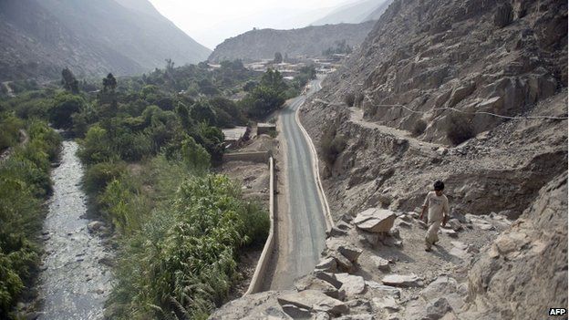


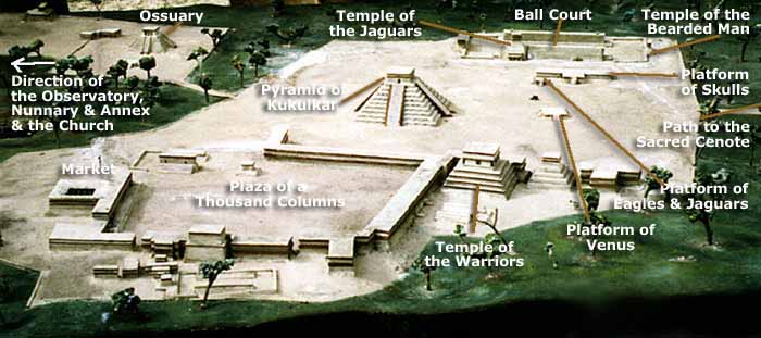
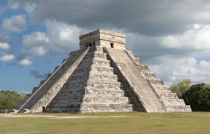
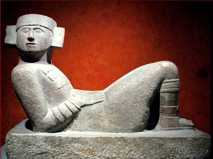
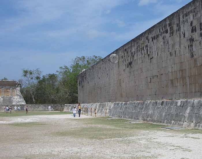
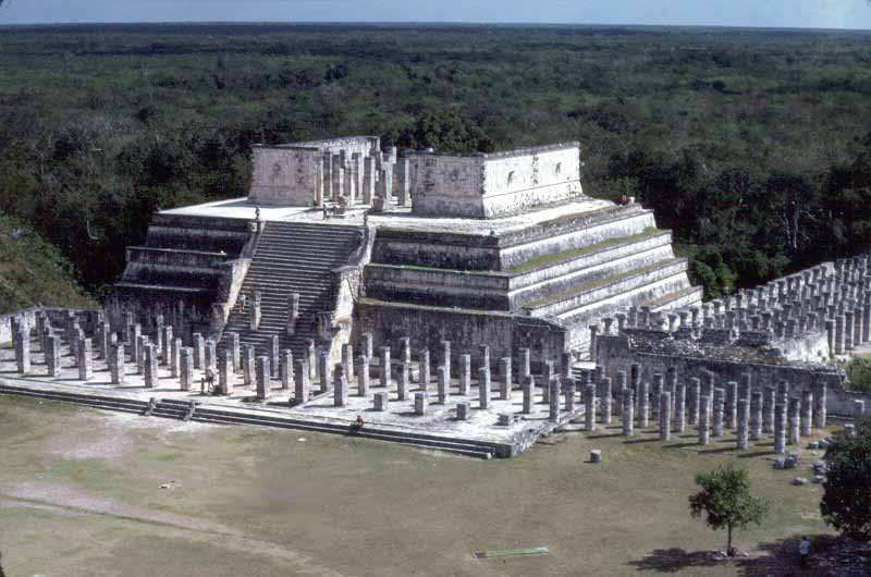
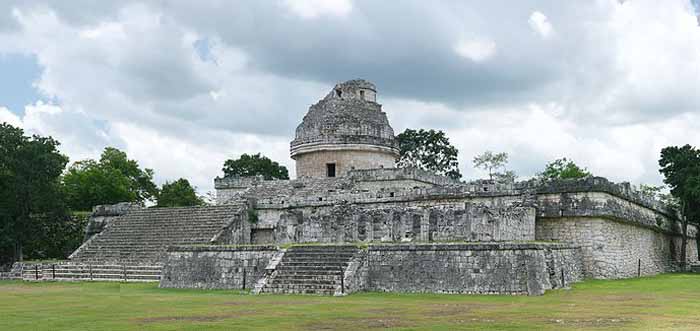


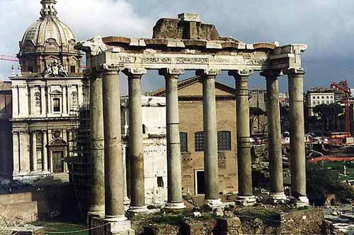


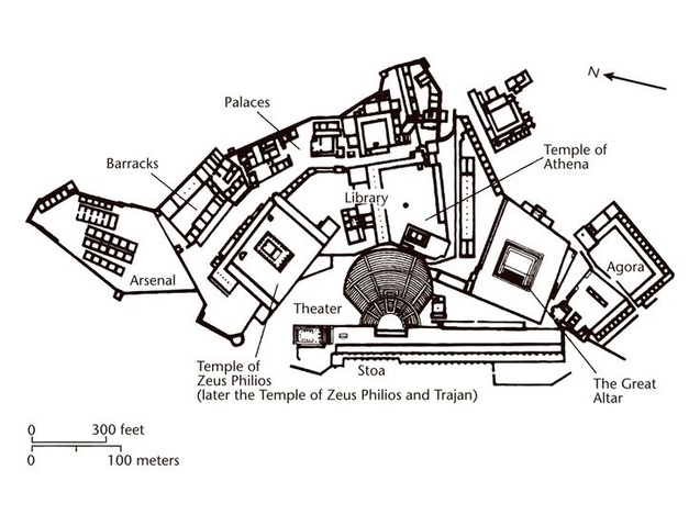
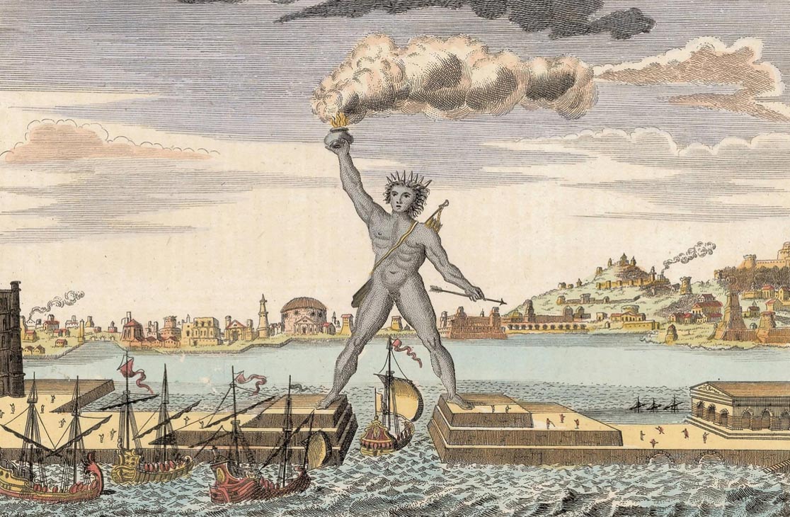


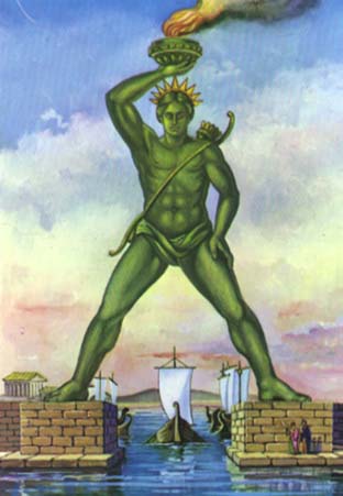

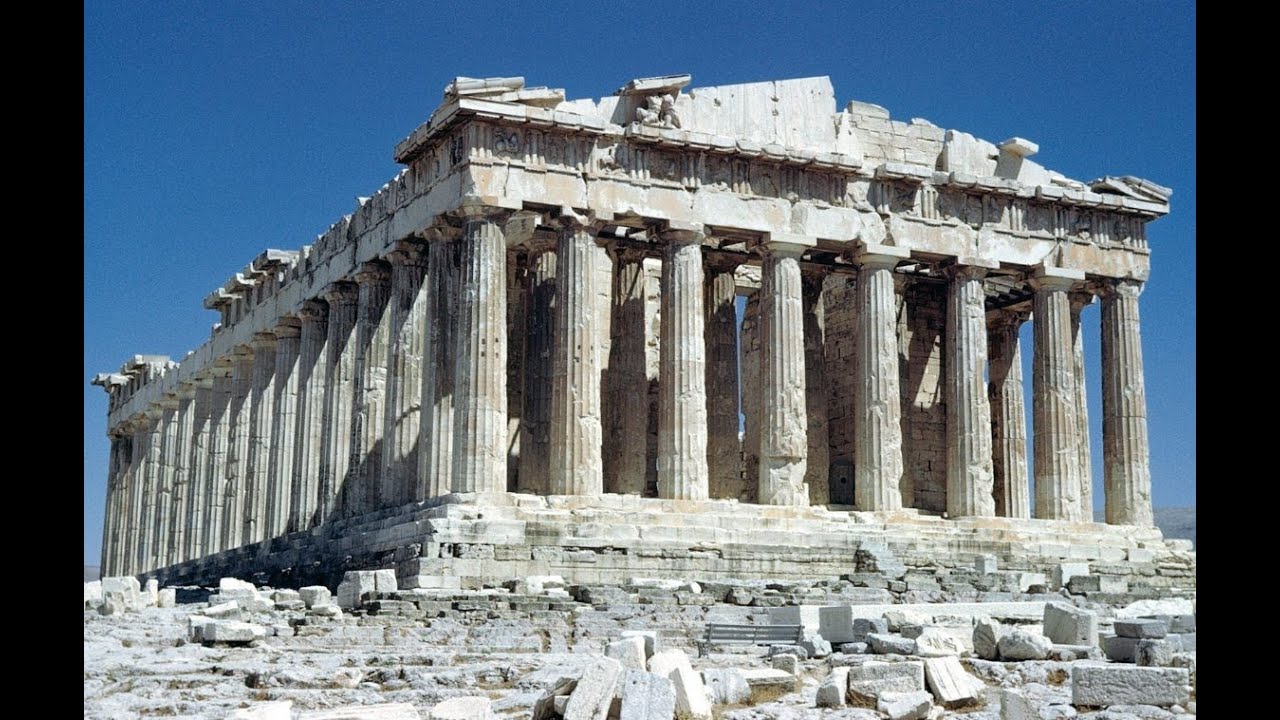


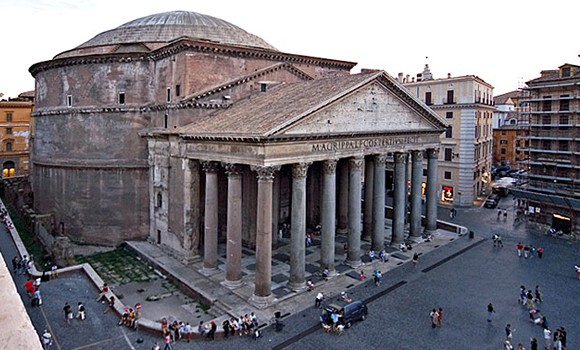
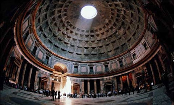
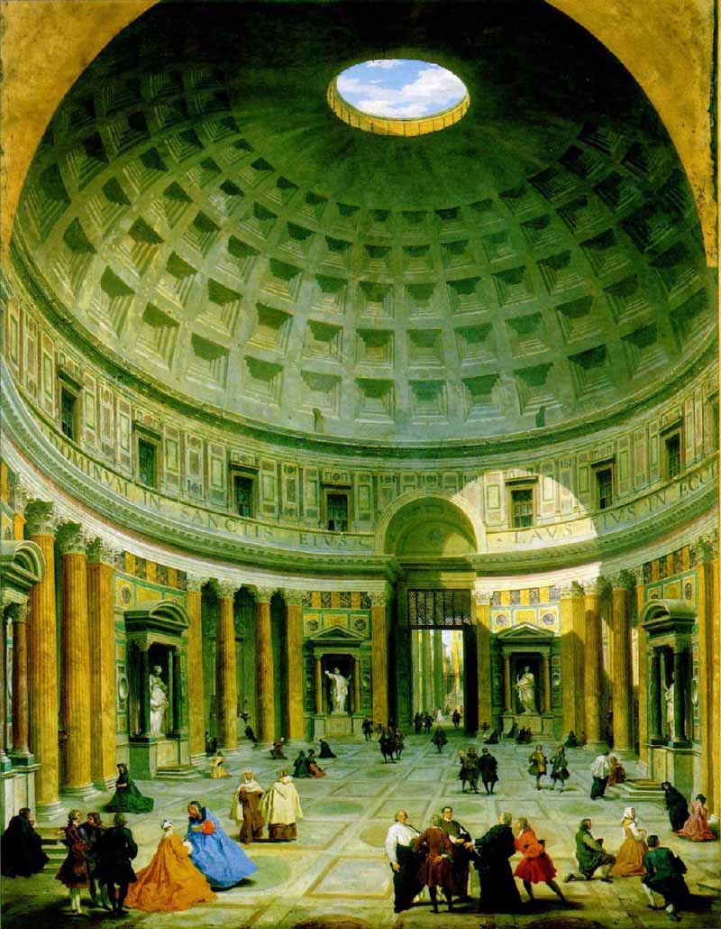
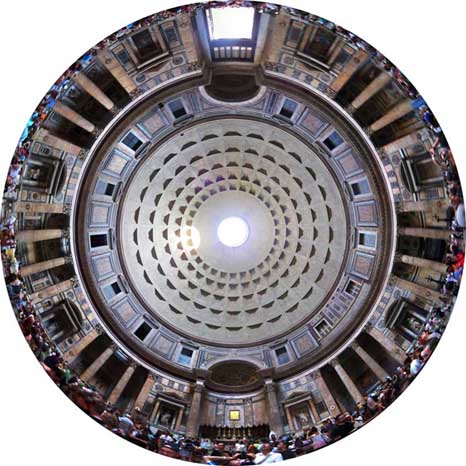
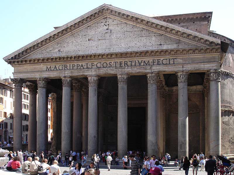
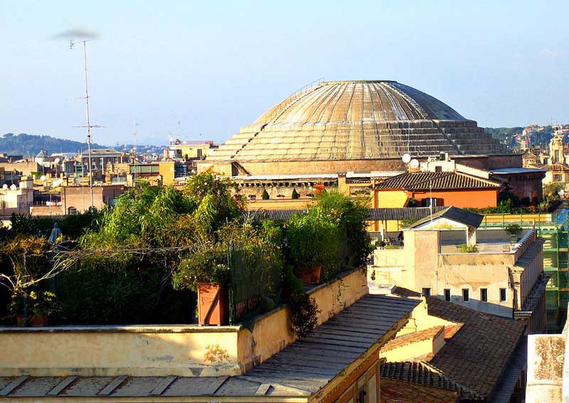
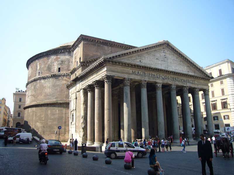


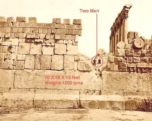
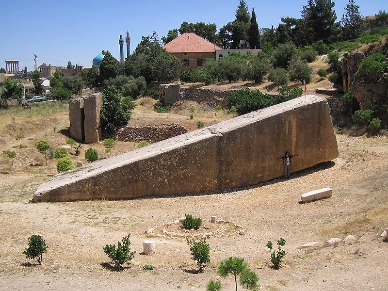
 png[/IMG] lbek.jpg[/IMG]
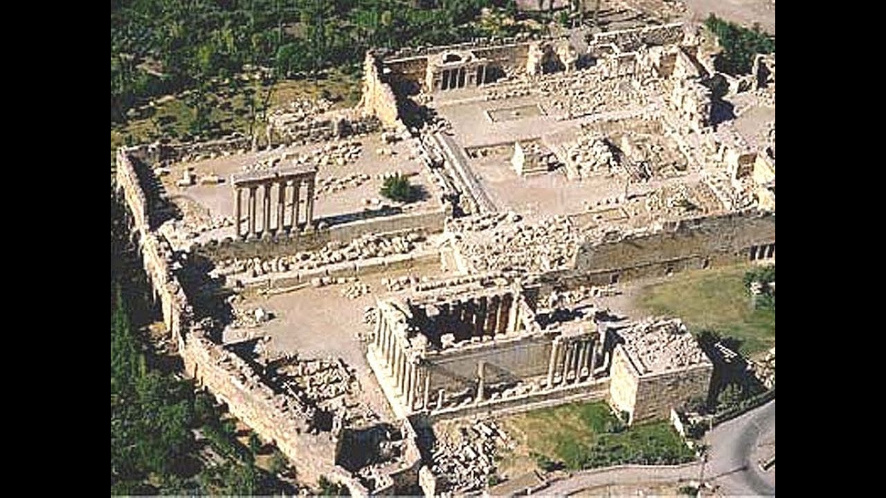
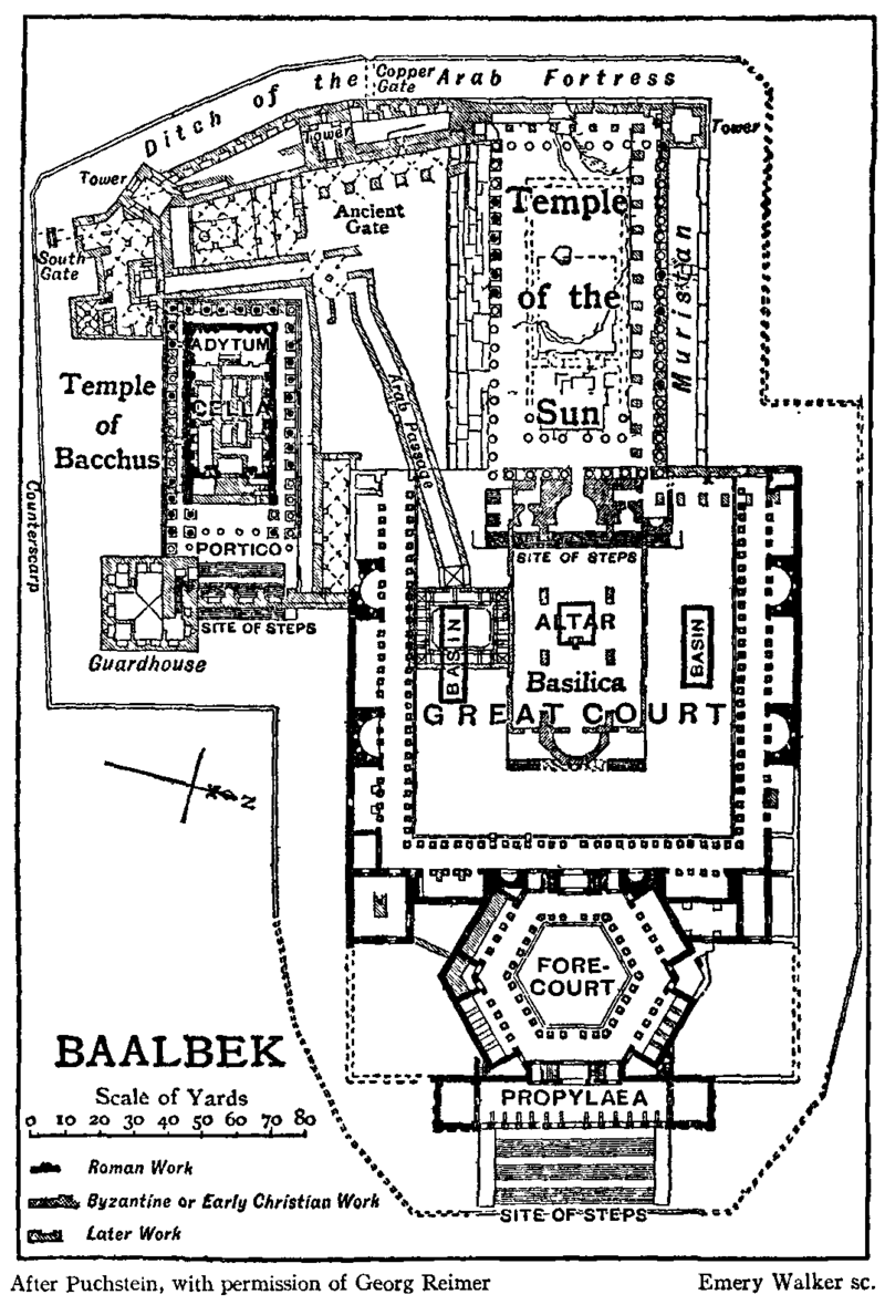

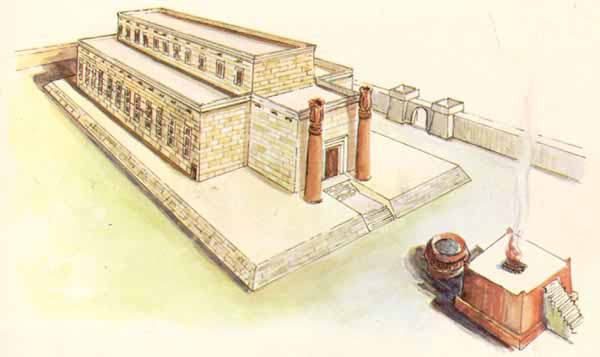
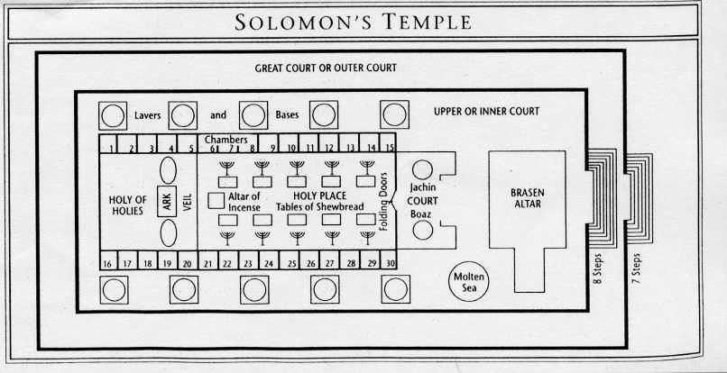


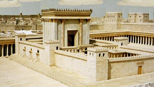
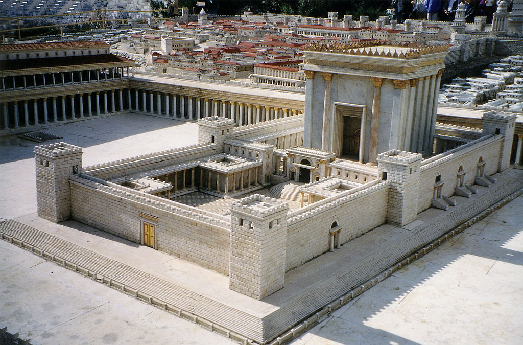


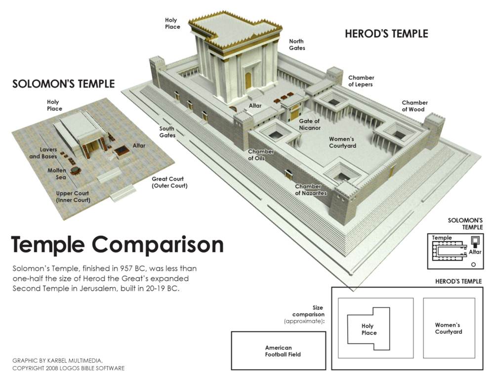
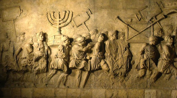

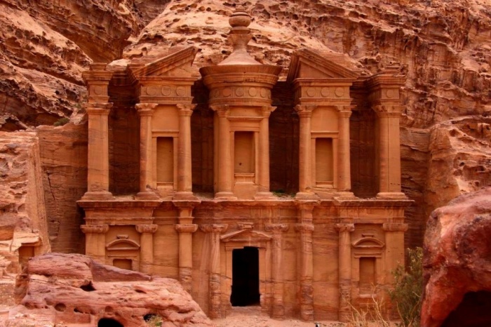
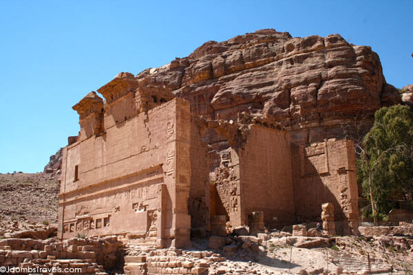
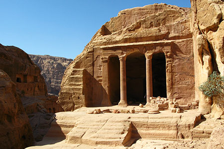

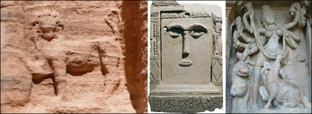
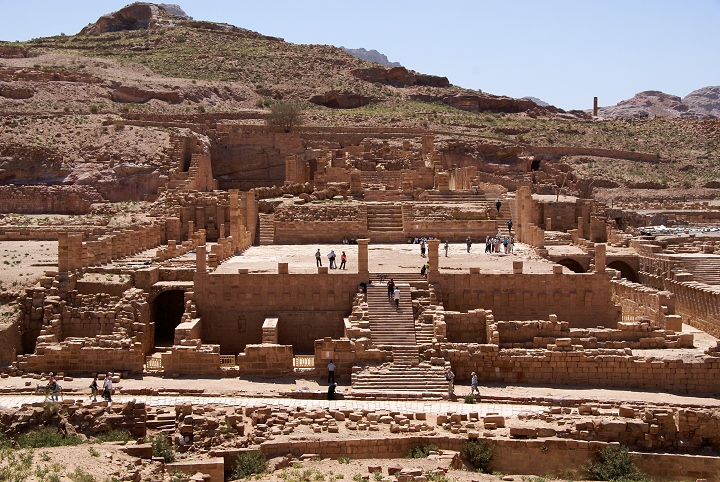


 Printer-friendly view of this topic