posted
Yes, I read Siali was a northern area, but IDK if it was further north like or if it went into Sudan?
Posts: 2508 | From: . | Registered: Nov 2011
| IP: Logged |
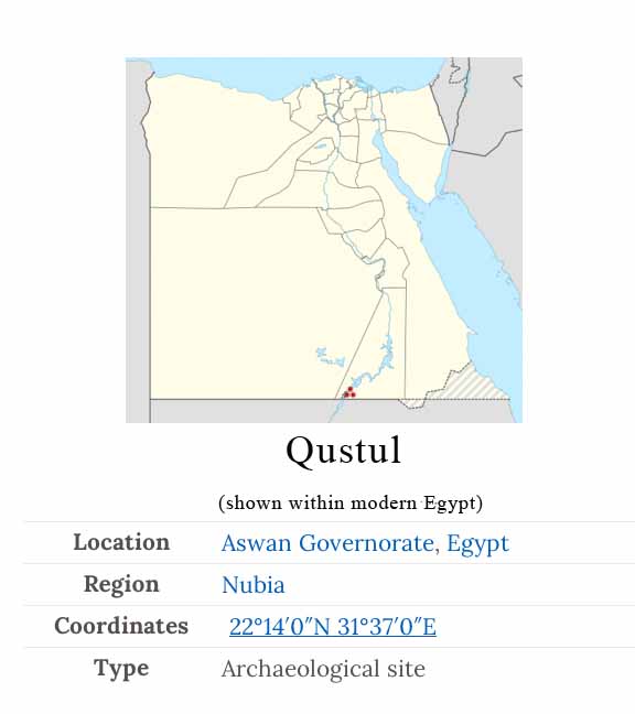
The Qustul site is now flooded by Lake Nasser and is no longer available for investigation. It was across from Nobatia in Faras
Posts: 42930 | From: , | Registered: Jan 2010
| IP: Logged |
posted
From my understanding people called it Qustul or Ta Seti. But Qustul was more like a capital but it also had ties to Siali. So then how far south at least did the rest of this Qustul kingdom go?
Posts: 2508 | From: . | Registered: Nov 2011
| IP: Logged |
posted
I am trying to understand what was the northern/southern boundary of this Nubian kingdom. I want to know if it passed through Sudan.
Posts: 2508 | From: . | Registered: Nov 2011
| IP: Logged |
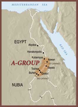
The A-Group was the first powerful culture of northern Nubia
A society whose ancient name is unknown, called A-Group by archaeologists, was the earliest Nubian culture with strong rulers. Developing out of Neolithic cultures of the Nile valley, the A-Group is known largely from its cemeteries. Its burials, artifacts, and rock art are found along the Nile from Kubaniyya north of the 1st cataract to the 2nd cataract. Much of the power and wealth of the A-Group came from trade. Its location gave it access to gold from the eastern desert, carnelian from the western desert, and exotic products like incense, ivory, and ebony from farther south along the Nile. The A-Group traded these resources for Egyptian products, many contained in large storage vessels, as well as for olive oil from the Mediterranean coast.
A-Group Nubia was the southern neighbor of Egypts emerging state
In addition to maintaining trade contacts with Egypt, A-Group rulers employed symbols that were used by Egyptian pharaohs of that time. Some Nubian seal impressions depict a bow above a rectangle (right), probably the earliest writing of Ta-Seti, Land of the Bow, an ancient Egyptian name for Nubia. The A-Group flourished until it was destroyed by pharaohs of Egypts First Dynasty around 3100 BC. Much of northern Nubia was not inhabited for centuries afterwards, at least partly because of Egyptian military action. There is evidence of some occupation during this time, however; a settlement at Buhen near the 2nd cataract, with Egyptian and Nubian pottery, may have been a base for trade or copper working during the Egyptian Old Kingdom (26862125 BC).
Posts: 42930 | From: , | Registered: Jan 2010
| IP: Logged |
Tukuler
multidisciplinary Black Scholar
Member # 19944
posted
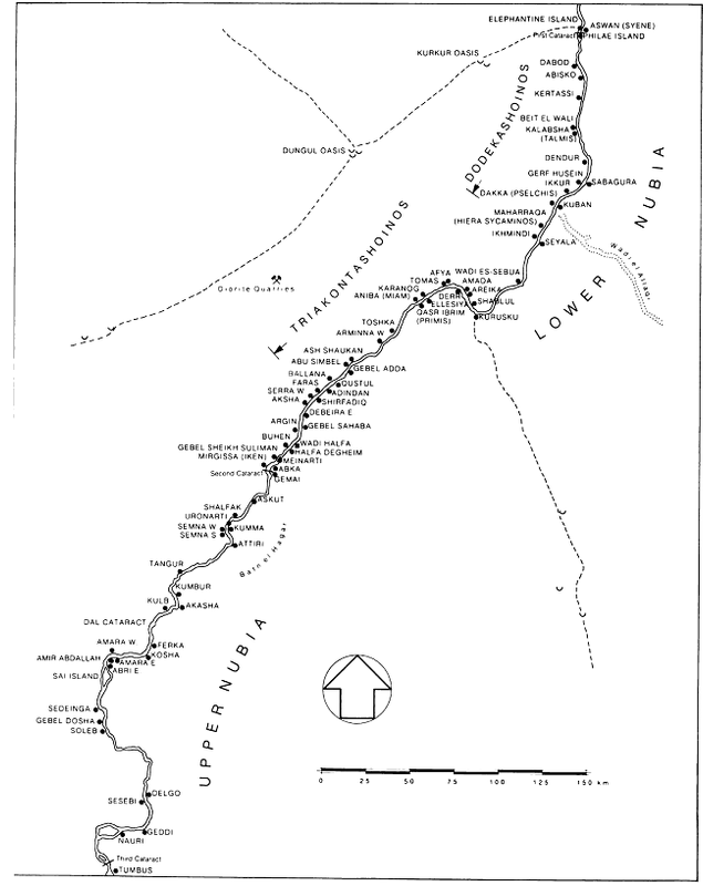
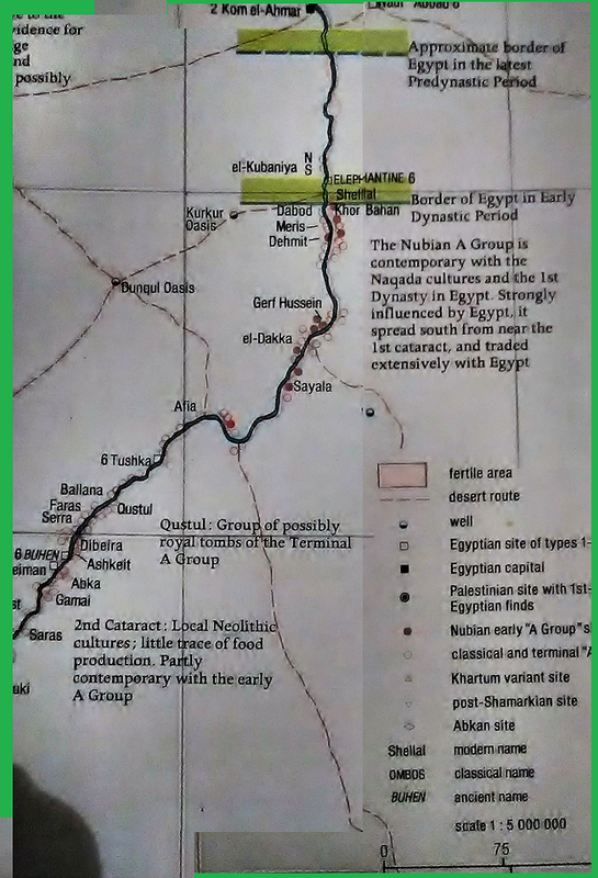
The A-grp (Ta Seti) map is a good birdseye view. Here's a detailed map from 3rd-1st Cataracts Unfortunately, it lobs off the rest of the sandstone region from 1st Cataract north to Silsileh. More on Silsila here.


 UBBFriend: Email this page to someone!


 Printer-friendly view of this topic