posted
I had to create this thread because my former one was hijacked, derailed and ruined. I am going to be clear. This thread has nothing, nada, zero, zip...To do with the Olmecs or Africans colonizing the Americas. But the possibility of Abu Bakr II reaching the Americas with his voyage that consisted of 2000 ships. It is historic fact backed up with historic text that Abu Bakr II went to sail across the Atlantic, but it seems Eurocentrics are hard nosed to not look deep into it.
I want the conversations in this thread to consist of sane educated theories and not off topic pseudo fantasies.
Again this thread is not about the Olmecs or Africans colonizing the Americas and introducing civilizations to the natives. Anyone that does the following will be ignored and I encourage others to ignore those people who do so.
So Clyde Winters. STAY OUT!Posts: 1135 | From: Top secret | Registered: Jun 2012
| IP: Logged |
posted
Here is something interesting that Brada posted on my thread on Egyptsearch Reloaded.
ORIGINAL NARRATIVES OF EARLY AMERICAN HISTORY REPRODUCED UNDER THE AUSPICES OF THE AMERICAN HISTORICAL ASSOCIATION General Editor, J. FRANKLIN JAMESON, Ph.D., LL.D. DIRECTOR OF THE DEPARTMENT OF HISTORICAL RESEARCH IN THE CARNEGIE INSTITUTION OF WASHINGTON THE NORTHMEN, COLUMBUS, AND CABOT 985-1503
INTRODUCTION
This letter, the earliest published narrative of Columbuss first voyage, was issued in Barcelona in April, 1493, not far from the time when the discoverer was received in state by the King and Queen. The Escribano de Racion, to whom it was addressed, was Luis de Santangel, who had deeply interested himself in the project of Columbus and had advanced money to enable Queen Isabella to meet the expenses of the voyage. He, no doubt, placed a copy in the hands of the printer. Only two printed copies of this Spanish letter, as it is called, have come down to us. One is a folio of the first imprint, discovered and reproduced in 1889. Of this the unique copy is in the Lenox Library in New York; its first page is reproduced in facsimile in this volume, by courteous permission of the authorities of the library. The other is a quarto of the second and slightly corrected imprint, first made known in 1852 and first reproduced in 1866. Facsimiles of both are given in Thachers Christopher Columbus, II. 17-20 and 33-40. Facsimile of the first page of the folio (first) edition of the Spanish text of Columbus's letter to Santangel, describing his first voyage, dated February 15, 1493.
quote:Certain principal inhabitants of the island of Santiago came to see them and they said that to the south-west of the island of Huego, which is one of the Cape Verde Islands distant 12 leagues from this, may be seen an island, and that the King Don Juan was greatly inclined to send to make discoveries to the south-west, and that canoes had been found which start from the coast of Guinea and navigate to the west with merchandise.
quote:Wednesday, July 4, he ordered sail made from that island in which he says that since he arrived there he never saw the sun or the stars, but that the heavens were covered with such a thick mist that it seemed they could cut it with a knife and the heat was so very intense that they were tormented, and he ordered the course laid to the way of the south-west, which is the route leading from these islands to the south, in the name, he says, of the Holy and Indivisible Trinity, because then he would be on a parallel with the land of the sierra of Loa327-1 and cape of Sancta Ana in Guinea, which is below the equinoctial line, where he says that below that line of the world are found more gold and things of value; and that after, he would navigate, the Lord pleasing, to the west, and from there would go to this Española, in which route he would prove the theory of the King John aforesaid; and that he thought to investigate the report of the Indians of this Española who said that there had come to Española from the south and south-east, a black people who have the tops of their spears made of a metal which they call guanin, of which he had sent samples to the Sovereigns to have them assayed, when it was found that of 32 parts, 18 were of gold, 6 of silver and 8 of copper.
posted
Facsimile of the first page of the folio (first) edition of the Spanish text of Columbus's letter to Santangel, describing his first voyage, dated February 15, 1493.
quote:Certain principal inhabitants of the island of Santiago came to see them and they said that to the south-west of the island of Huego, which is one of the Cape Verde Islands distant 12 leagues from this, may be seen an island, and that the King Don Juan was greatly inclined to send to make discoveries to the south-west, and that canoes had been found which start from the coast of Guinea and navigate to the west with merchandise.
quote:Wednesday, July 4, he ordered sail made from that island in which he says that since he arrived there he never saw the sun or the stars, but that the heavens were covered with such a thick mist that it seemed they could cut it with a knife and the heat was so very intense that they were tormented, and he ordered the course laid to the way of the south-west, which is the route leading from these islands to the south, in the name, he says, of the Holy and Indivisible Trinity, because then he would be on a parallel with the land of the sierra of Loa327-1 and cape of Sancta Ana in Guinea, which is below the equinoctial line, where he says that below that line of the world are found more gold and things of value; and that after, he would navigate, the Lord pleasing, to the west, and from there would go to this Española, in which route he would prove the theory of the King John aforesaid; and that he thought to investigate the report of the Indians of this Española who said that there had come to Española from the south and south-east, a black people who have the tops of their spears made of a metal which they call guanin, of which he had sent samples to the Sovereigns to have them assayed, when it was found that of 32 parts, 18 were of gold, 6 of silver and 8 of copper.
posted
In A.D. 1312, Emperor Abubakari Muhammad , of Mali gave his throne to Mansa Musa and embarked with his fleet into the Atlantic Ocean in search of the continent opposite Africa. Archaeological and epigraphic evidence indicates that Abubakari, and or members of his expedition settled in pre-Columbian Brazil.
The Indians have a tradition that Mansar Akban was the leader of another tribe which discovered the Cunan people.This Mansar Akban, may be a reference to Mansa Abubakari, who led the Malian voyagers to the Americas.
The Manding lived in mounds along the Niger rivers. The mound cultures of ancient America were built by Africans primarily Manding. The people of the Niger Delta formed river riverine communities which were partly vegetation with some aquatic animals were eaten.
The ancient Manding built several types of homes. In ancient times they built masonry houses and cliff dwellings identical to those found in the American Southwest. In Medieval times they lived on mounds in the most watery areas in their circular huts made a stone and wood on the top and their fields in front of the mounds tilled each day.
The Malian people introduced their technology to the Americas. The Manding built dwellings depending on the topography . Near rivers they lived on mounds. In semi-arid regions they lived in cliff houses, like those found in the Southwest. Today the Dogon who trace their descent to the Mande live in identical dwellings as those found in Colorado ,where Manding inscriptions dating to the A.D. 1000 's have been found related to the Pueblo culture.
Tellem Cliff Dwellings from West Africa
The most common signs found in Mandeland and the American southwest are habitation signs painted in red at Anasazi. These signs agree with Mande signs along the Niger river in Africa.
Cliff Dwellings from Anasazi
The Malian ships or canoes plowing down the NIger were operated by the Bozo and Sorko fishermen. The Bozo lived along the western arm of the Niger bend. The Sorko people, who spoke Songhay language submitted to Manding rule. The Bozo and Sorko, were the masters of the Niger river transport.
Many of the ships of the NIger could carry burdens of 60-80 tons. These canoes were ninety to one hundred feet long. The men usually sat three abreast with ease. Around forty men paddled.
Other canoes were joined together. These canoes were forty feet long and five feet across. These jointed boats were mainly navigated by the Bozo. In addition to canoes the fishermen along the Niger built rope sewn plank boats ninety to one hundred feet long.
Around A.D. 1310, thousands of Manding speakers arrived in the Americas from ancient Mali. Ibn Fadlullah al- Umari, in his encyclopedia "Masalik al Absar", said the mariners from Mali during the reign of Abubakari made transatlantic voyages. Al-Umari, obtained his information from Mansa Musa, who was handed the kingship of Mali by Abubakari when he set out to colonize the Americas.
Mansa Musa, said that Mansa Abubakari would not believe that it was impossible to discover the limits of the neighboring sea (the Atlantic). Musa, told al-Umari that:"so he sent out 200 ships equipped and filled with men and the same number filled with gold, water and enough food to last them for years. Muhammad Abubakari, commanded that the captain not return until the supplies were exhausted".
After sometime, according to Mansa Musa, a single ship returned and the captain was ordered to report his findings. "Prince", he replied "we sailed for a long time up to the moment when we encountered in mid-Ocean something like a river with a violent current. My ship was last. The others sailed on...they disappeared and did not come back".
"But the Emperor[Abubakari] did not believe him", continued Musa,"He equipped two thousand vessels, a thousand for himself, and a thousand for water and supplies. He conferred power on me [Mansa Musa] and left with his companions on the ocean".
The expeditionary force of Mansa Abubakari, must have been immense, because the average boat on the Niger, in the 1500's A.D., could carry 80 men. This means that anywhere between 25,000 to 80,000 men may have sailed from Mali along with Mansa Abubakari.
The mention of a violent current in mid-ocean by Abubakari's captain may refer to the Atlantic ocean currents which can carry a boat from Africa to the Americas.
We can hypothesize that Abubakari and his expeditionary force probably left the city of Niani, by canoe and traveled down the NIger to the Gulf of Guinea. From here the expeditionary force was probably carried by the Guinea Current out into the Atlantic where it met the South Equatorial Current. The South Equatorial Current carried the Mali explorers to Brazil.
Abubakari's ships would not be the last vessels to be carried to Brazil. For example, in 1500 , Alvares Cabral's ship was captured by the North Equatorial Current and swiftly taken to Brazil.
In Mexico the Malian wanders are depicted in the Mixtec Codex Dorenberg (fourtenth century). These migrates are bearded, they have large noses and lips, and are represented with black skins. In addition,to the Codex Dorenberg they are also seen in the Codex Tro, with staff or spear in hand, feathered headdresses, polished earrings, cloaks and loincloths made of the finest woven cotton. They wore arm and wrist bands, and small white shells on their ankles which rattled as they walked , usually in groups of two's or three's.
In Mexico, due to previous cultural development the Manding found large heavily populated Indian communities. Therefore the Malian colonists did not establish any large communities in Mexico, but they were active traders and are remembered for their merchandise.
The are Mexican traditions of groups of foreigners moving northward throughout the early 14th century. These men probably formed the vanguard of a larger body of Malians which probably entered Mexico in 1325, and fought the Mexicans around this time for land to settle. The battle of these Africans and Amerindians, is seen in the legend of a battle between an eagle and a serpent and the choice of the site of the battle as the place to build Mexico's Tenochititlan. The serpent is the totem of the Manding, it therefore probably represents the Malian forces, and the eagles the Amerindians. Among these foreign migratory groups it is reported in Amerindian traditions that they took the practice of agriculture and pottery making to the Chichimecs, and helped design and build the houses around Lake Texcoco in 1327.
ANASAZI
The Manding mentioned in the Mexican traditions of 1325, may represent the founders of Anasazi civilization of Four Corners section of the United States. Anasazi, is a Navajo word which means "Ancient Ones" for the founders of the spectacular cliff dwellings and great multistoried pueblos erected on open plains near the San Juan, Salt and Little Colorado rivers. Although American anthropologists accept the theory that the Amerindians entered North America across the Bering Strait about 20000-15000 years ago , the Hopis, on the contrary say their ancestors crossed the sea during their emergence to this present Fourth World, arriving somewhere along the coast of Mexico or Central America, then gradually worked their way northward to settle in their present homes in the Four Corners region.
They call the original inhabitants of the cliff dwellings "Ancient Ones". These Anasazi were probably Manding speakers. The ruins of their great stone cities are crouched low on the Mesa tops or nestled in caves along the sheer canyon walls of this high desert region. These stone cities are exact replicas of stone cities cliff dwellings found in West African areas that formerly formed part of the Mali empire, especially the Dogon towns.
In what is now known as Four Corners region where the states of Utah, Colorado, New Mexico and Arizona come together at a common point the Anasazi tilled the earth and even irrigated their crops, and stored some of the harvest for later use.
The Inscription from Palatki is written in the Manding language. It was found near the ruins of cliff dwellings.
Palatki Cliff Dwellings. The Palatki cliff dwellings are similar to the Tellem Cliff Houses. Malian Cliff Dwellings from Tellem
The Malians left many inscriptions in the Southwestern part of the United States. The presence of Manding in Four Corners, is supported by the appearance of Dogon and Bambara ideograms, called petroglyphs, on rocks in the Anasazi area. Moreover, there are several tablets found in Four Corners which have been deciphered that were written in an aspect of Malinke.
The Pilatki inscriptions is also written in Manding not Sanskrit. Below we see the following signs. The Malinke inscriptions were read from right to left. Top to bottom. There are five Malinke or Mande signs on the Palatki inscriptions. The inscription says:
Be
su i se
Se Gyo/Jo
The English translation is as follows: Exist here a superior place Of habitation. Make (this) place a success, consecrated to the Divinity
In conclusion, in 1310 thousands of Malians arrived in the Americas. Many of these Malians settled throughout South America and the American Southwest where they left numerous inscriptions written in the Malinke Bambara language that was spoken by the Malian court.
The Palatki inscription is written in the Mande language not Sanskrit. This inscription describes the picturesque setting where the Palatki inscription and cave dwellings were found.
Due to the spread of nomadic Amerindians from the northwest,the Anasazi were forced from their stone cities and cliff dwellings by the invaders. There was probably some intermarriage between Africans and Amerindians and today we see a negroid strain among the southwestern Amerindian populations. In addition many African communities were found in the Southwest when Europeans arrived in this part of the United States.
.
-------------------- C. A. Winters Posts: 13012 | From: Chicago | Registered: Jan 2006
| IP: Logged |
posted
Find out more about the Mali discovery of America in my book,African empires in Ancient America
Here is a discussion of some of the mounds built in America by the Malians.
MOUNDS IN SOUTH AMERICA
(C) Clyde Winters 2013
Many mounds excavated in South America dating back to the period of Mansa Abubakari's expedition to the Americas have yielded many artifacts depicting Africans. The major centers for Malian mound habitation outside of Mexico and the United States were situated in Brazil, Panama and Venezuela.
In Brazil there are many megalithic structures that seem to have their prototypes in Africa. For example, in Alagoas we find many stone monuments similar to the stone circles made by rock which denoted burial sites in West Africa.
The habitation mounds in Brazil are called sambuquis. Some of the sambuquis have radio-carbon dates going back to pre-history, while many of the mounds where artifacts have been found are related to the cultures of Venezuela, and have radio-carbon dates contemporaneous with the Malian voyages.
The mounds in Venezuela are situated along local rivers.1 Practically all of the ancient figurines from Venezuela are of Africans. African males are commonly represented on many ancient American sites. The art from Venezuela, on the other hand indicate that many of the African settlers were females.
The archaeological evidence which links the Venezuelan mound cultures to the Malian voyage to America and Sudan mound cultures in general date between A.D. 1150-1500.These blacks lived in eastern Venezuela. They were riverine people who used boats to communicate with each far-flung community.
The artifacts relating to the malian expansion in Venezuela were situated in the Valencia basin at the point where the Andes joins the Cordillera del Caribe, behind the coastal area of Puerto Cabello, the Llanos, a large expanse of the lowland extending up and along the Orinoco river.
The Malians established the Valencoid and Arauquinoid culture series in Period IV (c. 1150-1500) of Venezuelan history. These sites are situated along the middle and lower Orinoco river. As mentioned earlier the Orinoco river was a main settle-ment area for blacks in the New World.
The Manding of the Arauquinoid series were farmers. Archaeologists have discovered many hammer grinders, incised head lugs, with coffee-bean eyes and bowls of all styles with applique features like faces on collars including the coffee-bean eyes.
The Valencoid style comprises pottery from the mound site of the Valencia Basin. Here the dead were buried in urns identical to those used in West Africa. The Valencoid pottery is usually red and white, while some were tri-colored pottery: red-black and white, as in the El Topo style. The Vallencoid people also made collars decorated with human faces. The artifacts from Valencia corresponds to artifacts discovered by the French scholar Desplagnes, when he excavated mounds along the Niger river at the turn of the century.In the funeral chambers of these mounds he found numerous pots with a red slip, and copper instruments.
This Niger Bend painted ware is of the white-on Dark red-brown variety. It corresponds to the white-on-red painted pottery from the El Mayal style of Venezuela [2].
Another possible Manding/Malian site in Venezuela is the Terroid series of western Venezuela. The radio-carbon date for this series of pottery is A.D. 1350. The pottery was painted and decorated with various combinations of red, black and white. We also see other motifs including the spiral, and tiny birds.
The figurines from Tiero are of women in a sitting position with the right knee raised higher than the left, and the right hand placed on the knee. The buttocks serve as the base.
Barrancos Style Pottery
The statues from the Barrancoid series have been dated to A.D. 1300-1350. These artifacts may have been made by the Malians given their date of origin.
In the Barrancoid series we see blacks in anthropomorphic form. Miguel G. Arroyo in Arte Prehispanico de Venezuela , noted that the art of the Barrancoid series is similar to art styles found in contemporary Zaire, especially among the Mangebetu.
The Barrancoid style includes beautiful vases and effigy jars. They made statuettes of women and men either sitting on three-legged stools or in the sitting position with their legs and knees serving as a base, and the hands lying on the knee as in the case of the statue discovered in Djenne by the french archaeologist Mauny. This setting position was common in Malian art.
Those Venezuelan humanoids sitting on stools seem to be either eating out of bowls or in a thinking position. The stool serves as a base for the statue and the hands on the statue are placed on the knees. All the men and women figures have holes in their ears, the men wear girdles, while the women are nude.
In summary, the artifacts excavated in the ancient mounds of the New World indicate that Africans built many of these mounds. The fact that many art styles and artifacts recovered from these mounds illustrate similar themes suggest an origin for the mound builders from a common ideological system. This system originated in the Fertile African Crescent :the ancient Sahara, and was prominently illustrated in the art, literature and culture of ancient Egypt. As a result many researchers have been able to find analogy between ancient Egyptian culture elements and Meso-American culture features.
The fact that many of the mound builders in the Americas had culture items and iconographic representations identical to those found in the western Sudan resulted from the fact that much of West Africa around the Niger bend was not settled until after 500 B.C. Therefore ,those migrants that did settle the Americas would have come either from the area bordering on the Guinea Coast, or from middle Africa after the Sahara began to dry up.
The Mande speaking people dominated much of the region in Northwest and West Africa where the ancient Niger river formerly emptied in the Sahara. This led to their important role in the spread of cultural features which originated in the Fertile African Crescent to the Americas between 1500 B.C., and Columbus' discovery of the Americas.
1. Alfred Kidder, Archaeology of Northwest Venezuela. Peabody Museum Papers, vol.26.
2. L. Desplanges,"Etude dur les tumuli du Kulli dans la region de Goundam", L'Anthropologie, vol. 14, pp.151-172; and Desplagnes, "Notes sur les Origines des Populations Nigeriennes", L'Anthropologie, vol.17, pp.525-546.
Read more about this in
.
-------------------- C. A. Winters Posts: 13012 | From: Chicago | Registered: Jan 2006
| IP: Logged |
posted
Let me post some African oral history. The Ancient Egyptian transported their mummies to the American continents to be buried. The Egyptian Pharaohs sent white slaves to the American continents. The Malian Emperor bought white slaves in Europe and shipped them to the American continents. So white slaves were shipped to America before black slaves. The original black Native American became the mestizo and mulato that we see today because of their mixture with white European slaves.
The Egyptian and African built many countries and cities in America like PerHeru, Cush co, Tehuti uacan, Ta Enoch titlan, Meci co etc.
quote:Originally posted by mena7: [QB] Let me post some African oral history. The Ancient Egyptian transported their mummies to the American continents to be buried. The Egyptian Pharaohs sent white slaves to the American continents.
that's why there are no Egyptian bodies in the pyramids, they got shipped out
Posts: 42921 | From: , | Registered: Jan 2010
| IP: Logged |
Tukuler
multidisciplinary Black Scholar
Member # 19944
posted
quote:Originally posted by Son of Ra:
Does [al~Takruri] still come on here? I have some questions for him.
Here I am.
Posts: 8179 | From: the Tekrur straddling Senegal & Mauritania | Registered: Dec 2011
| IP: Logged |
posted
Leave it to Clyde Winters to disregard Son of Ra's pleas. You know Winters can't help himself when it comes disseminating his pseudo-history.
Getting back to the actual topic, I am not at all surprised by this. For the longest I have read European sources that speak of rumors of Africans having reached the "New World". There is also the evidence of New World goods being found in Africa.
Posts: 26239 | From: Atlanta, Georgia, USA | Registered: Feb 2005
| IP: Logged |
Is if Africans like the people of Mali were to reach the Americas. Would trade have been established? Because there are sources that state New World goods being found in African kingdoms. Also what is your view on the Hull Bay skeletons and is there any additional sources on physical remains of 'Negroid' people being found in the Americas?
@Djehuti
He's a hardheaded one... -__-
Anyways thats an interesting post you've made. Did you read the blog because I did also state that, like Ancient American decorations being found in an Ancient Nigerian city.
But anyways in my honest opinion I think almost every group like Africans, Vikings, Chinese, Indians,Arabs etc had contact with the New World in some way. IMHO I think is strange how this part of the world was NEVER reached or heard of by people of the 'Old world' until Columbus informed the rest of the 'old world' about it. I just dont believe that, when many civilizations of the 'old world' were skilled maritime people.
Posts: 1135 | From: Top secret | Registered: Jun 2012
| IP: Logged |
posted
The Ancient Egyptian, West African, Phenician-Canaanite-Carthaginian traveled, settled and traded in the American continents in the pre Christopher Colombus era. The Library of Alexandria and the Byzantine Constantinople library had world map showing the American continents.
Artifacts that prove the Ancient Egyptian, Phoenician, Roman, Chinese and Japanese traveled to the American continent before Christopher Columbus.
Many of us learned that rhyme, part of a longer history poem, when being taught in school that Christopher Columbus discovered America. Although nothing can be taken away from Columbus' daring voyage, he certainly was not the first to arrive on the shores of the Americas. For one thing, there were already people here - many Native American nations inhabited what later became known as North and South America and even the Caribbean islands where Columbus landed. Columbus probably wasn't even the first "white man" to make it here. It's fairly well documented that Icelander Leif Ericsson successfully sailed to North America in the year 1000 - almost 500 years prior to Columbus's voyage.
In fact, there's a growing amount of evidence suggesting that a lot of the familiar history of human exploration and "discovery" by our ancestors as we were taught it may be quite wrong. There is hard evidence of ancient civilizations making their mark in places where, according to traditionally accepted history, they just shouldn't be. Here's an overview of some of the most remarkable and fascinating cases.
GREEKS AND ROMANS IN THE NEW WORLD
Coins: Roman coins have been found in Venezuela and Maine. Roman coins were found in Texas at the bottom of an Indian mound at Round Rock. The mound is dated at approximately 800 AD. In 1957 near Phenix City, Alabama, a small boy found a coin in a field from Syracuse on the island of Sicily, and dating from 490 B.C. In the town of Heavener, Oklahoma, another out-of-place coin was found in 1976. Experts identified it as a bronze tetradrachm originally struck in Antioch, Syria in 63 A.D. and bearing the profile of the emperor Nero. In 1882, a farmer in Cass County, Illinois picked up a bronze coin later identified as a coin of Antiochus IV, one of the kings of Syria who reigned from 175 B.C. to 164 B.C., and who is mentioned in the Bible.
Pottery: Roman pottery was unearthed in Mexico that, according to its style, has been dated to the second century A.D.
Inscriptions: In 1966, a man named Manfred Metcalf stumbled upon a stone in the state of Georgia that bears an inscription that is very similar to ancient writing from the island of Crete called "Cretan Linear A and B writing." In the early 1900s, Bernardo da Silva Ramos, a Brazilian rubber-tapper working in the Amazon jungle, found many large rocks on which was inscribed more than 2,000 ancient scripts about the "Old World." Near Rio de Janeiro, high on a vertical wall of rock - 3,000 feet up - is an inscription that reads: "Tyre, Phoenicia, Badezir, Firstborn of Jethbaal..." and dated to the middle of the ninth century B.C. Near Parahyba, Brazil, an inscription on Phoenician has been translated, in part, as: "We are sons of Canaan from Sidon, the city of the king. Commerce has cast us on this distant shore, a land of mountains. We set [sacrificed] a youth for the exalted gods and goddesses in the nineteenth year of Hiram, our mighty king. We embarked from Ezion-Geber into the Red Sea and voyaged with ten ships. We were at sea together for two years around the land belonging to Ham [Africa] but were separated by a storm [literally 'from the hand of Baal'], and we were no longer with our companions. So we have come here, twelve men and three women, on a... shore which I, the Admiral, control. But auspiciously may the gods and goddesses favor us!" The Kensington Runestone, discovered in Kensington, Minnesota in 1898 contains an inscription describing an expedition of Norsemen into the interior of what is now North America. It's estimated that this expedition took place in the 1300s. In 1980, P.M. Leonard and J.L. Glenn, from the Hogle Zoological Gardens, Salt Lake City, visited a rock outcropping in Colorado that was reputed to be inscribed with "peculiar markings." Leonard and Glenn believe they are excellent examples of Consainne Ogam writing - a type ascribed to ancient Celts. One of the many inscriptions was translated as: "Route Guide: To the west is the frontier town with standing stones as boundary markers." A round, fist-sized stone was found during the early 1890s in an cemetery near Nashville, Tennessee. Its front was inscribed with symbols thought to be Libyan, pre-100 A.D. style. It translates as: "The colonists pledge to redeem."
Pictures: An experienced botanist has identified plants in an ancient fresco painting as a pineapple and a specific species of squash - both native to the Americas. Yet the fresco is in the Roman city of Pompeii.
Statues: In 1933, in a burial at Calixtlahuaca, Mexico, archaeologist José García Payón discovered a small carved head with "foreign" features in an undisturbed burial site. It was later identified by anthropologist Robert Heine-Geldern as "unquestionably" from the Hellenistic-Roman school of art and suggested a date of "around AD 200."
Structures: Many stone chambers dot the New England countryside and most archaeologists insist they are all potato cellars built long ago by farmers. Others argue that they are too sophisticated for such a mundane application. One, is built into a hillside at Upton, Massachusetts, has sophisticated corbelling that follows they style of Irish and Iberic chambers. It's theorized that it was really built by Europeans around 700 AD - long before the Leif Eiriksson voyage.
Ships: In 1886, the remains of a shipwreck was found in Galveston Bay, Texas. Its construction is typically Roman.
Toys: A doll made of wood and wax was found deep in a "Well of Sacrifice" at Chichén Itzá, Mexico, on which is written Roman script.
Tombs: In the Mayan ruins of Palenque, a stone sarcophagus was found that is very much in the style of the ancient Phoenicians.
THE FAR-TRAVELING EGYPTIANS
Statues: In 1914, archaeologist M.A. Gonzales was excavating some Mayan ruins in the city of Acajutla, Mexico when he was surprised by the discovery of two statuettes that were clearly Egyptian. One male and one female, the carvings bore ancient Egyptian dress and cartouches. They are thought to depict Osiris and Isis.
Inscriptions: Ancient Egyptian hieroglyphs have been found in New South Wales, Australia. Located on a rock cliff in the National Park forest of the Hunter Valley, north of Sydney, the enigmatic carvings have been known since the early 1900s. There are more than 250 carvings of familiar Egyptian gods and symbols, including a life-sized engraving of the god Anubis. The hieroglyphs tell the story of explorers who were shipwrecked in a strange and hostile land, and the untimely death of their royal leader, "Lord Djes-eb." From this information, scholars have been able to date the voyage to somewhere between 1779 and 2748 BC.
Fossils: In 1982, archaeologists digging at Fayum, near the Siwa Oasis in Egypt uncovered fossils of kangaroos and other Australian marsupials.
Language: There are striking similarities between the languages of ancient Egypt and those of the Native Americans that inhabited the areas around Louisiana about the time of Christ. B. Fell, of the Epigraphic Society, has stated that the language of the Atakapas, and to a lesser extent those of the Tunica and Chitimacha tribes, have affinities with Nile Valley languages involving just those words one would associate with Egyptian trading communities of 2,000 years ago.
Artifacts: Near the Neapean River outside Penrith, New South Wales, a scarab beetle - a familair Egyptian symbol - carved from onyx was unearthed. Another was found in Queensland, Australia.
Tombs: The April 5, 1909 edition of The Phoenix Gazette carried a front-page article about the discovery and excavation of an Egyptian tomb in the Grand Canyon by none other that the Smithsonian. The Smithsonian has since denied knowledge of any such discovery.
THE SCATTERED TRIBES OF ISRAEL
Inscriptions: In 1889, the Smithsonian's Mound Survey project discovered a stone in a burial mound in eastern Tennessee on which is inscribed ancient Hebrew lettering. Known as The Bat Creek Stone, experts have identified its letters as being Paleo-Hebrew dating from the first or second century A.D. Some of the letters spell out: "for Judea." An abridged version of the Ten Commandments was found carved into the flat face of a large boulder resting on the side of Hidden Mountain near Los Lunas, New Mexico. Known as The Los Lunas Inscription, its language is Hebrew, and the script is the Old Hebrew alphabet with a few Greek letters mixed in.
Artifacts: In June, 1860, David Wyrick found an artifact on the general shape of a keystone near Newark, Ohio that is covered in four ancient Hebrew inscriptions translated as: "Holy of Holies," "King of the Earth," "The Law of God" and "The Word of God." In November of that same year, Wyrick found an inscribed stone in a burial mound about 10 miles south of of Newark, Ohio. The stone is inscribed on all sides with a condensed version of the Ten Commandments or Decalogue, in a peculiar form of post-Exilic square Hebrew letters. A robed and bearded figure on the front is identified as Moses in letters fanning over his head.
ASIANS ON THE WEST COAST
Stories: Indian traditions tell of many "houses" seen on Pacific waters. Could they have been ships from Asia? Chinese history tells a charming account of voyages to the land of "Fusang." Old Spanish documents describe oriental ships off the Mexican coast in 1576.
Coins: In the summer of 1882, a miner in British Columbia found 30 Chinese coins 25 feet below the surface. The examined coins of this style were invented by the Emperor Huungt around 2637 B.C.
Artifacts: Japanese explorers and traders left steel blades in Alaska and their distinctive pottery in Ecuador. Underwater explorations off the California coast have yielded stone artifacts that seem to be anchors and line weights. The style and type of stone point to Chinese origins.
Structures: California's East Bay Walls, ancient low rock walls east of San Francisco Bay, have long been a mystery. No one knows who built them or why. In 1904, Dr. John Fryer, professor of Oriental languages at U.C. Berkeley, declared: "This is undoubtedly the work of Mongolians... the Chinese would naturally wall themselves in, as they do in all of their towns in China."
Like I said I find it hard to believe that one side of the world("new world") was never known to the old world, when many civilizations in the "old world" were skilled maritime people.
Posts: 1135 | From: Top secret | Registered: Jun 2012
| IP: Logged |
2. the second is the same picture on the cover of Malian writer Gaoussou Diawara's 1992 book Gaoussou Diawara theorised that Abubakari II sailed to Brazil in 1312 with a fleet of 2000 small boats. (his bio at end of post)
3. the third is a close up the right figure
The right figure is believed to be Mansa Musa ('Moses' in Arabic) Emperor of Mali. All the three photos are of the same picture made in 1375, 38 years after Mansa Musa died (1337) Mansa Musa was born in Mecca in the 1280s. An Egyptian scholar, Ibn Fadl Al-Umari, published Masalik ab Absar fi Mamalik al Amsar in Cairo around 1342 (around 5 years after Mansa Musa died) In the tenth chapter of this work, there is an account of two large maritime voyages ordered by the predecessor of Mansa Musa, a king who inherited the Mali throne in 1312. When Mansa Musa visited Cairo on his way to Mecca in 1324 he told the story.This mariner king is not named by Al-Umari, but modern writers identify him as Abubakari II.
below African king from Catalan Atlas (1375) Image of an Saracen king of West Africa, believed to be Mansa Musa, Emperor of Mali. From the Catalan Atlas of 1375, composed by cartographer Abraham Cresques of Majorca.
Below a different illustration and detail, I don't know the date or source, does anybody have it?
____________________________________________
Gaoussou Diawara
Born in 1940 in Ouélessébougou . After high school , Gaoussou Diawara went to FSU for study at the Faculty of Dramatic Art Institute of World Literature in Moscow. He wrote a thesis in literature and returned to teach in Mali. Writting extensively on European and African theater, he is currently a professor at the University of Mali , where he teaches at the Faculty of Letters, Arts and Humanities Greek mythology DER philosophy , theater and literature Africa DER science education , drama DER Letters , the theatrology and staging. He is also Chairman of the Writers' Union and President of the Malian Malian Centre of the International Theatre Institute. ABUBAKARI II (EXPLORATEUR MANDINQUE) (ABUBAKARI II, AN EXPLORER FROM MANDE) By Gaoussou Diawara
The author achieves in this book the synthesis of more than twenty years of research on the Mandingo emperor Abubakari II, who, in 1312, voluntarily relinquished the power and then explored the limits of ocean. His fleet would have anchored on the coast of Brazil.
Abubakari II was one of the pioneers of the era of great discoveries ... Before Christopher Columbus, Magellan and Vasco de Gama.
Gaoussou Diawara was born in Ouelessebougou, some 80km in the south of Bamako. He completed his primary and secondary schools in the country before obtaining a doctorate (PH. D Specialty Drama) in Soviet Union. He is author of several award-winning work created for the stage or studied in schools and universities in Mali. Gaoussou Diawara is a Knight of the National Order of Merit in France, Knight of the National Order of Merit of Mali, UNESCO Prize for poetry and Cross-African drama prize.
Posts: 42921 | From: , | Registered: Jan 2010
| IP: Logged |
West Africa & the Sea in Antiquity INTRODUCTION It is my intention here to look at whether can be said that west Africa had an ancient maritime tradition. There will be an also an attempt to trace this on other Atlantic-facing coasts. Most notably, there will be a brief examination of how supposed European and African material in America is dealt with by Academia.
The discussion begins with a comparison of what happens in adjacent areas and this in turn starts with what in conventional Old-World terms are the Palaeolithic (= Old Stone Age) in its later stages followed by the Mesolithic (= Middle Stone Age) and Neolithic (= New Stone Age). After this came the Metal Ages of the Copper, Bronze and Iron Ages.
In terms of chronology, this begins c.8000 B.C. but will take us into very much later periods. Equally vast will be the area with which comparisons and/or contrasts can be made and the beginnings of a sectional approach will be made with the Mediterranean.
East Mediterranean A brief look at any map of Africa reveals a very rough triangle of Cairo to Cape (of Good Hope)/Cape to Ceuta/Ceuta to Cairo. The latter brings us to what will be called here the Alexandria (Egypt)/Antakya (= Antioch, Turkey)/Athens or A/A/A-arc of the east Mediterranean having its western counterpart in Messina (Sicily)/Marseilles (Med.-facing sth. France)/Malaga (Med.-facing east Spain) or M/M/M-arc of the west Mediterranaean.
Some use the sea inside the A/A/A/-arc is proven when the lake/river-fishing shown by fish-bones and/or fish-hooks of the Natufian (= Early Mesolithic of much of Israel) was extended to small-scale sea-fishing. The Natufian is named after a cave-site at el-Natuf (Israel) but its habitation-sites are better known via its round-houses on drystone footings with beehive roofs. Given an emphasised entry, these round-houses take on keyhole-plans sometimes called tholoi (from the Greek tomb-type called a tholos). Some of the houses have burials below the house-floors.
Even more use of the sea inside the A/A/A-arc is proven by the Greek Mesolithic at another cave-site, this time at Francthi Cave (in the Peloponese). Here were fishbones of the large deep-sea fish called tunny and some obsidian (a volcanic glass used to make tools throughout, inc. the ever-smaller geometric or blade/trapeze-shaped microliths of later strata). The tunny are deep-sea species but do come inshore to spawn, so could have been caught offshore (as is still done in some parts of the Med.) and so may not indicate use of boats after all. This is the case with the obsidian, as it is from the island of Melos (c. 120 miles of open sea away). So getting from Francthi on the Greek mainland to the Aegean island of Melos definitely proves use of boats.
Paul Johnstone (Seacraft in Prehistory 1980) shows a variety vessel-types in the Aegean and some of the more primitive in the form of dugouts may even have been among the famous black ships taking the Greeks to fight in the Troad (= n/west Anatolia//Asia Minor) against Troy. This, of course, was the Trojan War. If Christopher Mee (Anatolian Studies 1978) is correct, it may even be that the true cause of the war was over marine resources. Mee adverts to the remarks of Aristotle that mackerel and tunny were in some abundance off the Troad and wants to connect this to the origin of the Trojan War (but witness the 12th c. Irish trio of Diarmaid, Devorgilla [his wife], Rory of Connacht & subsequent events).
West Mediterranean Blade//trapeze-shaped microliths do not only characterise the Mesolithic of A/A/A/-arc but are also traced across the Mediterranean by Graham Clark (Proceedings of the Prehistoric Society =PPS 1958). Often found with these geometric microliths is pottery of the type called Impressed Ware. This Neolithic pottery is usually the oldest found on most Mediterranean coasts, occurs on most of the islands of that sea and increasingly in the west, the impressions naming the ceramic are made using cardium (= cockle) shells (hence the term of Cardial-Impressed or Cardial Ware[s]). This discrete distribution across the Mediterranean on coasts of the M/M/M-arc is repeated by apparently tholos-related structures. Clark attributed this to seasonal pursuit of tunny.
Bernabo Brea (Sicily 1957) suggested there was an apparent avoidance of Calabria/Sicily (= s/east Italy) in favour of Apulia (= s/west Italy) by blade/trapeze industries, Impressed/Cardial Wares, tholos/keyhole-plans, Mycenaean Greeks, Classical Greeks, etc.
Having seen that one authority has linked the cause of the Trojan War, messrs Coles & Harding (The Bronze Age 1979) noting Scoglio del Tonno (s/east Italy). Here is the only place in Europe outside Greece where Mycenaean and native pottery is in equal amounts. This presumably means it was some importance to the Mycenaeans and the significance comes home when it is realised that Scoglio del Tonno means Tunny Place. If this is correct, it will be obvious that fishing was very attractive to Mycenaeans east and west of Greece.
Atlantic-west Europe The Late Upper Palaeolithic of most of west Europe is named after Le Solutre (France). This Solutrian Culture is known in France, Iberia (= Spain & Portugal) and (acc. to some) outside Europe. This school of thought points to 17 artifactual comparisons, a sail-boat in Solutrian cave-art plus use of hide/skin-boats akin to umiaks, kayaks of the Inuits/Eskimoes, currachs of the Celts , etc.
The Early Mesolithic of most of the west Iberian coasts is named after findspots in the Spanish province of Asturia. Some writers regard claimed picks as no more than waste-cores but Suzanne Palmer (The Mesolithic in Britain 1974) notes that waste-cores fitting into the palm of the hand could be used as picks when needed. In any case, such studies of the Asturian Culture as that of Jean Maury ( British Archaeological Reports = BAR 1974) demonstrate the pick can be a genuine tool in its own right. The Asturian tools called picks are akin to what Blake Whelan (Proceedings of the Royal Irish Academy =PRIA 1938) regards as likely boat-building tools. Little fish-bone evidence is known from Asturian sites but Maury relates Asturian artefacts of notched-pebble type to fishing-net/line-sinkers used on modern deep-sea fishing-trawlers for form, size and shape.
More such picks form part of The Irish Sea Mesolithic Group defined by R. G. Livens (in Prehist. Man in the West & Wales edd. A. Burgess & F. Lynch 1972), They include sites named after the town of Oban (west Scot.) and also occurring on adjacent islands. Here are found bones of deep-sea fish, of seal-breeds basking on skerries usually only from the sea, guillemots that during moult are usually flightless (so are easily taken at sea), etc. Graham Clark (Proceedings of the Society of Antiquaries of Scotland = PSAS 1954) took this to mean the use of boats but that the dominance of scraping-tools rather than wood-working tools means they are likely to have been skin-boats.
This probably means skin-boats more of skin-boats of the Celtic currach-type rather than those of the Inuit. This has further interest in that en route to developing a purely Celtic vessel-type, something very like the west Iberian saviero emerged and even today where these ancient types of fishing-boats are still used, they have oars resting on thole-pins. This is attested for the Homeric or Late Bronze Age in Greece and is exactly what is seen on the Irish currach, again to this very day.
The connection with fishing is underlined by the presence of a fishman-god closely resembling a deity called Maa yet to be discussed but of elsewhere. This god is shown by John Brown (Transactions of the Philological Society 1968) to attach to the catching of the food-fish called tunny so large that it gave rise to myths about marine myths. This west Iberian Maa was apparently the subject of a story in which he was killed at Gadir//Gades (= Cadiz, Spain). Melkarth (aka Melicertes & equated by the Greeks with their Heracles//Hercules) was probably the most important Phoenician deity outside Phoenicia. This is give even greater emphasis when we read in Strabo (1st c. B.C. Greek) that Phoenicians from Gadir/Gades sailed to some part of what is now Morocco for four days to specifically for these enormous tunny.
East & North Africa The Palaeolithic of much of east Africa is named the Olduwan after the famous type-site at Olduvai (Tanzania). Tools of Olduwan affinity are found in the Yemen. Whether this indicates use of the sea at so early a date to some degree matched by Indo/Austral events is uncertain. The suggested 50,000/40,000 years ago fits with the 40,000 years ago suggested online at www.allaboutzanzibar that African dugouts were fishing off east African islands and Whelan showing a Cape to Cairo spread of rostro-carinate/banjo-shaped tools for the building of dugout-canoes.
The poor soils of most of these small east African islands/islets does much to explain why fishing supplemented by trading and not farming was the economic mainstay. This is also the likely background of the littoral trade-network of east Africa rather than the suggested Phoenician sources that also supposedly went on to build Great Zimbabwe (Zimbabwe) with a parallel on the coasts of west Africa in the Northwest Atlantic Culture defined by Leo Frobenius (The Voice of Africa 1913). Such writers as Mikey Brass (www.usersdirectonline.net/archaeology/complex-we-ea) , Felix Chami (www.news.bbc.co/uk/hienglish/world/africa), etc show this as mainly in east African hands.
This is not to deny early Semitic traders in east Africa, as Kaseem Abdullah (www.zanzinet.org.history) cites the Egyptian Arapin and/or Aamu as used of Semito/Arabs on the Red Sea that Abdullah says is further seen in the island-name of Lamu (off Kenya) from Aamu via Arabic al-Amu. This seemingly places such traders on Red Sea coasts by c. 2000 B.C. The more so given that Arapin/Aamu was used apparently of Kinaan (= Hebrew for merchant) relating closely to Canaan/Phoenicia.
The opinion that Egypt and the Magreb are rather more of Africa than extensions of west Asia is followed here, so Egyptian belongs with the rather later Swahili as African languages on this view. Abdullah also notes Egyptian fleets under Phoenician command in the reigns of Ramesis I (13th c. B. C.) and Necho (7th c. B. C.) that respectively reached Madagascar and all-round-Africa. Egyptian ships of the type found in the pyramid-complex at Dahshur (Egypt) would have sunk in about five minutes and from Semitic names in the lists of those recorded in the name-lists from the Saqqara ship-yards, Phoenicians were building ships for Egypt. There is also the religious edict banning Egyptians from the Great Green usually taken to have been the Mediterranean. That this may mean Egypt little maritime expertise may be considered as confirmed by Wen-Amon (11th c. B. C. Egyptian).
Ships built of short lengths of timber are recorded in Egypt from Dahshur (c. 2000 B.C.) to Herodotus (4th c. B.C. Greek). This is a very long time for Egypt not to have learnt how to build ships and not to have done so successfully. In any case, lengthy maritime contact with Punt (= Somalia/part of Somalia) makes obvious that the tabu against going to sea was was usually ignored. The more so when we realise that for some writers the Great Green is some part of the Nile and notions of religious bans on Egyptians on any part of their own river are clearly absurd. In like vein would be bans on Nubians in Egypt (yet D. A. Welsby [The Kingdom of Kush 1996] shows Kusho/Nubians as mainstays of Egyptian armies) and on eating pork (yet the spade yields pig-bones aplenty) so such bans could be and were ignored. Douglas Lobley (Ships through the Ages 1972) saying the amphibious campaigns of Thutmose II of Egypt brilliantly anticipates those of World War II by millennia; the imagery of bird-flight by Wen-Amon (11th c. B.C. Egyptian) as ship-movement (& shown by Zurara to be matched right across Africa); The Punt fleets; the naval shipyards at Saqqara, those yards usually being under the command of Pharoahs eldest son; our Ship-harbour at Tanis; etc. must at the very least tell for some Egyptian interest in the sea.
R. B. Madison (the Berber Project = www.capitalnet.com) links east African material from Kenya/Uganda with that of blade/trapeze sites in the Magreb named after el-Gafsi/Capsi (Tunisia). Others would reverse the direction and still more would dismiss any connecton. Clark regards this Capsian as having a coastal form called the Oranian (after Oran, Algeria.) or Iberomarusian (= Mauritanian) but others would separate the Oranian and the Iberomarusian. Important here is the recognition that as Anatolia acts on the Balkans (=s/east Eur.), so that part of Africa that is the Magreb acts on Iberia (= s/west Eur. = Spain & Port.). This is implicit in the sources of the Mauritanian/Iberomarusian that despite the terminology, are actually in the west Magreb but came to affect the Iberian Early Mesolithic in tandem with the Capsian/Oranian in the opinion of Clark.
WEST AFRICA The African Aqualithic Easily the most salient factor for the northern third of Africa in for most of what in Europe would be the period called the Upper Palaeolithic was what John Sutton (Journal of African History 1974) called the African Aqualithic. Perhaps it comes as no great surprise there are debates on just how wet the Aqualithic or Great Wet Phase actually was. Anyone wanting to dispute Suttons concept has to answer what is shown in the rock- art of the Sahara that came to occupy what had been Aqualithia, as most of this vast region gradually dried out. This largely coincides with what the Arabs called Bil-as-Sudd (= Land of Blacks = Sudan but a very considerably larger region than the modern state, stretching as it did from nth. Ethiopia/Sudan in the far east of Africa to Mauritania/ Senegal in the far west of Africa).
This Saharan rock-art shows hippopotami, elephants, crocodiles, reed-marshes, boats made of reeds, men in those reed-boats using fish-nets, etc. This is reinforced by finds of leisters or fish-spears and the finding of such as the dugout-canoe at Dufuna (Nigeria), close to Lake Chad. The Dufuna canoe presumably links us with what was said about the tools used for dugout-building in the rest of Africa and its carbon-14 date is c.8000 B.C. This C14-date closely matches the 8000/7000 B.C. of the boats of papyrus or reed form .
With the demise of the Aqualithic due to the gradual decline in rainfall and the growth of what became the Sahara (Arabic for desert), certain things started to happen. One was the adoption of stock-raising, firstly of sheep then cattle at dates perhaps equal in date to that of west Asia and anterior to that of Europe (see below). There was also migration. It is of interest that the origin-myths of most of the tribes in east Africa look to the north and west, in Egypt looking south/southwest to Sudan, in west Africa north and east. If so, somewhere in what is now the south-mid Sahara is harked to and we are unlikely to be very far from the cradle of most African proto-tribes. The more so given that the term of Maa apparently occurs in the names of the Masai (=? Speakers of the language of M.) in east Africa and Mande (=? People of M.) in west Africa. It is tempting to see the sea-borne moves of the Mauritanian Culture as yet another expression of this migration.
Maa seems to have been a particularly popular deity across northern Africa according to Clyde Winters (homepage.edu/cwinters/r12). Winters attaches him to the benign fishing-based economy of Aqualithia that as seen was to gradually disappear. However, the demise of Aqualithia should not be taken as showing that west African fishing also vanished (see below).
The west African empire The arguments of Frobenius about a coastwise empire the length of Atlantic-facing Africa of have come under several serious attacks. A good example is that of Donald Harden (Antiquity 1941). Harden dismissed the Frobenius theories as fantasies. Also Frobenius stands to be challenged on the grounds of wanting to attribute this to Phoenicians and/or Etruscans. Even if the dubious dates derived via literary sources are accepted, the oldest date of c. 1100 B. C. for the Phoenician cities in the west, as at Gadir/Gades (s/west Iberia/Spain), Lixos (Morocco), etc. are far too late to have a bearing on something Frobenius says belongs between 1500/1200 B. C. This becomes even more so if the dates for these western Phoenician settlements are set archaeologically. This would mean dates of c. 800/700 B. C.
The cities of Yorubaland (Nigeria) so impressed Frobenius that he wanted to regard it as part of Atlantis and also cited the Yoruba tales of golden cities offshore linked to the Great Flood myths locally having Olokun (= Lord Of the Sea) flooding the world. Frobenius would have been even more impressed had he known more about the Eredo-type walls of part of Yorubaland being revealed by Patrick Darling (news.bbc.co.uk/hi/english/world/africa/newsid- 607000 / 607382). Whatever else is being shown by these walls, it becomes very obvious a very organised society that built these structures in ancient Nigeria.
Frobenius cannot prove the basic proofs of the political unity underlying the Northwest Atlantic Culture but can point to Yoruba 12-month voyages (presumably) servicing something akin to the east African pattern outlined above and in more detail by Brass plus others. This will be called the West-African Atlantic Complex (= W-AAC) here. Something that is in accord with what is said by Frobenius is that Yoruba towns arise from dealing with large amounts of local agricultural produce and Brass says the same of the towns of what archaeologists term the Dhar Tichitt Tradition (= the late prehistory of sth. Mauretania & adjacent parts of Mali/Senegal).
A feature of the Tichitt Tradition are houses inside stone villages that are ancestral to the ksours. They also had ordered street-plans. On the given dates of 1200-1100/300 B. C.), they arose at about the same time as the attacks on Egypt by Peoples/Folks of the Sea. Although called the Sea-Folks, there were some land-attacks via Palestine/Sinai and from the Rebu/Lebu, Meshwesh, etc, of Libya. Whether the defeats of the invaders in Egypt led to attention being turned elsewhere is uncertain but Brass does connect Libyco/Berber raids to the increasing number of proto-ksours enclosed by stone walls. Certainly, it seems the rise of transSaharan trade could provide resources that could lead to such as these enclosed proto-ksours, the rise of Jenne-Jeno (Mali), of Ghana (ProtoGhana = c. 300 B.C./400 A.D, Ghana 400/1100 A.D.), etc, might well attract unwelcome Libyco/Berber attention.
The rise of the Ghana Empire was attributed to the Soninke by Brass and to the Garamantes by Frobenius. Herodotus says the Garamantes were a numerous people. Frobenius says that as the Jaramas they reached the River Niger. The little known about the Garamantes comes from Herodotos. He tells us the Garamantes had chariots and that in them, they chased Ethiopians called Troglodytes (= Rock/Cave-dwellers) of local mountains that could run very fast. The chariots are part of Saharan rock-art and Hanno speaks of Ethiopians near the Lixitae that could outrun horses. This suggests the Libyco/Berber slave-raiding passed to the Garamantes, so reinforces those suggesting the Garamantes and the Lixitae were Berbers.
Livio Stecchini (www.metrum.org.) compared Herodotus (5th c. B.C. Greek Father of History) and al-Idrissi (12th c. Tunisian Father of Social History). This was on the distinction of the Mauri/Moors (= Ethiopians/Blacks) and Berbers/Arabs, so means such divisions lasted for millenia. Herodotus adding that the fierce Ethiopian-chasing Garamantes could not defend themselves means something here does not square. Henry Parker (Journ. of the Royal Anthropological Institute = JRAI 1923) noted Wanguru/Wangalurru as east Bantu tribenames and Wangara as a Sudanic term for the Mande. Besides Gara and Mante/Mande combine in Gara-mandes. Winters cites Ptolemy (2nd c. A.D. Greek) saying a Garamante slave was black and there are Latin words meaning black/very dark confirming this.
This makes it more than a little likely that if the Lixitae and Garamantes are close-kin, they were more likely to be more black than anything else. Nor can it be objected that the sources cited by Winters are too late to be relevant. The fact that almost identical tribe-names appear on nearly opposite sides of Africa takes us back to ancestral or proto-tribe stages that decidedly antedate any thing written by even the earliest Greek or Roman writer. What little we have about the Lixitae is from Hanno of Carthage (c. 500 B.C.). What seems to be his distinguishing between Lixitae and Ethiopians has great interest when read that for Hecateus of Miletus (slightly older than Her.), Lixos was an African not a Phoenician foundation. This is accepted online at www.sflac.org/phoenicians saying the Lixitae were African friends of Hanno.
This online site is dedicated to Phoenicia and its colonies (most important at Carthage = Poeni/Puni in Lat., hence Punic). Hanno says the Lixitae were pastoralists and Parker says they were fishermen. The latter should be borne in mind when it is recalled that the major economic activity of many Africans for millenia was fishing. Moreover, Ptolemy can again be cited as showing that this continued with the Ichtyophagi (= Fish-eaters) and should presumably be added to what has just been said about the Lixitae. This would mean that the maritime expertise tapped by Hanno on behalf of his Phoenico/Punic fleet was that of west Africans, the more so given what is about said to be about the Mauri of west Magreb.
The Mauri named Mauretania (the ancient nation), Mauritania (the modern republic), Morocco (via Marrakesh), etc. Mauri is shown by Frank Snowden ( Blacks in Antiquity 1971) to come from Greek mauros/Latin maurus and is but one of several such Greco/Latin words for Black Africans. Easily the most famous of these ancient terms is Ethiopians (= Burnt-faces = Blacks & hence Ethiopia). It was not confined to east Africa and neither was Habasha (also used of Blacks in east and west Africa & hence Abyssinia). When to this is added other Arabic words of zanj, sudd, etc, the point again is made that there are many words for blacks.
So words for blacks that are Africa-wide include Mauri, the more so given that east African juba (= king) matches that of the most famous of the Mauri king-names, Juba (the names of Juba I & Juba II). The Mauri and Garamantes thus also have in common, words that are also Africa-wide. Also the Mauri and the Garamantes were ruled by Juba II. Pliny (1st c. A.D. Roman) wrote about the African-trips of Hanno, Polybius (2nd c. Greek) and Juba II (1st c. B.C. African). Of the first much has been written, about the second very little is known but that of Juba II is said by Pliny to have reached the Fortunate Isles usually accepted as the Canary Isles (90/10 miles off west Magreb). Some writers state that Juba kept in touch with Senegal by sea. This would be appropiate, as Senegalese are claimed to have fished up to several hundred miles out to sea. Others would attach the Mauri fleet to the curious site in the U.S.A. called Burrows Cave (Illinois), so saying it could have crossed the Atlantic.
What this means is that west African proto-urbanism owes nothing to outside nor is it likely that it is coincidence that along almost the length of the west African coasts there are ancient maritime nations. What this should not do is cause us to overlook that this involves ships as well as dugouts. Nor have the critics of Frobenius answered what arises from the several traits that Frobenius traced even into the 20th c.
Space precludes attempting anything more than a short discussion of these traits here. They include sand-divination, hand not treadle looms, bows with frontal stringing contrasting with those of adjacent inland areas, arrowheads that being feathered and socketed also contrast with inland ones that mainly are not. What will be shown below about the circled-cross in west Africa also belongs here. This is nicely underlined by what is said by Roger Smith in the The Canoe in West African History (JAH 1970) about west African dugout -canoes.
Some African Gods of the Sea It is not my intention to attempt a full listing of gods of the sea in west Africa but some reference to them seems relevant. One of them is Kalunga. He is the Creator-god of the Luba people from parts of Angola, Congo (= Zaire) and Zambia but was also seen by them as their god of the sea and there is a very similar word used for bodies of water in the Congo. Equally telling must be that in the British Academy translation of the Pieter de Marees account of doings on the Guinea coast, messrs. van Dantzig & Jones quote him as saying that a word variously spelt as lungu/lunga/longo occurs to as far north as Gabon and that it means dugout-canoe.
Something of the same may have occurred in Nigeria. Here what was once a major, if not the major, deity of the Yorubas. He was called Olokun (= Lord of the Sea). His connection with large bodies of water comes with his becoming irate at the lack of reverence towards him by his human worshippers and flooded most of the world before the other gods stopped him. Frobenius equated him with the main Greek god of the sea called Poseidon. To this can be added that one of the golden lands under the sea was seen as lying off Yorubaland and was one of the factors leading to claims that here was Atlantis. If we have to believe in Atlantis, it may as well be seen as having been here. This after all is close to where Plato (5th c. B. C. Greek) placed it and makes more sense than some of the perverse misinterpretations putting it in Cuba, Bolivia, Antarctica or even on Saturn.
The days of the week for the Bini (naming Benin, Nigeria) are marked by Okuo (= north), Eken (= east & the day of rest), Aho (= south) and Orie (= west). Claudia Zaslavsky (Africa Counts: Number & Pattern in African Society 1999) shows the Igbo names were Nkwo(= north), Eke (= east), Afo (= south) and Oyo (= west). The Yoruba terms are Obatala (= north), Shango (= east), Oduduwa (= south) and Orunmila (= west). J.O.Lucas (Rel. of Yor. 1949) shows the latter names also connect with the four heads of the god named Olori Merin (= Lord of the Four Heads). They were shown as roundels in images of Olori Merin set on hills and the like in Yoruba towns marking the four quarters of the compass. This is the kind of way-finding that at sea returns us to the cross-shaped devices seen above as the SailorsCross.
David Henderson-Quartey (The Ga of Ghana 2001) shows a number of tribes as migrants in Ghana (= the mod. republic = ex-Gold Coast), thus the Lateh, Akra, Obutu, Mowure, Ga, etc. Henderson-Quartey (= DHQ of elsewhere in these pages) shows that coming from the sea was a common phrase relating to these migrations. Making it unlikely that this is just cliché is that DHQ shows failed Ga kings went back home (= went into the sea). DHQ notes such existing tribes of Ghana as the Guan merged with ProtoGa to form the Ga. It may be something similar saw a merging of the cults of Onyeni and Nai in the manner of Maa replaced by Melkarth at Gades/Cadiz. The second day of the Yoruba week was shown by A. B. Ellis (The Yoruba Speaking Peoples 1896) to be the Sabbath of Yoruba fishermen and honouring Olokun (= Lord of the Sea). De Marees (18th c. Dutch) shows that in Guinea (= Ghana) too the second day of the week was the rest-day of fishermen and dedicated to the (unnamed) god of the sea.
A deity of the sea that is named is Agwe. He is a goddess on the coasts of west Africa (esp. at Benin, Nigeria). There is rather less ambiguity in the Voodoo cults of across the Atlantic Ocean. Here Agwe is definitely a male deity as both god of the sea and honoured by specifically by fishermen of especially the Caribbean and adjacent parts of Meso and South America. Lucas (Religion of the Yorubas 1948) shows an Agwe-like festival in Nigeria. This apparently the Barque of Agwe that was loaded with all kinds of offerings and sent out on to the Caribbean Sea in his honour to ensure good catches of fish. This west African-derived cult does something to strengthen the suggested west African Ships of the Dead myths (see below).
Many reading this will have some knowledge of the ancient report of an attempt at rounding Africa c.500 B. C. This in effect is the logbook of the ship(s) on that expedition. It was seen above to have been led by someone from the Phoenician colony at Carthage (called Poeni/Puni in Latin, hence Punic). This Phoenico/Punic fleet is generally held to have reached Sierra Leone but some regard it as very possible that Hanno got further south.
What immediately concerns us here is the dedication made by Hanno to an unknown god of the sea that in the Greek translation was equated with Poseidon in the normal Greco/Roman practice of equating and/or assimilating non-Classical deities with and into their own pantheons of deities.
Reference has been made above to Melkarth as probably the most important of the Phoenico/Punic gods and as god of commerce and the deity to whom the Periplus (= logbook) of Hanno was dedicated at Carthage, is mentioned already. In any case, the Greeks equated him with their Kronos not Poseidon. Yamm is the Phoenician sea-god for some and Hadad is for others yet in many Phoenician god-lists, they are very conspicuous by their absence. That so maritime-minded a people as the Phoenicians had a sea-god is expected but this degree of confusion is surprising. It also raises the very real possibility that the unknown deity of Hannos dedication is African. Certainly, sea-gods in west Africa were hardly confined to places visited by Hanno.
With this latter point in mind, it is perhaps worth returning to what is said by Winters about Maa. It will be recalled that this was once a very popular deity across northern Africa and very closely identified with sea-fishing in the west Magreb. Winter also adverts to the Poteidan (= Wooden Mountain =? Ark-like) aspect of Maa. Directly relevant here are that Poseidon (father of Atlas) and Atlas were so closely identified with both the sea, astronomy/ astrology/ navigation that they might be seen as hypostatic doublets. The maritime connection seems confirmed by the Pleaides. These stars are used calendrically and/or navigationally the world over. In Greek myth they are seen as the daughters of Atlas and very firmly attached to west Magrebi parts of Africa. The links of Maa and the Atlas dynasty are a further indication of the African connection.
Fishing & Sailing in Ancient west Africa There is a nice correlation of Angola to Morocco for what is said by both by Frobenius and Smith. It was shown that lungu/lunga from Angola, the Congo and Zambia means not only dugout-canoe but also occurs in as words akin to those for large bodies of water but also for the gods of the sea of peoples in those countries. Voyages for trading/fishing purposes lasting 4/5 months and several hundred miles are known for Sulawesi/Australia, Arabia/east Africa and Guinea/Angola. Those reaching Angola did so in dugout-canoes going against the prevailing winds and currents. This calls for an expertise confirmed when Smith cites Jean Barbot (17th c. French). Barbot also shows these west Africans baked a special biscuit.
How did these west Africans gain their expertise? Much of it will have been gained over several millenia of largely unrecorded fishing that as will be seen often occurred at some distance from the nearest land. Fishing according to Smith led to the Yoruba title of Aromire(= Friend of the Waters) but he saw it as indicating as no more than the best fisherman. However, Samuel Johnstone (Hist. of the Yorubas 1921 & 1998) saw it suggesting some kind of Admiral and it has a near-identical cognate in the Songhay political figure called a Hari-Forma (= Chief of the Waters). Frobenius further seems to have regarded the 12-month voyages of the Yorubas as also linked to the politics of the littoral communities of Guinea to Angola.
The Yorubas were also seen as having some of the clearest evidence of a sea-god in all west Africa. With religion in mind, it is worth noting A. B. Ellis (Yoruba-speaking Peoples of the Slave Coast 1894) recording that Bda-da was the 2nd day of the Yoruba week, was the sabbath of the fishermen and honoured Olokun seen as the god of the sea. Yet another god was Olori Merin (=Lord of the Four Heads). He was symbolised by an equal-armed cross with heads or roundels marking those arms that bore the Yoruba words for the north, east, south and west winds. In turn, this closely resembles the basic 4-point compass/wind-rose that inside a circle is variously called the circled-cross, wheeled-cross, Atlantis cross, etc.
However, the most telling term used of these early compass-forms is the Sailors cross. West Africa is oft-seen as a repository of matters very ancient. A difficulty is just how far back in time that traits only being recorded by Europeans from the 15th c. onwards can be projected. However, in the case of the circled-cross, John Morwood (in Celtic Vision edd. J. de C. Ireland & D. C. Sheehy 1985) and Crichton Miller ( The Golden Thread of Time 2000) demonstrate its use on Atlantic-facing coasts of the Old World from the time of the Bronze Age onwards. This date matches what Frobenius gave for what is called here the West-African Atlantic Complex (= W-AAC) for reasons that are hopefully obvious.
The early Europeans referred to used the term of Guinea very loosely according to J. D. Hargreaves (in Africa & the Sea ed. J. C. Stone 1985). It could describe the whole coast covered by what has been called just the W-AAC. It still has some validity to describe west Africa from north of the Congo to south of the Bulge. west Africa from the Niger Delta (Nigeria) to Cape Three Points (Ghana); etc. Somewhere near midpoint of west Africa, the first west African pilot/interpreters stopped being useful to Hanno of Carthage. They were replaced by new pilot/navigators. Jona Lenderer (www.livius. org/hanno/02) says they will have been of the west Africans called Kru.
If small 1/ 2-men canoes can truly be linked to the Kru, the famous the Kru Canoes of Sierra Leone by James Hornell (Mariners Mirror = MM 1923) is misnamed as the Kru are rather more of Ivory Coast and Liberia than Sierra Leone. Of the many early European pictorial maps, that of west Africa in the Ramusio Atlas (15th c. Italian) shows European ships, west African dugouts plus large fish on the open sea in close proximity. The size of the fish return us to the monster-myths of the Brown article (see above). The canoe-size was labelled by Hornell as Kru. Hornell says this type was specifically for fishing. Elizabeth Tonkin (in Stone ib.) also says the Kru were known as the Fishmen or Mena. The last seen as the boldest of west African sailors.
Most past maritime nations had Ship of the Dead ship(s) tied ship/boat-burial. China had simple punt-like boat-coffins and Europe had the more famous Viking longship-burials. The sipak (= funerary-barge) in Egypt could range from the humble dugout to the large ships of pyramid-complexes. P. A. Talbot (Southern Nigeria 1926) shows dugouts used for burials. Richard Nunoo (African Arts 1974) and Nichola O Neill (ib) show the same in Ghana, where DHQ notes oath-taking over chiefly coffins. There is enough here to illustrate strands of something in west Africa either shared or comparable with the great nautical powers of the past (see also above re. Agwe).
Canoes/boats used for burial is an idea that could be revived anywhere and in the case of Ghana has occurred. However, Nai Nii-Tete (asafoatse1@hotmail.com) says Egyptian Book of the Dead motifs are part of Ghanaian canoe-out. Nunoo shows some the designs are definitely Pre1930s and often pictorialise basic Akan proverbs. So though the jury may still out on west African Ships of the Dead but they just cannot be dimissed out of hand. This is the context in which to place moon-&-stars designs of Ghanaian canoes. West Africa has already been seen to attest the association of stars and dugouts. The relevance of this for navigation is known, the more so, perhaps when we realise birds figure here too.
Two of the great names of maritime history of seas washing east African shores are George Hourani (Arab Seafaring 1951 & 1995) and G. R. Tibbetts (Arab Navigation 1971). The latter cites Ahmad ibn-Majid (16th c. Arab) on differences between Indian Ocean and Mediterranean navigational methods. Hourani cites four Arabic tales of Buzurg type. One has sitting in a mityal (= canoe) distinguished from the dunij (= dinghy) in the middle of the Indian Ocean. The differences seems to mean the canoe was probably a dugout that being on the Indian Ocean must mean the dugout-canoe was seen as not just as sea-going as ocean-going, as in west Africa.
Dugouts were but one ancient form fishing off Indian coasts and were virtually all that fished off west Africa. P. C. Chakravarti (Indian Hist. Quarterly 1930) notes millennia of vast Indian fleets and even of a bridge of ships between south India and Sri Lanka/Ceylon. Harold Lawrence (in Af. Presence in Early Amer. 1992) lists the 3000 vessels raised by Askia Ishaq, 2000 by Abubakri, several hundred by Sunni Ali, several hundred by Mansa Musa, etc. According to Lawrence there is even a west African version of the bridge of vessels in that across the Niger so that the victorious troops of Sonni Ali would not get their feet wet. To this can be added the 700/800 vessels that fished off west Africa according de Marees.
De Marees depicts shows these dugouts in the woodcuts of his book. He shows many were masted. Some fishing occurred at night but then starlit navigation has been shown above several times. Nobody should regard the Pacific prau (= sailing-canoe) as equalled in west Africa. Yet as the prau was thrice as fast as European ships (even in full rig), so a Kru-type dugout with just a single occupant could outspeed Europeans in calm seas. The special baking to an ancient recipe given by the Cairo Museum to the as part of traditional foods on the Ra crossings of the Atlantic seems matched on Guinea to Angola voyages. On the latter, a particular type of biscuit was taken as it would not spoil.
Other long voyages were those from the Indonesian island of Sulawesi (= Celebes) to Marege (= north/ northwest Australia), from the vaguely-defined Arabia to east Africa, etc. They all lasted for several months, were of several hundred miles in duration and were for fishing and/or trading and this was also the case for those from Guinea to Angola. Arabia to east Africa movements were based on the mausim (= winds = monsoon) from the northeast to the Sabaean Lane (=Aden/Red Sea) then east Africa. The return was made months later using the reverse monsoons. Smith says Guinea to Angola runs counter to the prevailing tides and currents. This was coped with very capably.
Yet another current is that uniting the Cape Verde and Canary Islands. This is the Canarian Current flowing south from the Canaries. Just west of the Cape Verdes, it veers to the west and becomes the North Equatorial Current. Allied to Northern Trades Winds, this could whisk unwary crews off onGuinea to Guyana routes (to the Caribbean & Sth. Amer.). It seems the Cape Verde Islands were not permanently much before the Europeans. This is oft-put to an African lack of interest in or even fear of the sea. This has to be seriously modified, as Roy Bridges (in Stone ib.) notes east African islands facing the Indian Ocean more in touch with each other than with the coast.
Also facing the Indian Ocean were the Malay ancestors of the Polynesians apparently knowing of islands but shown by Peter Buck (Vikings of the Pacific 1967) to have bypassed them for other islands. West-going Malays appear to have known of but missed the Andamans, Nicobars, Sri Lanka, Mauritius, Seychelles, etc, by going straight for Madagascar. Farley Mowat (West Viking 1973) tied the Thule of the Cronian Sea (as per Pliny, 1st c. A.D.) to Iceland in the Greenland Sea yet it was cenuries before Faroe and Icelans were permanently settled. So it need no be a great surprise that west Africans knew of islands that they did not settle on.
There are no real problems linking Austronesia (= with ProtoMalaya) with Proto/Early Polynesia (consider Java & Bucks Havaiiki[= Little Java = Homeland). Thus Havaiiki (in mid Poly.), Avaiiki (Cook Islands), Hawaiiki (New Zealand), Havaii (Society Islands), Hawaii (nth. Poly.), Savaii (Samoa), etc. The fact that on fishing/coasting trips, Polynesians could acquire knowledge of places perfectly suitable for colonisation that were then apparently ignored in favour of other islands and settled later is but one of numerous shared Pacifico/west African traits. Particularly notable is that of canoes and this amplified by what is to be said about Senegal.
As to ancient peoples supposedly scared of the sea, this includes Hindus who ceased to be when at sea, Hebrews/Jews (acc. to anc. epigraphy), Egyptians banned by religious edict from the Great Green, parts of west Africa, etc. As to India, Thomas Rattray (17th c. Eng. cited by Johnstone) shows Indians on ootsol fishing swimming around their ancient boat-types. De Marees also shows fishermen swimming their ancient boat-form that too was an ancient boat-form. Online historians of early surfing argue that this was Peru, Polynesia (esp. Hawaii) and west Africa. M. S. Grant states that this arises from where people were in intimate contact with the sea.
That the Indian fishermen and did not stop being Hindus by going to sea is discussed online at coolatlanta.com/greatpages/sudheer/book. Rafael Patai (The Children of Noah 2000) and Steve Collins (www.equinox-project.com/ dhrts) argue strongly for a Hebrew/Jewish maritime tradition. There may have been ancient religious bans and Egyptian sailors may have been confined to the Red and Med. Seas but they clearly sailed on the Great Green. West Africans depicted as swimming around their fishing-craft and/or surfing on boards, hardly suggests any great fear of the sea, the more so given that they stood a very good chance of being taken by sharks.
Sir James Alexander is cited online at www.soul-surfer.com/surfing-origin. As showing west African surfing from Ghana to Senegal. Michael S. Grant (www.metroactive.com/papers/ metro/08.15.96 surfbook-9633) was shown just above to have stated that this arises from close intimacy with the sea. This also tells against the supposed disinterest in and/or fear of the sea. From Mauretania (the modern nation-state) to the Cape Verde Islands is 450/500 miles and from Senegal to the Cape Verde Islands is 300/350 miles. Bradley cites Pacheco Periera (15th c. Portugese) as saying that west Africans fished up to 100 leagues (= c. 300/350 miles) from the nearest shores and it seems that they were mainly from Senegal.
Moreover, it is here that the Venetian exploring on behalf of the Portugese named Alvise da Cadamosto (14th c.) found the enormous 40/60-man dugout-canoes called almadias. Here there appears to be almost a return to the cliched piety and/or steadfastness that as Cheka Anta Diop (The African Origins of Civilization 1974) says came to affect the folklore and/or mythology of many countries outside Africa. Good examples is the Bible and the leopard not changing his spots, nor the Ethiopian his skin cited by Walter MacRay (The Black Presence in the Bible 2000) and the connecting of Ethiopians with piety towards the gods that is at least as old as Homer (?9th c.B.C. Greek).
Niger boats
Certainly, there would be times when only muscles could provide the surge of power needed. On the other hand, it should not be forgotten that some dugouts also had sails. Van Sertima (They Came Before Columbus 1975) comments on this efficient and almost Polynesian-like combination of muscle and sail. Another Pacifico/Polynesian linkage may be Hornells comparison of some Pacific and west African paddles for elongation and pointed-shape. Johnstone notes the claim for Chinese sources for the guara. For Heyerdal (The Ra Voyages 1971) and Bradley, more likely ancestors would be in the steering-oars of African craft and ONeill records west African use of the lee-board closely related to the guara.
The importance of the variously called lee/guara/centre-boards is that they allow for much safer sailing in bad weather. It is the elongated and pointed paddles that took the Heyerdal/Bradley attention. Here it is worth reminding ourselves skills needed to avoid adverse tides and/or currents seen for Angola, Nigeria, Sierra Leone, Ivory Coast, Liberia and now for Senegalese not wanting to go to the Caribbean and geographically near parts of South America. Of the greatest interest here is Diop pointing out that the Djahi (= Place of Navigation) used in Egyptian of Phoenicia is matched used in Wolof of Senegal (also note Senegal from Wolof sunugal = our dugout-canoe).
Making a Dugout Canoe
A major feature Senegambian archaeology are megaliths (= large stones) of stone-ring type that are associated with Great Flood myths according to Stories from Senegambia by Florence OMahoney (1974). This has it that they are the stone footings of PreFlood houses, so connect with the tundi-taro (= stone houses) of rather further east in Continental Africa (so stressing yet again the African sources for what occurs in west Africa). Even further east is set the story of Wen-Amon (11th c. B.C. Egyptian). He is pictured in Lebanon as watching birds returning home and wishing that he too was going home but by ship. Coming back to west Africa there is Gomes Zurara (16th c.) saying birds and stars were part of land and sea navigation.
Stone rings are associated with sky-watching for reasons of astronomy and/or astrology, after all, this is what is suggested for the most famous stone circle in the world, Stonehenge (Wilts, Eng). Closely, allied to this could be sky-watching the purpose of maritime navigation. Having seen that there are Great Flood myths in west Africa, it is as well to remember that this often involves direction-finding birds (as per Noah & the Ark). However, though Great Flood myths appear in west Africa, they are seen to be separate there. On the other hand, Africa is seen from Wen-Amon (Egypt) to Zurara (west Africa), the principle of using birds by land-seeking sailors is proven. It is further both world-wide and extremely sensible.
The involvement of Egypt and Israel must caution against the much-quoted comments of Pliny (1st c. A. D. Roman) that in Taprobane (= Ceylon = Sri Lanka) birds as navigational aids indicates that mathematics were lacking. This hardly applied to either Egypt or Israel. Nor was high culture exactly missing from ancient Sri Lanka. Also, in a pre-instrumental age every method of getting home on out-of-the-sight-of-land (= ootsol) voyages would be used. As already stated, it would have been eminently sensible for this to have occurred. Helping this in west Africa is the knowledge of the star-systems of such as Sirius, the Pleaides plus other systems. As part of this was the firm tying of Atlas and his family to west Africa in Greek myth.
Poseidon was seen as the Greek god of the sea, arose from the depths of the sea and as founder of Atlantis. Atlas (his son) was seen as a great astronomer, as naming Atlantis and the Atlantic and knew the depths of the sea. Arab writers are cited by Van Sertima as showing Abubakri having called on the intellectual cream of the western Islam of his day. The great empire in this case was that of Mali ruled by Abubakri and the great fleet were those he raised for exploration of Lands Beyond tales to the west. Malian knowledge of the great deep seems shown by the recording of the underwater stream (= North Equatorial Current) in Abubakri legends.
Abubakri ruled a vast empire based in mainly in what today are Mali, Mauretania and Senegal. The most famous example of knowledge of Sirius (= the Dog Star) in Africa is in Egypt (as Sothis) and the Dogons of Mali (as Sigi Tolo). Rod Ewins (www.justpacific.com/fijianart/ cliffart/ cliffpaintings.) suggests Sirius is depicted as being sailed towards by a sailing-canoe in Fijian cave-art and just such a combination occurs in Nigeria as the Yoruba Irawa-oko (=Sirius Canoe-star). Rudolph Vilaverde (guam. org. gu/starcave) argues for a Chamorro (Guam) version of the star-maps of Micronesian fishermen matched in turn by west African navigation using the Pleiades.
Fishing was also seen as the economic mainstay of the African Aqualithic. Of the several groups of Aithiopes (seen above to indicate blacks) labelled as Ichthyophagi, They are placed on the African shores of the western (Atlantic) Ocean by that most eminent of Greek geographers, Ptolemy (1st c. A.D.). An absence of fish-bone evidence has been shown that it does not need indicate fishing did not take place. Nor can the fact that the dietary habits of one specific west African group came to the notice of the Classical writers of Greece and Rome be taken to indicate there was only the one fishing-culture in the whole of west Africa. Nevertheless, Ptolemy is particularly welcome for confirming ancient west African fishing.
Moreover, the deity demonstrated by Clyde Winters as widespread in the Aqualithic of northern Africa called Maa also has close connections with fishing. Nor was this confined to lakes and rivers, as he was seen to possess close maritime associations. His major characteristic was the one that for Winters tied him with the family of Atlas. This family were seen to include the Pleaides as the seven daughters of Atlas and Pleoine. This connects the Pleaides very closely with the part of west Africa that is west Magreb. The Pleaides were noticed above as part of very extensive maritime navigation. This has been particularly proven for the Pacific and by the Pleiades (?) originally meaning Sailing Stars in Greek myth tied to Atlas in west Africa.
The Ark-like character of Poteidan helps to give a maritime framework for the economy based on fishing in the Aqualithic of Africa that in turn was seen to be given a sound basis by what is said by Ptolemy about the Ichthyophagi as Fish-eating Ethiopians on the Atlantic-facing shores of west Africa. Their location was probably somewhere in what is now the modern republic of Mauritania. If it is correct that the ancient territory of what is now called Senegal was in touch with the Mauretania of antiquity, then the wooden ships implied by the Poteidan connection are very relevant. They at least, suggest that there was more to west African water-craft than dugouts, as further shown by what we know of the ships of the Mauri.
It was seen that the origin-tales of the ancestors of most east Africans, Egyptians and west Africans lead us to conclude that they started their migrations in some part of what is now the south Sahara. It was suggested above that part of this migration may have sea-borne. This would help to explain both the W-AAC traits along west African coasts and the Mauritanian/Iberomarusian in Iberia. This must be the context against which to place the occurrence of Maa being slain by Melkarth at Gadir/Gades. This surely has the smack of one leading god symbolically replaced by the leading deity of the new power in the land. If that new dominance was Phoenician, we should also recall that they succeeded to the tunny-fishing too.
West African Craft & Sailors: some international comparisons. It is perhaps something of a surprise that so excellent a survey of non-European vessel-types as The Sea-craft of Prehistory by Paul Johnstone (1980) has so little about the African forms but this omission is rectified by others. Thus James Hornell (MM 1923 & 1946), Robert Dick-Read (Sanamu: Adventures in Search of African Art 1964), Roger Smith (JAH 1970), Stuart Malloy (in Blacks in Science: Anc. & Mod. ed. Van Sertima 1983), Ivan Van Sertima (see below), Michael Bradley (Black Discovery of America 1992), Gunnar Thompson (Discovery of America 1994), Nichola O Neill ( The Coastal Fishing Canoes of Ghana 1996), etc. The last being a University thesis is particularly detailed.
Smith pointed out that a specific ship-type had emerged on Atlantic coasts. Johnstone and Craig Weatherill (Cornish Archaeology 1985) demonstrate that this was the Celtic ponto peaking in those of the Celts of that part of Gaul (= most of mod. France) called Armorica (= mainly Brittany). These Celts were the Veneti. Weatherill and George Little ( Brendan the Navigator 1947) suggest these Venetic are shown in Britain and Ireland by pictorial and modelled reconstructions respectively. Bradley and Thompson have attempted equally hypothetical reconstructions for west African ships that at least take us away from looking purely at dugout-canoes.
Van Sertima further lists log-rafts, reed-boats, Arab-like dhows, Polynesian-type double-canoes. Malloy shows short lengths of trunk sewn together to form longer vessels and Bradley allows for something like this for wider craft. Harold Lawrence (aka Kofi Wangara; In Af. Pres. In Early Amer. 1983) also says that falsas (= extra planks fixed to the sides of the vessel) would also have added space. Some canoes are also known to have had structure/cabins amidships. Bradley also noted masted canoes on the Rivers Congo and Niger and Pieter de Marees (17th c. Dutch) says the same of the Guinea coast (= mainly the modern state of Ghana).
Comparisons between Egypt are easier when such as Hornell (MM 1923), Herodotus (4th c. B.C. Greek) Heyerdal (The Ra Voyages 1971) are combined re. dugout, sewn-plank and reed-boats in Egypt. All have close west African matches. Ra 1 was a reed-boat that had a broken steering-oar replaced by oars thrust through the reeds to act in almost guara-style. Elongation of paddles in Egypt and west Africa can lead to ineffective paddling, so may not have been solely for paddling. These long paddles may have been used as centre/guara-boards allowing relative progress into strong winds, as apparently known on both sides of Africa. Both the papyri/reed-boat and dugout forms are among types successfully taken across the Atlantic.
Herodotus also says Phoenicians founded Utica (Tunisia) c.1100 B. C., Lixos (Morocco) plus Gadir/Gades (Iberia/Spain), Carthage (nr.Utica),etc. After the Babylonian conquest of the city-states called Phoenicia, Carthage became the most important of the Phoenico/Punic states. Strabo (1st c. B. C. Greek) says Phoenico/Punic crews from came in hippoi from Gadir fished off parts of Morocco. The Gades hippos was a small vessel akin to the Kru-type for size. Although the fishing function of the hippos was not its only one, it becomes obvious from Strabo (1st c. B. C.) that these Gaditanian crews came to Morocco to fish for tunny. Here they would have met Africans that Ptolemy called Ichthyophagi (= Fisheaters).
The grouping of littoral communities known in Phoenicia, Greece, east Africa, etc., appear to offer better analogies for west Africa than does the empire defined in west Africa by Frobenius. The dates suggested by Frobenius antedates the c.1100 B. C. just seen for the first Phoenicians in the west, so rules out any direct linkage. Bjorn Landstrom (The Ships of the Phoenicians 1970) thought it likely some Greek craft sent to fight against the Trojans were actually dugouts. This, of course, means that many of the grand black ships in The Catalogue of Ships of the Iliad by Homer (9th c. B. C. Greek) were not quite so splendid after all. This shows that the west African dugout would be the close cousin of some of these Greek ships.
This should not prompt dismissal of the dugout, as those of the Northwest Coastal Culture (= NCC) of much of western North America coped with some of the fiercest seas in the world. An NCC canoe of Haida type was rigged as a schooner by Capt. John Voss and is said by Philip Banbury (Man & the Sea 1975) to have survived a circumnavigation of the of the world in the early 1900s. The NCC was a (a) grouping of ancient coastal peoples, as was the W-AAC in west Africa; (b) the NCC had a range of canoe-forms, as did west Africa; (c) the NCC went several miles out to sea, as west African fishermen were seen to do; (d) NCC dugout-canoes were usually paddled over long distances, as were west African dugout-canoes.
Long paddles also appear in the Marquesan sector of French Polynesia and are compared for elegance of design with those of west Africa by Hornell. As Polynesians settled ever-remoter Pacific islands, their stock-list got ever smaller until only pigs, dogs and chickens were left. This will be seen to resemble what has been suggested to have been borne westwards by west Africans in the way of pigs, dogs and cats. Paddling in Polynesia was supplemented by use of the sail, as was also seen for parts of west Africa. Canoes in the Pacific range from 40/80-man almadia/war-types to 1/2-man or smaller (=? fishing) canoes. This greatly resembles what was said about west Africa. This particularly means Polynesian and west African navigation.
The Chinese contribution to world culture is well shown in the multi-volumed Science & Technology in China by Sir Joseph Needham. Among the maritime achievements claimed are invention of the rudder, lee/guara-board, compass,etc. Johnstone shows a near-complete sequence from Huang-tis (c. 2900 B. C.) comments re. about boats dug out from logs to the sampan (= three planks). Bradley makes out a good case for Africa and the guara. Johnstone cites Chinese sources re. 12-month and shorter voyages. Those of 12 months reached as far west as India and in the time of Cheng-Ho (14th c.), Chinese ships got to east Africa. The very long distances this marks, must cause us what lay behind the 12-month west African voyages.
Indonesia probably provides the ancestral stages of Polynesian skills. Here was 1mill./half mill. years ago, Australia had been reached by c.50,000 B.C., the astonishing Java to Madagascar migration of c. 100 B. C./ 100 A. D., etc. Shorter were Sulawesi to Australia trade-trips. Polynesia and Sulawesi also feature in myths of birds as sailing-aids that from Sulawesi westwards frequently attach to Great Floods myths. Hornell (MM 1923, Antiquity 1946) not only compared the paddles in Polynesia and west Africa for also cited several of these birds-as-aids tales in India and Sri Lanka. More such stories were shown to appear right across Africa from Egypt to west Africa.
India has (a) a claimed dock-area would be the oldest known anywhere; (b) may have invented the compass; (c) the Cola Empire (8th c. A. D. sth. India). The Colas are said by J. C. Chakravarti (Indian Historical Quarterly 1930) to have taken religion and culture complex as their ships conquered large parts of southeast Asia. A sea-borne religio/cultural complex is also argued for west Africa (see below). Hourani cites the Buzurg tales of the Indian Ocean seperating the dunij (= dinghy) from the mityal (= canoe). This means the canoe was seen not just as sea-going but as ocean-going, as again west Africa. Tibbetts demonstrates Sirius was important in the navigation of the Indian Ocean and as much was seen of west Africa too.
Semitic groups were seen to have dominated much of the early east African trade but that beyond the Red Sea, Africans did so. Paralleling this on the west African littoral would have been the W-AAC from Angola to Morocco. The best works in English known to me about Arab sailing are G.F. Hourani (Arab Seafaring in Anc. & Early Med. Times in the Indian Ocean 1948 & 1995) and G. R. Tibbetts (Arab Nav. in the Indian Ocean 1971). We add The Sindbad Voyage by Tim Severin (1982) showing Sohar (a reconstructed ancient type, the dhow) taken across the Indian Ocean. Another transoceanic voyage was that by Hannes Lindemann (Alone at Sea 1956 & 1999) in a dugout more akin to the Kru type to the almadias.
A ship excavated at Nydam (Schleswig-Holstein, Ger.) probably attests the type of ship bringing the Germanic ancestors of the Anglo-Saxons/English across the North Sea to raid Late Roman/Early PostRoman Britain. John Heywood (Dark Age Naval Power 1991 & 1999) shows the Nydam ship was probably both paddled and rowed, so comes near Polynesia and west Africa on this count. The paddle scores over the oar on seaborne raids, in that the intended target could be approached very much more quietly. Heywood recalled this from his British Army experience and this would not have been lost on those launching such raids, as where they were a way of life, as in Polynesia, west Africa and North Sea-facing Europe.
Probably one of the most distinctive ancient ship-types was the Viking Drakarr (= dragon-ship). Colin Martin (The Sea Remembers ed. P. Throckmorton 1996) saw a Hjortspring/Nydam/Kvalsund//Oseberg/Gokstad sequence for them. Percy Blandford (An Ill. Hist. of Small Boats 1974) cites the captain of the Gokstad replica crossing the Atlantic in 1891 as saying the hull worked a lot. The fact the hull worked quite a lot is held to indicate seaworthiness but the longship does not have the strength of the dugout because the latter is usually one-piece construction. Moreover, Bradley shows many west African dugouts have the strength of yachts of the modern 5-ton Virtue class taken on several Round-world and Transatlantic trips.
Messrs. Morwood and Miller were seen to regard the circled-cross as an early sailors aid. It occurs in the Atlantic Bronze Age of west Europe from Iberia via Ireland to Scandinavia and in west Africa from Nigeria to Mali/Senegal. Atlantic Europe was also seen to have had a very distinctive ship-type peaking in the ponti of the Venetic Celts (anc. Gaul/mod. France). The pictorial reconstruction of a ponto by Weatherill was seen to have been done by Thompson, Bradley plus others for west African ships. The other typically Celtic form is that called the currach. It differs from the dugout in terms of material but the dugout and the currach do share being very archaic yet decidedly seaworthy types that are still extant in the 21st c.
That such skin/hide-boats as currachs/umiaks/kayaks are very seaworthy is not to be gainsaid and this has been seen to be equally true of Kru and almadia types. The currach called Brendan was taken by Nicholas Severin and crew across the Atlantic in two legs. On the first leg they ate modern foods and on the second ate traditional Medieval Irish food (? as shown in the 10th c. Irish poem called Aisling Meicc Con Glinne = Vision of Mac Con Glinne). The papyri/reed-forms called Ra1/Ra 2 taken over the Atlantic by Heyerdal plus crew ate only in the ancient Berber/Arab manner (& baked as per Cairo -see elsewhere). The all-fish diet naming the Ichthyophagi was followed on the Bombard/Lindemann crossings of the Atlantic.
The west Iberian saviero/xavega seems to be a close relative of the Venetic ponto. They were rowed with oars on thole-pins not in rowlocks. This is shared with the Irish currach that as a very ancient form gives some hints of age, the more so given that ramh (= oar) is one of the few PreNorse words to do with matters maritime that came down from Old-Irish. The implied long antiquity also relates to the emergence of the great size and height of Venetic ponti, their bolts as thick as a mans thumb, massive cross-beams, rawhide (not cloth) sails, chains (not ropes) for anchors, etc. This should mean that paddling vs. rowing as an indication of progress is pointless; note too the long distances paddled in west Africa and Polynesian dugouts.
Barbot is cited by Hargreaves (in Stone, as above) re. the Portugese sources of of west African sails. Sails in west-facing Europe were seen to be one of many traits evolving on Atlantic coasts owing little to elsewhere. Those in Egypt emerge from Nile Valley conditions and those of the Sixth Dynasty (c. 2350- 2280 B.C.) bear some likeness to west African forms but are not identical. Elsewhere in this work, the west African dugout was seen as basically a riverine form with some sea-going capacity. This should mean it and its traits owe very little to outside and in this way, the African matting-sails that are very unlike Portugese ones in form and material should be significant. Moreover, African stiff-edge sails allied with long paddles led to guaras.
More international comparisons That the west African dugout-canoe evolved on rivers there but could take to the sea has further interest in that navigation on both inland and maritime waterways shows great similarity. Stephen Renshaw & Saora Isara (Archaeoastronomy & Ethnoastronomy News = AEN 1996) attest some fishermen in Japan used the Pleiades to decide when to fish. T. A. Bass is cited by J.C. Holbrook (AEN 1998) as showing the Bozos of Mali in west Africa do much the same and above it was seen that the same stars connect very directly with fishing at sea off parts of west Africa.
Knowledge of Sirius (= the Dog Star) was also widespread and in Egypt was known as Sothis. In ancient Egyptian, Sirius also relates to Siris (= the Nile) and occurs in (O)siris (the Egyptian god of the Underworld). The Nile on earth supposedly reflected the Milky Way towards which went the barque of Osiris (? taking the dead souls to the Underworld). Such tribes in Mali as the Dogons, Bozos, etc, also knew about Osiris. Numerous New-age writers regard the astronomical/astrological knowledge of the Dogons as rather more complete than it actually is. Yet they do appear to have possessed considerable information about Sirius, Saturn, Jupiter, Venus, etc, on a level only relatively recently available.
It seems to me that like most outside influences on west Africa, that of Egypt is a hand that has been somewhat overplayed but for both the Dogons, Bozos, etc, Sirius was the Eye of Osiris. The identification of Osiris with a river may have other echoes, in that the Bozos fished on the River Niger itself called a variety of names by Arab writers, thus Nile of the Blacks, Black Nile, Nile of the Negroes, etc. However, nowhere is the combination of Sirius and navigation better shown in west Africa than in Nigeria by the Yoruba term of Irawo-oko (= Canoe-star). In tandem with this must surely go the 12-month voyages of the Yorubas apparently helping to hold together the W-AAC of almost the length of Atlantic-facing Africa.
Information gathered about winds, tides and currents led to Pacific and Indo/Austral wind-roses (= early compass-forms). The Muallim (The Sea-Pilot; 1st/5th cs. Sanskrit text) says the same kind of knowledge was required of sea-going pilots. Semitic science was first used at sea by the Phoenicians (acc. to Pliny) and as wind-roses passed to Greeks of Ionia/Miletus (now part of west Turkey). This route is further shown by Ionic Apeliotes (= East Wind) not the Apheliotes of Attic forms of Greek reaching mainland Greece (acc. to Stecchini). It became the 4-pointer of Homer (? 9th c. B. C. Greek), the 8-pointer of Aristotle (4th c. B. C. Greek), 12-pointer of Timosthenes (3rd c. B. C. Greek), etc. Persian words in Arabic wind-roses probably attest similar borrowings reaching the Erythraean (= Eritrian) Sea (= western Indian Ocean). The same kind of information was seen in west African from Nigeria to west Magreb and the de Canestris Map (14th c. Italian) symbolises Africa by a wind-rose. Celtic wind-roses seem shown in Iberia by Orosius (as Baumgarten [Peritia 1985] as a 4th c. A. D. Latinised Iberian Celt); in Gaul by Mathew of Paris (12th c. English), etc. Nordic Europe has them proven by the Viking/Norse sagas and a Greenland remnant.
Captain James Cook (18th c. English) famously wrote that Polynesia steered by the sun by day & the stars by night, with an especial stressing of the Pleiades (= Huihui = Makali). Bright Pacifico/Indo/Austral night-skies meant the compass was long delayed because it was felt not to be needed. Star-lore and sea-lore seemingly combine when we read of Molem Kana whose name is said by Tibbets to apparently combine Indian canaque (= astrologer) and muallim (= sea-pilot). Messrs. Ballard (MM 1923), Dimmock (1944), Hourani (ib), Taylor (The Haven-finding Art 1957), Tibbetts (ib.), etc., all attest considerable Arab astronomical/navigational expertise. Aratus of Soli (4th c. B. C. Greek) says Phoenicia took position at night by the Pole Star called Phoenike (= Phoenician) by the Greeks (so confirms where they learnt their navigation). West African knowledge of the stars from Angola to the west Magreb indicates starlit navigation itself part of what happened from west Africa to Scandinavia. Oral star-lore in west Europe is held by Sean McGrail (Anc. Boats in N/west Eur. 1998) to ally closely with navigation, as shown for Iberian Celts (?via Pellitus) by Geofrey of Monmouth (12th c. Brit.) and Gaulish Celts by Julius Caesar (12th c.). Norse sagas record more night-time navigation at sea.
Polynesians also apparently followed migratory birds to such remote parts of the Pacific as New Zealand, Hawaii, Easter Island, etc, and their myths oft-link this to Great Flood tales that can also appear as separate strands. More such birds attach to Great Flood myths in Sulawesi (= Celebes, Indonesia) according to James Fraser (Antiquity 1946) cites Indian texts of c. 500 B.C. noting observation of migratory birds for maritime purposes. Semitic Flood myths in Akkadia (= Babylonia = sth. Iraq) have Ziusudra (the Sumero/south Semitic Noah) sending out a swallow, dove and raven and in Israel have the more famous Noah sending out a dove and a raven to espy land. Pytheas (4th c. B. C. Greek) of Massilia (= Marseilles) was thought by C. Hawkes (Pytheas: Europe & the Greek Explorers = 8th Annual Myres Lecture 1975) to possibly have been guided to Iceland by hooper swans. Flood-tale strands in Africa include Senegalese stone rings explained locally as the footings of PreFlood houses, Wen-Amon has home-going birds in ship-imagery, Zurara-type tied to Ababakri tales, etc. Hornell and G. F. Marcus (The Northern Conquest of the Atlantic 1980) shows this in west Europe when noting Celts settled Brito/Irish islands marking the route of migratory birds. Hornell also alludes to the rediscovery of Iceland by Floki (10th c. Viking) sending out three ravens and on the third bird not returning, followed its flight-path and rediscovered the island of Iceland.
Africans in early Europe? It might be thought that anything said here would be superfluous in the light of Martin Bernals Black Athena volumes showing African influences on Europe. The Bernal study is of a differing nature to this, nor is his needlessly confrontational attitude mine. Nor can my article hope to match the massive scale of Bernals books or the range of intellect demonstrated by Bernal.
It seems reasonably obvious that fishing was the first and foremost economic activity in Aqualithia. Closely related must be the occurrence of a god in Iberia seen to have been killed at Gadir/Gades by the leading Phoenician deity called Melkarth. This has the smack of an earlier deity being replaced by a new leading god, with that earlier deity apparently the African Maa shown already to closely attach to fishing and possibly to sea-borne migration from west Africa to Iberia.
Over most of the African Aqualithic, fishing came to be replaced by economic activities more appropiate to the climatic deterioration that was to lead to the rise of the Sahara Desert. Over most of this area was the ram-as-lightning symbolism held to attest the growing preponderance of sheep in the economy. Frobenius cites German opinion as saying that African influence led to sheep being the domesticated animals in the European Neolithic (= New Stone Age).
Some of the Saharan rock-art of very early date shows Blacks herding cattle and some attach this to Fulani herders still in the general region. Also widespread in Africa are kraal-type cattle-enclosures. Jane Grigson (Journ. of African History 1994) has shown an African origin for African cattle. Since Frobenius wrote, excavation has shown that the earliest domesticated stock in most of the European Neolithic were cattle. However, Ruth Whitehouse (in The Origins of Europe ed. D. Collins 1975) argued that the African kraal-type structures were ancestral to those of Europe variously called Smilcik (west Balkans), trincerati (Italy), El Garcel (Iberia), etc. The Italian trincerati have dates satisfactorily earlier than those of the people of midEurope called Linearbandkeramik (= LBK). This may mean that what was said about the Latin/middle/Nordic route for sheep may again be so for cattle.
Smaller domesticates are dogs. Ivan Van Sertima (1975) notes an early African breed was the Basenji. It was/is widespread across Africa and may have been the prototype of the head of the canine-headed deity of Egypt called Anubis. Online articles attest that this breed seems to have spread across the Mediterranean Sea from the Canaan Hound of Palestine/Israel to the Ibizan Hound (& related breeds). This is more or less the case with the domestication of small felines.
East Africa has very good claims for very early feline domestication and here Kings of Kush include Shabako (=Great Cat), Shabakto (= Great Tom-cat). The Royal linkage is known in Egypt and Nigerian folklore shows kings of Calabar had cats guarding his grain. Words for cat are surprisingly common in west African tongues from what Lucas says, thus ologbo (Yoruba), nwon-bo (Ibo), ologbosi (Ijaw), ologbi (Igala Isoko), etc. Lucas also says the name of Bast (=Bubastis =Pasht; the Egyptian Cat-goddess) occurs too in west Africa. This seemingly means that cats were as common in Africa as dogs but get less attention and it seems the Nubian kadis (=cat) occurs across the Mediterranean as Numidian (= Algeria/Morocco) kadiska, Greek kottos, Latin cattus (hence cat in most Eur. tongues).
It is uncertain whether The Prehistoric Movement of Plants between Africa and India by Roger Blench (2000) applies to Latin Europe. The more so given that the climatic worsening of the Magreb occurs in Andalusia (= south Iberia) but in milder form but further contact seems shown by trade.
There are several studies of long-distance trade inside Africa but to my knowledge, that between west Africa/west Magreb and Iberia has not been so thoroughly since that of messrs. Harrison & Gilman (in Anc. Eur. & the Med. ed. V. Markotic 1977). They focussed on the part of Africa that is the west Magreb and Iberia during the Copper/Bronze Ages. To this can be added what is said by Stephen Arts (www.anomalist.com/features/tartessos), about such trade continuing into what is formally (in European terminology), the Iron Age but does so in terms of Atlantis.
Of three German attempts at identifying where Atlantis was, that of Frobenius put it in Yorubaland (Nigeria), that of Paul Borchardt (cited by Stecchini) with the west Magreb and that of Adolph Schulten (cited by Arts) with Tartessos (= s/west Iberia). As said above, if we have to believe in Atlantis, it may seen as of here, as this is close to where Plato placed it. Schulten and Arts take this further when identifying Tartessos with the Tarshish of the Biblical story of Solomonic trade between Tarshish and Israel, so at one go would settle where Atlantis and Tarshish were.
That the drying-out of the Magreb has a milder parallel in Andalusia (= south Iberia) brings us to this apparently being described by al-Makary (10th c.Arab). He is said by Van Sertima to be the unacknowledged source of many Ibero/Spaniards also reporting on such conditions. Also mentioned by al-Makary is someone called Tarraco that Van Sertima says has had his position usurped by Batrikus. It is not hard to recognise the Latin patricius (= noble/leader) in Batrikus (see the useful discussion on this point by Nicholas Fuentes, Wandsworth Historian 1991). Van Sertima identifies Tarraco with Taharquo of the Kusho/Nubian (= 25th) Dynasty of Egyptian Pharoahs.
After several disasters, namely where the superior Assyrian iron weapons of defeated Kusho/Nubia bronze ones, the ousting of Taharquo from Egypt, the floods mentioned by al-Masudi (10th c, Arab), etc, Nubians are said to have gone east and the Kushites to have gone west. On this count, there are such as the apparent revival of Egyptian-like traits of pyramid-building in Kush with west African echoes. Also the reverance for cats in Egypt at Royal and religious level (inc.burials) seems known in Kush (see above) and west Africa (so Lucas cited just above).
The latter seems well shown by the various spellings of Bast, Bubastis, Pasht (= the Egyptian Cat-goddess), etc, as Bau/Ba (= cat and/or soul) in various west African tongues that appear almost Thai/Siamese in concept. There are also west African folktales about cats. To this we add west Magreb and/or Iberia. Here the Kushites/Cushites successfully invaded led by Taharquo/Tarraco. Thus Taharko/Tarraco and Batrikus (= Leader) are not so contradictory after all. There are the normal caveats about this but it does give us (?) another Africo/Iberian linkage.
Yet more come via the lengthy extracts given by R.R.Maddern (PRIA1861-4) from some of the Ibero/Spanish writers cited by Van Sertima but he does so in showing Ibero/Irish links. Then there is the much-discussed African-as-Giant theme, the Ibero/Irish war-god named Net/Neit plus Lands End and Mizen Head. The Celtic names for Lands End Cornwall) and Mizen Head (west Cork) respectively are Belerion (= Gk. Bolerion/Lat. Bolerium) and Carn Ui Neit (=The Cairn of Ns Grandson; as this particular grandson of N. was Balar, this was the Cairn of Balar).
In short, the southernmost points of Britain and Ireland respectively were marked by Beler/Balar-names and Balar was of the Fomoire. DHQ tells us about various west African peoples as coming from the sea and one suggested meaning of Fomoire is from the sea. The Fomoire Afraic (= F. from Africa) were seen as African giants that had brought the Giants Dance (see below) from Africa to Ireland. The giant size occurs again in the head of Balar, as it took four men to open his one baleful eye (witness further the likenesses with giant blond Celts led across the River Sperchios led by Bren[nos] to invade Greece; British Celts led across the Irish Sea by the wading giant Bran & the Celtic Druids as The most just of men).
Several writers have regarded west Africa as a place where traits that had died out elsewhere survived. This very long survival is directly relevant for what will be seen to have been written by Bradley. This may also be when Basil Davidson plus others compare Nok (Nigeria) figurines with some of the peoples of modern Nigeria (esp. the Yorubas, the largest ethnic grouping in mod. Nig.).
Yet another ethnic grouping in Nigeria are the Bini. Their tradition holds that their first Obi (= King) and first metal-workers were Yoruba. A much-seen figurine of a Bini Obi holds shamanic objects appearing to be of very ancient symbolism but is, in fact, of the 14th c. The Bini naming Benin are clearly important for maritime and Delta matters. Not only do the Bini bring this to the coast but probably played no small part in the rise in the use of the manilla as currency along the River Niger (esp. the Delta) and near-coastal parts. They are of gold, have expanded terminals, are usually U-shaped, etc. Seamus MacCall (So Began the Irish Nation 1935) depicts an African female wearing many items relevant for the Late Bronze (= LBA)/ Early Iron (= EIA) Ages in Ireland.
Most notable are the pennanular brooches oft-having the decoration of terminals of the gold gorgets with shared antecedents in Iberia and Ireland, as with many other items but this discussion belongs elsewhere. Matching the being of gold, expanded terminals, not being quite closed rings, etc. of Irish dress-fasteners, sleeve-fasteners, the manilla currency function seems that of the so-called ring-money of Ireland (esp. as some are not quite closed).
The once neat picture of Irish goldwork has become somewhat complicated of late. Analyses of some of the Irish sun-discs shows they are of Iberian Group-S gold; the gold of the Broighter (the most famous of the Irish EIA gold-hoards) is of German PC-gold; Irish legend has Credne going to Iberia for gold; the Latin or (= gold) occurs as Old-Irish oir; British gold is now being said to appear in Ireland, etc. It makes us wonder how Ireland was ever called a prehistoric Eldorado. So adding a possible west African component to this becomes less problematical. The more so given that the circled-cross occurs along the west African coasts and that it too occurs in gold in the form of the above-noted sun-discs of Atlantic-facing Europe, so continues the distribution up to Iberia/Ireland/Scandinavia.
This is even more so when it is realised the circled-cross is attached to sailing on the Atlantic by Van Sertima (see below). Nor is the metals unconnected with the metals-trade, indeed the very title of Weatherills above-noted article is Ships of the Veneti A fresh look at the Iron Age tin ships. The Venetic ponto also occurs in Britain and Ireland (acc. to messrs. Weatherill & Little see above). When noting the possible sails of west African canoes, it was shown Smith noted Atlantic sails by late centuries B. C. as those of the Celtic ponto (esp. those of the Veneti). This seems confirmed by the sail and mast of the most famous of the objects in the Broighter (Derry, Ire.) gold-hoard, the gold boat dated to about the same period as the Venetic ponto. In fact, John de Courcy Ireland (Ire.& the Irish in Maritime History 1985) wishes to identify the Venetic ponto with the Broighter gold boat.
Bradley wants to somewhat over-egg the pudding when giving an African origin to the script in the Book of Ballymote (14th c. Irish) called Ogam. There are, of course, disputed claims for this peculiar script. They usually emphasise non-Irish sources (esp. Latin) but nobody has satisfactorily explained the change from the very handy Latin alphabet to the cumbersome Ogams.
However, in passing, we can observe the following. Such British sources as Nennius(9th c. British), Giraldus Cambrensis (12th c. British), Geofrey of Monmouth (12th c. British), etc, talk of African sources for the Irish race and the last about African giants bringing the Giants Dance (=? Stonehenge) to Kildare (Ire.) that in turn were later brought to Salisbury Plain (Wilts., Eng. & the site of Stonehenge). There also are the small dark men that supposedly built Callanish (Isle of Lewis, Scot. & oft-claimed as the Scottish Stonehenge) and also appear in the Popular Tales of the West Highlands by John Campbell (1860 & 1985). In at least one of them, a small dark man is seen as the King of Spain. Are these more Africo/Iberian links?
AFRICANS IN THE AMERICAS? Background Probably even more controversial than The African Presence in Early Europe is The African Presence in Early America (ed. Van Sertima 1983).
Among the oldest skulls in South America are those called the Luzia type. Their Australoid/African look has been attributed to Pacific Crossings (see below). In like vein are giant stone balls sculpted into heads of Olmec-dated Mexico oft-cited by Van Sertima but denied by many others. The latter are explained as being baby-faced, being were-cats or from use of blunt tools. Nigel Davies (Voyagers to the New World 1975) noted that Polynesians unwittingly took rats to remote parts of the Pacific and wondered where were the rats brought in PreColumbian ships reaching the Americas? Tony West (www.angelfire.com/zine/meso/meso/diffusionprob) asked where were the PreColumbian diseases of the type that so devastated PostColumbian Amerinds? Also what was missing from the extensive transAfrican networks that had to be met by transAtlantic trade? Another question to be posed in tandem in with this is where are the harbours if there are claimed fleets of African ships? West further says blacks in the Americas could not have become leaders/rulers, the more so given that Frank Joseph (Ancient American undated but No. 8) points to blacks as bound captives of Olmecs (an early dominant Amerindian people in PreColumbian Mexico). Mahatma Randy (www.i-pocalypse.net/mahatmarandy.) asked where are the tales about tales about Africans sailing to new lands?
More of the same could fill these pages but the reader will get the general point. The objection that appeals to me the most is one about blacks ending up in Amerind cooking-pots as the plat-de-jour. This is not said solely about blacks but mainly relates to them. Those of black origin will no doubt be delighted that our putative cannibals were so discerning. Plainly, some of these objections are more rather surreal than substantial.
There seems to be six main theories about the oldest groups reaching the Americas. They are (a) east Siberia/Bering Sea/Alaska (& an overland spread); Pacific Coasts (& a spread via coastal refugia [= ice-free pockets in icefields] along west Amer. Coasts); (c) Pacific Crossings between Australia and the west coasts of south America; (d) crossings between north Atlantic refugia and a claimed 17 matches of Solutrian (see above) and PreClovis/Clovis artifacts; (e) mid Atlantic or Guinea (w/Afr.) to Guyana (Sth. Amer.); (f) combinations of all or any of the foregoing.
That Academia prefers ProtoPolynesians in the Pacific is instructive but no great surprise. What this means is that voyages of c.8000 miles of purposeful type at dates in the Late Palaeolithic are being accepted. When the deliberate voyages of the Polynesians are looked at, they rarely were more than 500 miles at one go and those of c.2000 miles are rarer still. So any purposeful trips of c.8000 miles at a single go of so early a date that were successful would truly be the stuff of songs and legends around the old camp-fire. Given that most of the Luzia-type skulls appear in northeast South America, this calls for a trek across the north of South America, so makes this an even more heroic as a feat.
Also surely being overlooked here is the contrast of the c. 8000 miles between Australia and South America and yet only 1500/1600 miles between Guinea (= most of west Africa) and Guyana (n/east South America). Nor should the so-called conveyor-belt currents of the middle Atlantic be overlooked. These demonstrate that the Canarian Current flowing along west Magrebi coasts to the Cape Verde Islands turn west to become the North Equatorial Current that allied with the Northeast Trades Wind could whisk unwary crews west to the Caribbean. Knowledge of these currents in west Africa have been noted above.
Crossings of the north Atlantic dated to the Solutrian (= a Late Upper Palaeolithic of much of parts of west Europe) are increasingly accepted. This is based on progress via ice-free areas in the icefields across the north Atlantic in skinboats of kayak/currach type. As the Solutrians were hunter/gatherers, fishing can be allowed as part of their economy but for Solutrian skinboats, to my knowledge, there is no evidence (& the sailboats in Solutrian cave-art are best forgotten). What does emerge from this is that it is not long-distance voyages in the Stone Age or even the specific ones on the north Atlantic that are being doubted, only those from west Africa. It is the latter that provide the most plausible ancestry for Luzia-type skulls.
The theory of Davies plus others requires that Africoids were among the PalaeoAmerinds/PalaeoIniuts. They were submerged but remerged on the far side of the Americas. This is just possible but extremely unlikely.
Davies/West doubts re. the devastating diseases brought in the wake of Columbus and his European successors can be voiced again but applied to somewhat earlier. In the light of the Inuits/Aleuts just simply never stopped crossing the Bering Sea and Norse sagas telling of several voyages across the north Atlantic that are given respectability by excavation, yes where is the evidence for the devatating diseases brought in from outside. How long non-American bacteria and/or viruses in the Americas survive is unknown to me but do we assume that Viking ships arrived disease-free and/or rat-free? Nor are we told if Inuit (=Eskimo)/Aleut plus Norse/Viking voyages form part of Wests diffusionprobs, or again is it only the African voyages that are being objected to?
The settlement at LAnse-aux-Meadows (Newfoundland, Canada) has house-sites and artefacts differing radically from those of their coeval neighbours. They most closely marry with those from Norse sites in Iceland, so do much to confirm what the Viking stories say about settlement in North America. However, what if the Ingstad excavations there had occurred under the circumstance of the appalling digging-techniques consequent on the treasure-seeking that passed for archaeology in the 19th c. (& still with us in the metal-detector brigade)?
The longhouses would have been described as of Five-Nations affinity at best. More probable is that that they would probably have placed alongside such as the Kensington Stone, the Davenport copper-plate, etc. and dismissed as fantasies. Van Sertima, some years ago commented that LAnse-aux-Meadows was a single setllement. Despite years of diligent searching around the nearby Epaves Bay it remains so and before going on to the next sub-section it is worth noting what is happening here.
Quite simply, on the strength of a single settlement, all that is said in the Viking sagas about crossings of the north Atlantic is now held to be proven. Previously, the Norse/Viking tales were at best thought to be fairy stories. The African evidence to be looked at is not confined to one site or to one category of evidence. For the later phases, the accounts by Islamic writers must be at least as reliable as the Viking sources we are now being told can be taken at face value.
Evidence for Blacks? Attempts at reconstructing ships that had emerged from largely Atlantic conditions were shown above. They were largely theoretical but for the Celtic form(s) there is some archaeological evidence and for the African ships there is the figure of Maa. He was noted as having a Poteidan aspect relating to the Greek Poseidon. It also apparently means Wooden Mountain and may attest an Ark-like vessel, so indicates wooden ships comparable to those of Egypt and/or Greece in west Africa. To this has to be added what is said about the fleets of Mauretania by Classical writers. For many this would have some confirmation provided by such as Burrows Cave (U. S.).
On the other hand, the vessel-form that most clearly marks west Africa is the dugout. A pertinent comparison is made by Richard Mac Cullagh (The Irish Currach Folk 1993) of currachs surviving storms when more modern wooden types were being destroyed. This matter of supposedly archaic forms matching or even surpassing even more recent types was also made when comparing modern yachts of Virtue class with dugouts for strength. The point is particularly made when it is realised the Virtue yachts have a growing number of circumnavigations round the world and numerous transAtlantic crossings to its credit. The dugout has also been taken across the Atlantic. Here we find Mande ku[lu] (= canoe) as Mayan [zu]ku (= dugout-canoe) in MesoAmerica. The dugout was part of what Egypt called the sipak (= funerary-barge), was used for burial in Ghana (acc. to Nii Nai-tete [as above]) and Nigeria (acc. to P. A. Talbot [as above]) and matched for near-identical name, identical function and Royal linkage by the Mexican sipac. Diop adds Wolof (Senegal) loto (= canoe) with the same meaning in the Amerindian tongues of Sara and Baguirmian.
Much of any discussion about west Africa lacking harbours can really only do so by detaching west Magreb from the rest of Africa. If nothing else, the admittedly brief description of west Morocco contained in Facing the Ocean by Barry Cunliffe (2001) gives the lie to such views. In any case, safe anchorages were among the things that attracted both the Phoenicians and their Carthaginian descendants. Nor are such safe havens confined to northwest Africa but are noted to as far as the Congo.
Moreover, questions about the absence of harbours do rather tend to overlook the very nature of the dugout-canoe. Quite simply, it can be beached almost anywhere but if evidence of something more permanent is required, reference may be made to admiring British Army comments cited in the Roger Smith article (see above) regarding the Lagos canoe-ports. Also large fleets of them could be assembled, thus c. 2000 by Abubakri, several hundred by Mansa Musa, several hundred by Sonni Ali, c. 3000 by Askia Ishaq (acc. to Lawrence in Van Sertima 1992), the 700/800 of the fishing-fleets reported by de Marees,etc.
Bradley has written that for cultural diffusion from the Old World to the Americas at a stage of formative culture(s) certain things are needed. It is probably useful to indicate somewhere that combines literary and archaeological proofs. It was seen above that there is literary testimony about migration from mid-east Africa (esp. Kush/Nubia) westwards in Africa. Further to this are suggestions house-forms that had become archaic in Egypt appear in west Africa. The pyramid-building that had died out in Egypt long before the rise of the Kushite Pharoahs of Egypt was revived in Kush/Nubia and appear in mudbrick/adobe in west Africa stepped-forms. The using of bronze but minimal iron by Kushites seen above is also a decided feature of west Africa. Domestication plus weaving of cotton is known in Egypt, Kush/Nubia and west Africa. To this can be added use of reed-boats and dugout forms of water-craft.
There is the very real difficulty that comes with such as the proven destruction of the griotic (= oral-historical) tradition in west Africa by millenia of wholesale slave-raiding by Africans (preying on other Africans), Arabs and Europeans. At the American end of things, the Spanish burning of thousands of Amerind documents was equally devastating. However, in the case of house-forms, there are the roof-combs as another long-lived feature in west Africa and even allowing for the destruction of the American evidence and much excavation still to happen, this finds good analogies in the Americas in the form of the Moche domestic architecture.
West African religio/funerary architecture also good parallels throughout the Americas but especially in the La Venta (Mex.) tomb/temple pyramid-complex of the Olmec (?1500-500 B. C.) period. The much-delayed west African Iron Age seems to have meant that bronze remained very much the major metalwork form there. This meant parts of west Africa remained bronze-using for considerably longer than the rest of Africa and this again is directly comparable what occurs in Mexico/MesoAmerica and the rest of the New World. Bradley says a particular development in west Africa and the Americas was that bronze was usually for ornament rather than tools and/or weapons and that this contrasted with the Mediterranean; as there bronze was mainly for weapons.
Copper was common in west Africa but other metals that could be alloyed with copper to form were relatively scarce, so most of their weapons, tools and artifacts were of a wide variety of materials. West African wooden vessels with angled legs are very possibly ancestral to ceramic vessels of multiple bent-leg form(s) that are again widespread in the New World. The long paddles of west Africa were seen as the probable origin of the guara-boards and allowed for safer sailing in windy conditions. The crossed-circle was/is frequent in west and also occurs in the Americas (on vessels that are sea-going too).
Dogs were an early domesticate and an early African breed was the Basenji. It seems its head was the model of the canine-headed god called Anubis (an Egyptian god) and the basis of breeds of across the Mediterranean from the Canaan Hound of Israel to the Ibizan Hound (& its relatives) of Iberia. Burial of animals in Egyptian tombs was commonplace but that of horses only part of this, whereas in Kush/Nubia horses plus chariots were buried in high-status graves. In these graves, the dog-headed Anubis occurs as a decorative component and dogs are shown by R. R. Dennett (At the back of the Black Mans Mind: Notes on the Kingly Office in West Africa 1906) to have adorned the box-carts of chiefly graves in parts of west Africa. Van Sertima shows that dogs plus wheeled-vehicles fused into one object are often found in Mexican tombs and that Basenji-like models appear in several Peruvian graves.
The domesticate with perhaps the best claim for maritime dispersal is the cat. East Africa has probably the best claim for consideration for feline domestication (see Feline History Group Newsletters 1990-2002 & above). Cats were seen right across Africa with religio/royal links proven from Kush and Egypt. Ellis and Dennett suggest the same in west Africa. Davies re. blacks in the Americas looks like very like Michael Pollard (Ency. of the Cat.) re. New World Hairless cats (akin to the Sphinx breed) in terms of saying they are relict populations. These American cats are reported from South America, Mexico (where the linkage is with Aztec Princesses) and North America, so if this is correct, the Royal link continues on the far side of the Atlantic.
Yet another domesticate that may have travelled was the pig. A major African breed was the Guinea Hog (= Red River Pig = Potamuschoeris porcus). Thompson noted some of them in Brazil but cannot state that they were there before the 18th c. It can be said that the peccary is the pig native to South America and there are some similarities with what Van Sertima says about of the banana and the plantain in South America, namely that they proliferate before the beginning of the 15th c. Also that this was far too early for this not to have been PreColumbian. The similarities of small animals borne in dugout-canoes that were sailed and paddled over long distances in Polynesia and west Africa will be obvious.
West African ships have been briefly touched on and the major west African sea-going vessel that is the dugout-canoe has also been discussed. Its ocean-going properties have been proven by practical experiment. Also comparison with other proven ocean-going craft demonstrate just how strong it was/is shown. Those in funerary use across Africa from Egypt to west Africa were seen to have had links both Royal and/or religious and in Egypt such a coffin was a sipak. This word is virtually identical with the Mexican cibac/sibac. The Royal linkage and funerary function is identical. Winters says Mande (widespread in w/Af.) zu[ku] (= canoe) appears as Mayan ku[lu] in MesoAmerica. Diop says the same of Wolof (the main language of Sen.) loto (= canoe) occurring in some of the Amerind tongues of North America, notably Sara, Baguirmian, etc.
The Poteidan or Wooden Mountain aspects of apparently Ark-like vessels from west Africa take us to the seven caves & seven canyons that are wooden galleys described in several American texts. The main ancient American sources are those collected by Bernardo de Sahagun (16th c. Spanish collector of Mex. native folklore), Ixtlilchotl (18th c. Aztec noble), Popol Vuh (the origin-myths of the Quiche Maya), etc. The African and American texts are so alike that they demand a linkage.
The seven caves, seven canyons that are wooden vessels are frequently taken to refer to Spanish galleons. Not only did birds lead to a (?) Greek, PreNorse Irish and Norse/Vikings to Iceland but also led the Portugese to the Azores (1432)and Brazil (1503). Shortly after this, maps setting parts of South America in correct longitude and latitude appear. It is generally felt this came via Spain. The Aztec and Mayan texts record the figure had a leader of new arrivals variously named as Gucuzman, Kukulkan or Quetzalcoatl. His cross-adorned cloak makes him sound very like a Christian bishop, the more so given that his party are oft-seen as whites. He also had a snakeskin-boat. This might be reinforced by claims that the 12 ways & seven ships of Amerind texts are also carved on Stone No. 5 at Izapa (Mex.) that on turning not to be so, do not support non-European elements.
Vessels in the Americas include the Gran Chaco and pelota types of skin-boat of South America. Bradley noted a possible in a Mayan mural and those from Ireland, Norway, Canada, etc, shown by Johnstone that in certain conditions of sunlight to look glass-like must surely resemble the snakeskin one of Quetzalcoatl. Canada also has the more famous skin-boats of umiak plus kayak forms. This means that wooden vessels are not the only craft being recorded in the Amerind sources, as skin-boats are hardly Spanish galleons. In any case, the very Christian look of Quetzalcoatl has the smack of Spanish interpolation(s) to justify their invasion of what became Latin America.
As to accurate maps by Europeans, George Stokes (Ire. & the Celtic Church 1886) long ago pointed up the laughable knowledge of John Malalas (the leading Byzantine geographer of the 8th/9th cs. A. D.). Medieval tendencies were wont to fill in gaps with here be monsters. Nor were things always greatly improved by the time of Jonathan Swifts (18th c. Irish) satire on this (cited in Essays on Africa by J. V. Tooley 1963), thus So Geographers in Afric maps, with savage pictures fill their gaps, And oer inhospitable downs, place elephants for want of towns. In short, European geographers filled gaps in their knowledge with imagination and did so for centuries, if not millenia. Nor should it be forgotten that Europeans could not set longitude accurately much before the work of John Harrison in the 18th c.
From the above, it will be immediately obvious that mapmakers from any country in Europe are not the source of the accurate mapping of parts of South America. Joan Covey s (in Van Sertima 1983) African Sea-Kings in America are more likely candidates for this information. It should also be borne in mind that Europeans have consistently underrated the intellectual prowess of Africans. The volumes in the History of Cartography mainly edited by messrs. Hartley & Woodward show how many times Africans have drawn maps for Europeans at almost the drop of a hat that were usually filled with salient topography not whimsy.
Most Europeans would regard the Zulus as very black Africans yet they call themselves Abantsundu (the Brown folk) and several Europeans report a range of skin-shades wthin the same African ethnic grouping. This does something to disturb preconceptions, the more so given that Amerind texts record a similar mix among those coming from the sunrise landing at Panco (= Panuco, Huasteca Prov., Mex.), so means the pale-skinned and bishop-like Quetzalcoatl was not so unique after all. Nor should it be overlooked that he is not always depicted as white/pale-skinned and his bird-feather cloak with all the bright colours of the quetzal-bird does not sound particularly Christian.
The bright colours of rainbows also feature among the snake-gods worshipped by Australian Aborigines according to Bradley. However, this is hardly confined to Australia, especially as Bradley notes east African awe for the python shown by the twirling snakes at some Kushite temples. He says the veldt of southern Africa is python-free and the concept taken by the Bantu was transferred to the yellow cobra. Bunzi is a goddess of the Congo invoked as a brilliant snake, Abuk was the first Dinka woman and was also a snake and there is the Ewe (Ghana) myth about Anyiewo as a great snake having a rainbow as his reflection. The concept is known in Egypt and across the Atlantic, where the latter is part of a snake/feline/bird trinity. Part of this was a merging of snake plus bird in the feathered-serpent or Quetzalcoatl cult. The bird was the quetzal of the Guatemalan highlands having brilliant colouring but the feathered-serpent occurs early in lowland Mexico, as when shown as a mural at the La Venta (Mex.) temple-platform of Olmec date.
Nor do birds only combine with snakes, as Winters (www.geocities com/ athens/academy/8919) shows someone being initiated into the Kuno-tigi (= humano/avian cult) of shamans (= witch-doctors/medicine-men) as forms of were-creatures (= part-beast/part-man) by a shaman. Both figures are wearing the conical hats attesting the religious in west Africa and the Americas and all occurs on board a ship going west. This is again depicted on Stone No. 5 at Izapa (of slightly later than the true Olmec Culture in Mexico). Winters relates this to Si/Sye (used of the Mande by themselves) to the Zuiva (=? Loyal Ones)/Tutul Xiu said by the Yucatec Maya to have brought writing to them. Linguists hypothesise past but now non-existent words by asterisks and reinforcing the above is Mande *sebe (= writing) as Mayan cib/chib plus Mande amankye (= teacher) as Mayan amoxaque.
Another were-cult has shamans turning into were-felines, lions in east Africa/Egypt, leopards in west Africa, jaguars in MesoAmerica, etc. Winters holds that another scene carved on Izapa No. 5 is of someone being initiated into this were-cult, as all occurs under a jaguar-glyph. Bini tradition was seen not only to show movements within west Africa but also to bring cultic practices to the west African coasts and of great interest is that the cultic objects held by the above-noted Oni of Benin greatly resemble those held by a shaman-cum-jaguar carving at San Augustin (type-site of the PostChavin San Augustin Culture, Columbia). As the Chavins (Peru) are mountain-folks, it is to be expected the local big cat to be worshipped was the puma/mountain-lion. Instead, the main temple at Chavin de Huantar (naming the Chavin Culture) is of jaguar-plan, so parallels the Olmec processional way of jaguar -mosaics at La Venta (the Olmec site of Mexico).
Anyone with knowledge of Greek history will know that the earliest written Greek is that called Mycenaean or Linear-B script that apparently vanished with the collapse of Mycenaean/Achaean Greece and when Greece revived, a new type of alphabet that Greek tradition holds came from Phoenicia pertained. Amerind sources that we saw were tapped into tell us those that were seen came as coming from the east came as teachers but left for points south and in doing so, left so little of their civilisation behind that virtually all had to be reinvented. Clearly, Greece offers a very real parallel here for the Mexican situation and this is probably not confined to Greece or Mexico. This lessening of numbers and influence over time also emerges from the Wiercinsky studies of Olmec skeletons showing Africans as c. 15% of the population in the Early Olmec but only c.5% in later periods. Such studies build on those of messrs. Hooton and Vargas Guadarama (as Van Sertima 1983).
Blacks as giants stories abound in Africa from Egypt as part of the Ramessid statues of Pharoah(s) as giants but also those among the giant heads of prisoners at Tanis (Egypt) to those mentioned by Diop as occurring in west Africa. Diop also says they appear outside Africa and in the case of the Fomoire of Ireland not only was a claim of African giants made but heads of colossi size were also shown above. More colossi are those of African look at Olmec sites. Nor should Van Sertima be overlooked when quoting Mexican folklore about Black giants and that Africans could be up to 18 inches taller than Mexican Amerindians.
These were originally spheroids of basalt that were carved into giant heads. They can appear as far as c. 50/80 miles from source(s), be up to 8/9 feet in height and be between 10/50 tons in weight. Their transport and carving clearly represent substantial communal investment in time and effort yet also signal elites in command of considerable resources. The prominent positions of these heads at Olmec temple-sites seemingly confirms the god-king/priest-king status of these elites. Such rulers are most unlikely to tolerate being portrayed as baby-faced. Any sculptors blaming blemishes on poor tools and/or too-hard stone would also get short shrift, as their short careers would be most likely terminated with their becoming the very next sacrifices atoning for the perceived insult to the gods via their earthly repesentatives.
Nor are the facial traits confined to statuary. They are repeated in terracotta and Von Wuthenau (in Van Sertima1983) adds another in rock-art. This includes colour, thick lips, scarification, tattooing, tightly-curled hair, hair-styles (inc. braided-locks), wide noses, headscarves, compound earrings, etc. Unless it be assumed that the sculptors, potters, rock-artists and gold-workers doing the same thing are all incompetent, this seems to add up to a convincing picture to me.
The notion of Africans as prisoners is an interesting one. This was touched on in connection with those among the heads at Tanis. So frequently were Kusho/Nubians seen as the bound prisoners of Egypt that in Kusho/Nubian eyes they came to symbolise Kusho/Nubians and there are also the above-noted bans on Nubians entering Egypt. Yet Kusho/Nubian princesses became the mothers and wives of Pharoahs and Kusho/Nubians oft-served in Egyptian armies (esp. as archers). Kush was seen to appear in the name of Kashta/Kushtu (founder of the 25th or Kushite Dynasty of Pharoahs) and Nubian in the title of The Black Pharoahs: Egypts Nubian Rulers by R. Morkot (2000). Several writers have discussed depictions of blacks as bound prisoners of Amerinds (esp. in Panama & Ecuador) yet Africans could and did become rulers of large chunks of those countries and elsewhere in the Americas. As to their being prisoners, surely the Old Testaments how are the mighty fallen says it all. In short, the joys and snags of going to war.
On what was said already, the arrivals at Panco (Mex.) came from the rising sun (= the east) and the colossal heads of Africans at La Venta (Mex.) also face the east. The pyramid at La Venta seems to have been built on a north/south orientation apparently unknown in the Americas before the rise of the Olmecs and relevant here must be that on the very platform of this temple were the African colossi just noted.
It is extremely unlikely that this can be taken to mean west Africa provided the Americas with its civilisation but that what have been called the mother-cultures of South America and North America, the Chavin and Olmec Cultures respectively came under extensive African influence(s). This it should be observed was at crucial times for these Amerind cultures.
Nor should we overlook that Ekchuah of the Mayas is usually depicted as black. As his name apparently means Black Calabash, this may mean that to the African animals suggested to have been taken to the New World are to be added west African plants. Trade using laden canoes traded west of Africa according to Bartolome de las Casas (16th c. Spaniard on the 3rd Voyage of Columbus). Harold Lawrence (in Van Sertima 1983) notes stories of black traders on the Caribbean side of the Atlantic and the black god, Ekchuah, was the Mayan god of trade.
If the point needs making, the only land-mass west of Africa are the Americas. Harold Lawrence (in Van Sertima 1983) points out that fleets involved in trade across the Atlantic means something very purposeful. Lawrence wrote that there are accounts of a type of cloth widespread in west Africa called almaizor. Its method of manufacture plus the garments made from it are known in both west Africa and in the Caribbean and adjacent parts of the South American continent.
Lawrence also adverts to an alloy with an apparently very long history behind it in west Africa. It was mainly of 18 parts gold, six parts silver & eight parts copper. This was the famous guanin used there for both ornaments and weapons and led to the terms of both Guinea and Ghana. When Columbus came across spearheads in the Caribbean/nearby South America, he collected some and sent them to Spain for analysis that proved they too were of a comparison identical to that of the west African guanin. Lawrence further shows a number of place and/or tribe names in parts of South America adjacent to the Caribbean relate closely to the west African guanin and also the objects made from it.
So in answer to the question what was it that was not being met via the transSaharan trade that prompted Africans to trade across the Atlantic is largely unknown. Especially at early dates but the peculiar results on certain Egyptian mummies may yet show this. Given that evidence from a variety of international sources has been used here to illustrate certain points, another may go amiss here, namely that all too often trade-goods going one way are known in some detail but for the other side, educated hypotheses are resorted to. In short, guesswork.
Conclusion Before finally closing, it is worth recalling the differing treatment of claimed European and African crossings of PreColumbian date. Those of Europe are probably most definite during Norse/Viking times and they indicate they were quite numerous. The archaeological respectability given to this by the LAnse-aux-Meadows excavations has been touched on. It still remains a single settlement. Now contrast the corresponding west African material.
The latter covers several sites and many categories of evidence but is the subject of routine denials by Academia. It is to be hoped that there will soon be a serious study of the Abubakri material (? on the lines of the Penguin Classics in the U.K.) but the documentary sources supporting later African voyages are both wider and earlier than anything to do with Abubakri. These Islamic texts must be at least as reliable as any of the Norse/Viking tales.
Finally, even if this article can only be taken something as a preliminary study, something that has emerged from these pages is that even if only half the above is correct, there is rather more maritime history in west Africa than might be supposed. Equally, from the international parallels, it seems that west Africa was not found wanting in comparisons with some of the great maritime nations of the past.
Harry Bourne
Posts: 13012 | From: Chicago | Registered: Jan 2006
| IP: Logged |
posted
Leo Wiener, in Africa and the Discovery of America also discussed the fact that the West African zodiacs are of 13 months like that of the Amerindians ( Vol.3, p.279). This information is based on the work of F.Bork, Tierkreise auf westafrikanischen Kalebassen, in Mitteilungen der vorderasiatischen Gesellschaft, Vol.21, p.266.
Prudence M. Rice in Maya Calendar Origin, makes it clear that the Maya sacre calendar of 13 month 20 days include the day names: rain, Lord, world, snake ,deer and rabbit (see p.34). This is interesting because the same characters are found on the 13month calabash from West Africa.
Mande calendrics are the result of a combination climatic, social andastronomical factors. The moon, seasons and stars are used for reckoning time. The major star studied by the Mande is Sirius.
Mats play an important role in Mande calculations. The mat and mat motifs play an important role in Mayan society as well.
If you look at this calabash you will notice that in the center of the calabash we have a figure that resembles the Kanaga sign. It also very interesting that this Kanaga figure also includes a mat constituting the central design in the figure.
The characters on this calabash are explained by Mande cosmology. We see the following charaters on this almanac.
1. 2 lizards pointing out the four directions (North, South, East and West) plus the mat in the center of the four directions. These lizard figures probably represent the world. 2. Antelope (deer) 3. 7 circles or the Pleides 4. butterfly 5. bow/ double sword 6. grain/tree 7. 2 people representing humanity and the headrest denoting royalty in African societies 8. Crescent Moon & star (Venus?) 9. heart or ace of club figure 10. rabbit/hare 11. crocodile & snake 12. Crane 13. Calabash or bowl
These figures on the Calabash are ritual emblems associated with Malinke-Bambara.The Malinke-Bambara recognized the Sirius system in their cosmology.
In relation to the Lizard in facing upward we see the calabash or bowl on the right hand side. This calabash may represent the water bowl of Faro, the leading god of the Bambara. On the left hand side of this Lizard we see the seven circles, which are believed to have represented the seven stars of the Pleides. Among the Malinke-Bambara and other West African people the Pleides was a marker of the growing season.
The second Lizard is facing left. Above the right arm we see the seven stars of the Pleides. Below the right are we see the double sword which may represent Orions sword. Orions sword is that region of the sky below Orions belt that includes the Orion Nebula. It is interesting that in relation to the Pleides and Sword of Orion, we see the rabbit/hare. This is most interesting because Orion was said to be the hunter of the hare/rabbit.
The Antelope is believed to have taught human beings to farm. It relates to the Malinke-Bambara tradition that a half-man half-antelope introduced agriculture to mankind.
The Crane is also related to Malinke-Bambara tradition. Among the Bambara the Crested Crane is credited with the birth of speech.
The adult figure on the calabash and the head rest make it clear that this figure represented a Lord of dignitary. Finally the heart shaped or ace of clubs figure probably represents the flani da. The flani da symbolized the One Creator.
This interpretation of the calabash from the Guinea coast suggest that it records some event that involved agriculture. It also suggest that it corresponds to Malinke-Bambara calendric traditions.
The Maya day signs: Lord ,World, snake, deer, and rabbit are found on the sacre calendar of the Maya. As noted above these same signs are found on the Guinea calabash calendar (or almanac ?). We have shown how the signs on the Guinea calabash are explained by Malinke-Bamabara ideology. The similarity in Mayan and Malinke-Bambara ideology found in the calendrics can best be explained by the fact that the Maya and other Amerind groups got this calendar from the Olmecs, who I have shown spoke Malinke-Bambara. These shared ideology for the figures on the sacre Mayan calendars and the Guinea coast calabash support the view of Leo Wiener in Africa and the Discovery of America that the calendars were related.
Wiener wrote: In the first place, the central square contains the Mandingo tutelary god with his attributes and appurtenances. The numerical calculations based on 20 and 13, which is the essence of the American calendars, is surely built on African models. Here again we possess but the scantiest material for verification, but just enough to be startling and unique(p.270).
Coe and Stone, Reading the Maya Glyphs wrote : "The first part of a Calendar Round is the 260-day Count, often called in the literature by the ersatz Maya name "tsolk'in". This is the eternally repeating cycle , and concist of the numbers 1 through 13, permuting against a minicycle of 20 named days. Since 13 and 20 have no common denominator, a particular day name will not recur with a particular coefficient until 260 days have passed. No one knows exactly when this extremely sacred calendar was invented, but it was certainly already ancient by the time the Classic period began. There are still highland Maya calendar priests who can calculate the day in the 260-day Count, and it is apparent that this basic way of time-reckoning has never slipped a day since its inception" (pp.41-42).
This sacre calendar has 13 months of 20 days (13x20=260). John Montgomery, How to Read Maya Hieroglyphs, wrote "The Tzolk'in or 260 day Sacred Almanac, was widely used in ancient times for divinatory purposes. Guatemalan Maya and other cultures in Mexico still use it as a means of "day keeping". The origins of the 260-day calendar are debatable although a number of scholars have suggested it corresponds to the nine month period of human gestation" (p.74).
Lets recap Wiener noted the existence of 13 month 20 day zodiacs in West Africa, and the American sacre calendar of 20 days and 13 months. Coe and Montgomery says the 13 month 260-day calendar continues to be used in Guatemala and other cultures up to today.
This proves that you are making claims without any foundation. It further supports Leo Wiener's discussion of the 13 month calendar of the Americans that you dispute.
As pointed out on numerous occasions during this debate many Mayan groups record successfully time only using the 13 month 20 day calendar so there was no need for the Mande to record a date and use a system like the Haab (Tun+ Wayeb ) to determine its actual time. A similar calendar of 13 months and 20 days was recorded on West African calabashes.
First of all science is based on hypotheses testing. Wiener made a number of claims:
1. West Africans had a 13 month zodiac. 2. There was a Mande origin for the Mayan notation system. 3. Mande writing was the source of the inscriptions on the Tuxtla statuette.
These premises provides several testable hypothesis in relation to the Mande and Mayan connection:
There will be a relationship between Mande and Mayan languages. There will be a relationship between Mande and Mayan numerals and system of notation. There will be a relationship between Mande and Mayan calendrics.
Now that we have these hypotheses we will test them. Most of the solution for these hypotheses comes from Robert J. Sharer ,The Ancient Maya (5th Edition,1994)
The Mande use a base 20 notation syste,. The Maya did not use a base 10 system, the base number was 20 like the Mande system. Base 20 is vigesimal. Landa wrote:
quote:
Not only did the Indians have a count for the year and months, as has been said and previously set out, but they had a certain method of counting time and their affairs by their ages, which they counted by twenty year periods, counting thirteen twenties, with one of the twenty signs of their months, which they call Ahau/Ajaw
Sharer, p.572
This makes it clear that the Maya had a base 20 notation system. . The Mayan values like the Mande increased by powers of twenty (Sharer, p.558).
That they used this system to record time. Use of the term Ajaw lordis interesting. This term is cognate to the Mande term gyo/ jo the term used to describe the Mande rulers in Mexico, duties as both ruler and religious leaders. In addition to this term the Mayans adopted other Mande terms
English Mande Mayan
Birth si sij
God Ku Ku
Demi-God-King Gyo/Jo Ajaw
Day kene kin
In relation to the Mayan zodiac Sharer wrote: The ancient Maya may have had a zodiac, composed of thirteen houses (months) or a 13 uinal (month) 20 kin (day ) 13x20= 260.This agrees with the calabash calendars in West Africa.
This zodiac formed the bases of the Mayan sacre calendar which was 260 days or 13x20. The ceremonial practices of the Maya were determined by the sacre calendar.
Mats play an important role in Mande calculations. The mat and mat motifs play an important role in Mayan society as well.
In fact the ruling title on mayan emblem signs is ah po lord of the mat. In fact the symbol of Mayan rulership was pop (a woven mat).
In conclusion, Wieners work provides three testable hypotheses:
There will be a relationship between Mande and Mayan languages. There will be a relationship between Mande and Mayan numerals and system of notation. There will be a relationship between Mande and Mayan calendrics.
As illustrated above the Mande notation system of 20 and 60 is also the system of the Maya. The Mayan name for day kin, may also be of Mande origin since it agrees with the Malinke-Bambara term kenè that means day light, day. The Mayan term for series of 360 days is tun, this corresponds to the Mande term dõ-na an arrangement of dates/days, the Mande term for calendar is dõ-gyãle-la. The Mayan speakers probably used tun, because they learned the Mande calendar in association with ritual days of the Mande.
All of these hypotheses were confirmed. The Maya and Mande share similar zodics and base 20 notation system. In addition, many of the key terms relating to Mayan ritual and religion agree with Mande terms . The evidence leads us to only one conclusion the Mande speaking Olmec introduced base 20 notation systems and calendrics to the Mayan Indians.
posted
Europeans learned about America from their travels along the West coast of Africa.Vasco da Gama, is said to have found out information concerning the West Indies from Ahmad b. Majid, of West Africa (Bazan, 1967). .
In A.D. 1312, Emperor Abubakari Muhammad , of Mali gave his throne to Mansa Musa and embarked with his fleet into the Atlantic Ocean in search of the continent opposite Africa. Archaeological and epigraphic evidence indicates that Abubakari, and or members of his expedition settled in pre-Columbian Brazil.
The Indians have a tradition that Mansar Akban was the leader of another tribe which discovered the Cunan people.This Mansar Akban, may be a reference to Mansa Abubakari, who led the Malian voyagers to the Americas.
The Manding lived in mounds along the Niger rivers. The mound cultures of ancient America were built by Africans primarily Manding. The people of the Niger Delta formed river riverine communities which were partly vegetation with some aquatic animals were eaten.
The ancient Manding built several types of homes. In ancient times they built masonry houses and cliff dwellings identical to those found in the American Southwest. In Medieval times they lived on mounds in the most watery areas in their circular huts made a stone and wood on the top and their fields in front of the mounds tilled each day.
The Malian people introduced their technology to the Americas. The Manding built dwellings depending on the topography . Near rivers they lived on mounds. In semi-arid regions they lived in cliff houses, like those found in the Southwest. Today the Dogon who trace their descent to the Mande live in identical dwellings as those found in Colorado ,where Manding inscriptions dating to the A.D. 1000 's have been found related to the Pueblo culture.
According to Cadamosto the Mali marines wore white caps on their heads and a white tunic. On the side of the skull-caps worn by the Malian martines, a white wing decoration was emblaxoned, and a feather was stuck in the middle of the skull cap.
On board each naval vessel stood a marine with a round leather shield on the arm and a short sword. Other marines were armed with bows and arrows .
Murphy reported that the Malian military wore a uniform consisting of sandles, loose fitting cotton breeches reaching down to the knees, a sleeveless tunic, and a white headdress of either cotton or leather, decorated with one or more feathers .
The major weapons of the Malian soldier included iron-pointed spears, daggers and short swords, wooden battle-clubs and the bow and arrow .
The Malians left many inscriptions in Brazil and elsewhere after they arrived in the Americas. These inscriptions are of two kinds. One group of inscriptions were meant to warn the Manding expeditionary force not to camp in certain areas.
.
. Inscriptions in this category are found at Piraicaba, Brazil. Another group of inscriptions were left in areas suitable for settlement.
Once a safe place was found for settlement, the Manding colonists built stone cities or mound habitations. One of these lost cities was found in A.D. 1753, by banderistas (bandits). .
. Wilkins, reported that these inscriptions were found in the State of Bahia,Brazil by Padre Tellesde Menezes, in Marajo near the Para-oacu and Una rivers engraved over a mausolea. They tell us that the personage buried in the Tomb was named Pe.
The most startling evidence of Malians in Brazil , is the "Brazil Tablet", discovered by Col. P.H. Fawcett in an unexplored region near the Culuene river. The interesting thing about this Tablet, was the fact it had "African pigment" and features.
The most startling evidence of Malians in Brazil , is the "Brazil Tablet", discovered by Col. P.H. Fawcett in an unexplored region near the Culuene river. The interesting thing about this Tablet, was the fact it had "African pigment" and features (printed above) .
The personage in this Tablet was an elite of Malian colony in Brazil. Evidence suggesting a Manding origin for the Brazil Tablet are 1) THE CROWN worn by the personage on the tablet; 2) the Manding inscriptions inscribed across the chest and feet of the figure on the Fawcett Tablet; and 3) the evidence of breeches similar to the Manding style military uniform worn by the personage depicted on the Fawcett Tablet.
The decipherment of these inscriptions detail the burial place, and cause of death of a Mansa or Mande King. it appears that the Mansa on the Brazil Tablet" was named Be. It tells us that Be, was buried in a hemisphere tomb (i.e.,mound) .
The Malians in South America also built their homes on top of mounds. There major centers of habitation appear to have been Panama and Venezuela in addition to Brazil. In Brazil there are many megalithic structures that seem to have there prototype in Africa. For example, in Alagoas we find many stone monuments similar to those found in West Africa, such as stone circles formed by rocks placed vertically on the ground.
The habitation mounds in Brazil are called sambuquis. Some of the sambuquis, have radio-carbon dates going back into pre-history, while many of the mounds where artifacts have been found are related to the cultures of Venezuela, and have dates contemporaneous with the Malian voyages.
In conclusion the ancient tombs and Brazil tablet indicate that Malians probably landed in Brazil. This is a significant artifact because the elite on the Brazil Tablet, wears a uniform associated with Malian marines. The discovery of a Brazil tomb dedicated to Pe, may in fact be the tomb of Be, who is depicted on the Brazil Tablet.
References: G. R. Crone, The Voyage of Cadamosto, (London,1937) pp.57-59.
E. Murphy, History of African Civilization, (New York,1972) p.111.
Harold T. Wilkins, Mysteries of Ancient South America, (Secacus, New Jersey:Citadel Press, 1974), pp.40-45; and Branco, p.146.
Winters, C.A. (1977). The influence of the Mnade scripts on American ancient writing systems. Bulletin de l'IFAN, t.39, Ser.B ,Number 2, 405-431.
Winters, C.A.(1979). Manding writing in the New World--Part 1, Journal of African Civilization, 1 (1), 81-97.
Check Bradley's Discovery of America for West African boats. Bubacar would've used an extended dugout riverine type watercraft with adaptations for ocean voyaging.
posted
Gassou Diawara book Aboubakar II look like a good book. I hope he have a kindle or pdf version. To think outside the box there is a possibility Aboubakar traveled to America to become Emperor of a kingdom or Empire there . The Egyptian/Mande/Ibo knew about in the BC era.
There are two maps showing the Malian Emperor Mansa Musa receiving the Moorish Ambassador in trader. The difference is in one map the Moor is white in the other the Moor is black. The Malian Emperor is wearing a yellow robe in one map and a blue robe in the other. Lioness good job I didn't realize Musa mean Moses. Marc Washington showed that the crown and fleur de lys of Emperor Mansa Musa was the origin of the Euuropean king crown and fleur de lys symbol.
Nice picture of Malian zodiac.
nice picture of Malian King in Brazil. The Malian King crown look like a Southern Egyptian Pharaoh crown.
Posts: 5374 | From: sepedat/sirius | Registered: Jul 2012
| IP: Logged |
Tukuler
multidisciplinary Black Scholar
Member # 19944
No that's not Bubacar II of 14th century Mali. That is abu Bakr of 11th century Mauritania.
Trying to find a translation of the caption on the map with the pink mulithamun but only this so far "The text beside a Touareg riding on a camel and also a group of tents informs us that this land is inhabited by veiled people living in tents and riding camels." http://cartographic-images.net/Cartographic_Images/235_Catalan_Atlas.html
OK here
"All this region is occupied by people who veil their mouths; one only sees their eyes. They live in tents and have caravans of camels. There are also beasts called Lemp from the skins of which they make fine shields."
hmm a Lemtuna ?
Posts: 8179 | From: the Tekrur straddling Senegal & Mauritania | Registered: Dec 2011
| IP: Logged |
Check Bradley's Discovery of America for West African boats. Bubacar would've used an extended dugout riverine type watercraft with adaptations for ocean voyaging.
map by Abraham Cresques dated 1375(?) (copy ?) Catalonia (Northern Spain)
__________________________________________
by Mecia de Viladestes dated (based on map by Abraham Cresques) dated 1413
The man on the camel in both versions has been described by some sources as Tuareg or an Arab merchant and it's uncertain if it's a specific person
I'm not sure how they determined the camel rider is Tuareg, it may just be because of the veil over the face. (maybe also tent type)
Some think it's Abu Bakr ibn Umar ibn Ibrahim ibn Turgut, (died 1087; commander of the Almoravids from 1056 until his death. Some Tuaregs may be descended from them.
But Mansa Musa died in 1337. So the map would have to be showing the two men from differnt time periods. I guess it's possible
However Abu Bakr II (Abubakari II) is of the 14th century like Mansa Musa. Abu Bakr II (fl. 14th century) may have been the ninth mansa of the Mali Empire. He succeeded his nephew Mansa Mohammed ibn Gao and preceded Kankou Musa I. Abubakari II appears to have abdicated his throne in order to explore "the limits of the ocean"; however, his expedition never returned. Virtually all that is known of Abubakari II is from the scholar Al-Umari. Mansa Musa is supposed to have succeeded from Abubakari.
What is known about the kings of the Malian Empire is taken from the writings of Arab scholars, including Al-Umari, Abu-sa'id Uthman ad-Dukkali, Ibn Khaldun, and Ibn Battuta. Lack of reliable documentation is a serious problem in this period, and Ibn-Khaldun's comprehensive history of the Malian kings does not list Abu Bakari II as a mansa of Mali.
So there are these two Abu Bakrs. (and others) If I am not mistaken the name Abu Bakari does not appear on the map. Therefore it is uncertain who that camel rider is. I had marked it Albakari II earlier and I think because of the time period he is more likley Albakari (Abu Bakr II) than Abu Bakr of the Almoravids. Albakari II might even be mythological but he could still be portrayed on a map. But from what I've been reading now I would't call either of them either of the Abu Bakrs. It is is an unknown person riding a camel with a veil
Scholars are not even certain the other figure is Mansa Musa. That is a better guess I think than guessing who the camel rider is
_____________________________________________
Going back to the first map at the top of the thead> map by Abraham Cresques dated 1375
^^^^ although some sources say this is the by Abraham Cresques dated 1375. To me it looks like a new condition modern copy when compared to this similar version>
^^^^ one notable difference are the flags. They are black with insignia. In the picture above they are white with nothing on them, they look blank.
The one with the black flags is probably the correct one since Gaoussou Diawara used it for his book:
Tukuler
multidisciplinary Black Scholar
Member # 19944
posted
On this map there's no question about the personal identity of the veiled black camel rider, a Sanhadja not a Soninke.
The caption at his head clearly reads Rex Bubeder a Latin corruption of Bubacar alluding to Abu Bakr the famed ruler of the al~Murabitun confederation.
Posts: 8179 | From: the Tekrur straddling Senegal & Mauritania | Registered: Dec 2011
| IP: Logged |
posted
The later map maker may have changed the identity of the camlel rider because the skin tone is changed and the word Rex Bubeder is apprently not on the second map
Regardless there are many Abu Bakrs in Ilsamic history Abu Bakr, also known as Abubakari I or Manding Bory, was the fifth Mansa (Emperor) of the Mali Empire, reigning from 1275 to 1285.
Why wouldn't he a Malian be more likely that the earlier 11th c Almoravid Abu Bakr ibn Umar who was not contemporary to Mansa Musa of Mali?
Posts: 42921 | From: , | Registered: Jan 2010
| IP: Logged |
Tukuler
multidisciplinary Black Scholar
Member # 19944
posted
Maybe this maybe that maybe you don't know what you're talking about.
Especially since you don't even ken which map is which as if there's only one map by one mapmaker when I've sourced the map by date and cartographer.
All obstinacy aside if anyone's confused by snakey just gimme a holler and I'll lay it down straight for you again if you have already gone to the other threads where I gave the details.
The caption at his head clearly reads Rex Bubeder a Latin corruption of Bubacar alluding to Abu Bakr the famed ruler of the al~Murabitun confederation.
[/QB]
the solution is simple
Mecia de Viladestes made a map dated 1413 (based on map by Abraham Cresques 1375)
It has Mansa Musa iis in it. He died in 1375.
So he was alive when the original 1375 map maker was alive. It's a contemporary map. Another person in the map has the name Bubeder. If that means Abu Bakr we look to Islamic history of the name, the first notable was companion to Muhammad b 573
there are many other Abu Bakrs
here are just a few
Abu-Bakr Ibn-Umar (d. 1087), Almoravid ruler
Abubakr Sa'd ibn Zangy (12311260), ruler of Shiraz
Abu Bakr i (mansa), reigning from 1275 to 1285. Prince of the Mali Empire Mansa Musa's grandfather
Abu Bakr II (fl. 14th century) (Abubakari) the ninth mansa of the Mali Empire _____________________________________________
So who is contemporary of the 14th century map maker? Mansa Musa and Abu Bakr II
so there is no reason for an Abu Bakr who died in the late 11th centory to be on that same map. The Almoravids wer not even in power at the time. By then they had been succeeded by
Almohad dynasty (11471248)
Marinid dynasty (12441465)
At the height of their power, during the rule of Abu al-Hasan 'Ali (13311348), the Marinid army was large and disciplined. It consisted of 40.000 Zenata cavalry, while Arab nomads contributed to the cavalry and Andalusians were included as archers. The personal bodyguard of the sultan consisted of 7.000 men, and included Christian, Kurdish and Black African elements.
^^^ this is contemporary for the map maker
I have shown the cover of a book, written by a Malian, which identifies the camel rider as Abu Bakr II (fl. 14th century) (Abubakari) the ninth mansa of the Mali Empire
Mansa Musa's time, again . 1280 c. 1337
Anybody who thinks the camel rider on the map who is an Almoravid leader from the 11th century show me a credible historian's book saying that, not a website link, enough nonsense
If hes not Abu Bakr II (fl. 14th century) (Abubakari) of Mali
he's even more not
Abu Bakr 11th century, capital Marrakesh,
Posts: 42921 | From: , | Registered: Jan 2010
| IP: Logged |
Tukuler
multidisciplinary Black Scholar
Member # 19944
posted
The idea is to present sound historical analysis not to convince data mining clowns.
Anyone who's studied West African history knows the Lemtuna Sanhadja veil wearers and the Mali Soninke non veil wearers are distinct ethnic groups not to be confused on for another and that no mansas of Mali were Lemtuna or any other Tamazight speakers.
Viladestes' map (1413 CE) depicts a black skinned veiled camel rider clearly labeled Rex Bubeder.
The veiled people, Kel Tagelmust, are Tamazight speaking Imazighen. They had a confederacy in the 11th century. The confederacy was called Sanhadja.
The Sanhadja confederacy was the brainchild of Lemtuna, Tamazight speakers of southern Mauritania. Their "rex" was abu Bakr.
A physical description of Yusuf ibn Tashfin successor and kinsman of abu Bakr makes note of his dark complexion.
There was no single ruler over the Mauritanians during the time of the Mali empire. Iirc there no Sanhadja confederacy then because it had long since disintegrated.
Viladestes' Rex Bubeder is an homage to a bygone Mauritania making his map interesting to the eye of the viewer.
The other West African ruler on Viladestes 1413CE map is labeled Rex: Musa Meli. There were two mansas of Mali named Musa.
The 9th mansa c. 1312-1337 was named Musa. The 14th mansa c. 1373-1387 was named Musa.
Mansa is a title in the Mandingo language. Mali was the Mandingo kingdom that became an empire.
The famous Mansa Gonga Musa was the 9th mansa ruling from ~1312 to 1337. In Cairo he explained that he came to rule when his predecessor abdicated to voyage westward across the Atlantic.
Mansa Musa did not say who this adventurer emperor was. Mansa Musa himself descended from the brother of Mali's founder Sundiata. Sundiata's brother's name was Manden Bori aka abu Bakr.
A commoner named Sakura, who was a general, became the 6th mansa. Records name a Qu and a Muhammad reigning after him and before Gonga Musa. Other records have an abu Bakr as mansa somewhere between Sakura and Musa.
That mansa abu Bakr is supposed to be the one who masterminded the transatlantic expedition.
He is commonly known as Bubacar II but does not appear in any written document listing the mansas of Mali.
Anyone other than the data mining clown that needs clarification or further expansion on the above?
Posts: 8179 | From: the Tekrur straddling Senegal & Mauritania | Registered: Dec 2011
| IP: Logged |
posted
^^^Everything dosen't have to be published to be a good hypothesis. It seems to me Tukuler has formulated a good hypothesis with supporting data. In the real world this is good science.
quote:Originally posted by Clyde Winters: ^^^Everything doesn't have to be published to be a good hypothesis. It seems to me Tukuler has formulated a good hypothesis with supporting data. In the real world this is good science.
.
he should state it is HIS hypothesis and as far as I know not something other scholars support. I would would say it is a so so hypothesis
This is the original map 1375
^^^ light skinned camel rider, Historian Hugh basil Davidson said "a berber camel rider who might even be Ibn Battuta himself" Ibn Battuta 1304-1368
_______________________
Here is 1413 map The map maker added "Rex Bubedar" and made the man dark skinned, darker than Mansa Musa. You can't even see Mansa Musa's eye. How did that happen This new dark figure is completely blackened you can't even see any features.
Yet in the same map
Tukuler said
"Rex Bubeder a Latin corruption of Bubacar"
where is any source saying that ? why isn't it a variant of "berber" or something else? Even the word Bubacar, where is source reference on that? I couldn't find any definition and no proof that Bubeder = Bubacar anyway
Tukuler said
" a Latin corruption of Bubacar alluding to Abu Bakr"
But instead of Abu Bakr II of Mali who lived in the 14th century, like Mansa Musa and the map maker himself he thinks the figure is a different Abu Bakr, the leader of the Almoravid in the 11th century. Why would map maker show a leader two Maghrebian dynasties earlier? Did any Catalonian writer even apply "Rex" to Maghrebian rulers as well as Malian Kings? I don't know but their should be precedent for that to argue that the figure is a man of 3 centuries before the map maker. And a "Rex" is going to be riding a camel ???
And his argument is based solely on the fact Mansa of Mali could not have a veil. (and without proof that Rex Bubeder alludes to either of the two Abu Bakrs. Where is the damn "C' or "K" sound?? That is problem assumption #1 )
And this theory also assumes the map maker from Northern Spain knew which garb was proper to a particular ethnicity in North Africa. These medieval illustrators have all sorts of mistakes based on second hand info and no google at the time
^^^ the veil here may be under the chin but not covering the lower face. Is it just a different position for the same thing? I don't know
below a modern portrait of Mansa Musa that wysinger had posted. I don't know if the clothing is accurate but it's the similar type, positioned under the chin
^^^ and here is another point of view that the throned figure is not Masa Musa but is Abu Bakr II (aka Abubakari II) who Al-Umari said was the mansa before Mansa Musa
So this is why Gaoussou Diawara used the earlier map with the light skinned camel rider
So who is the camel rider then?
He's a berber of the 14th century
and Bubeder has no relation to the name Bakr
___________________________________
Even if Tukular thinks I might be right, he can't get out of it now, he's been writing for years the camel rider in the later map is Abu Bakr ibn Umar ibn Ibrahim ibn Turgut
His sole argument to place a berber in a 14th century map as a berber iof the 11th century is the word Bubeder. That is why theory has no legs at all
That has to be proven before any discussion of clothing even begins
Posts: 42921 | From: , | Registered: Jan 2010
| IP: Logged |
Tukuler
multidisciplinary Black Scholar
Member # 19944
posted
quote:Originally posted by the lioness,: ^^^ this guy's unpublished theory
Didn't read your last nite post before posting myself this morn.
You think people here are like you unable to post something unless somebody else said it aka vapid CutterPasters?
I am able to read and synthsize in these matters which is not the same as data mining.
I gave my deduction method and the deduction was simple and the deduction was factual.
Tell me what difference it makes to post that some professional also made the same simple deduction?
What will it change? Anything?
Posts: 8179 | From: the Tekrur straddling Senegal & Mauritania | Registered: Dec 2011
| IP: Logged |
Tukuler
multidisciplinary Black Scholar
Member # 19944
posted
Quit the Bubeder clowning. Nobody's falling for it.
How silly can you get? de Viladestes Bubeder is * veiled * camel riding * in the SW Sahara
and you clown around with Abu Bakr names (not the geo-specific Bubeder) from anywhere in the eastern hemisphere.
Who's stupid enough to fall for that clown class act?
posted
My mistake was to think the camel rider was Abubakari II because I thought it was a given that the crowned figure was Mansa Musa. It turns out Diawara as with the Sengal stamp seems to indicate that they think the figure is Abu Bakr II ( Abubakari II) . I'm not sure why they think this when it says Musa below him but the crowned figure could be either Malian king.
I've said from the start the identities are uncertain. None of this is clowning, that ad hominem bull.
You have been calling the camel rider Abu Bakr of the 11th cent as if it's fact.
There are berbers in the 11th ce and up until now.
You have not proven the camel rider is Abu Bakr of the Almoravid, You have not sourced this word Bubeder or Bubacar or proven that the two words have the same meaning maybe that is clowning, passing theory as fact Keep trying and I will bring a posse of scholars down on you
Posts: 42921 | From: , | Registered: Jan 2010
| IP: Logged |
Tukuler
multidisciplinary Black Scholar
Member # 19944
posted
quote:Originally posted by Tukuler: Another clown antic
Claiming Diawara says Mansa Abubakari II is camel rider on the jacket.
Quote where he says that.
minus one and counting
Posts: 8179 | From: the Tekrur straddling Senegal & Mauritania | Registered: Dec 2011
| IP: Logged |
What will it change? Anything?
Posts: 8179 | From: the Tekrur straddling Senegal & Mauritania | Registered: Dec 2011
| IP: Logged |
Tukuler
multidisciplinary Black Scholar
Member # 19944
posted
Laugh clown laugh
Quote where Diawara identifies the crowned sovereign on his book's jacket as Abubakari.
Quit clowning and Hop to it on the double back up your lies
paper lion lying ass clown
you can data mine but you can not analyze
the difference between the scholar and the donkey carrying the scholars book
quote:Originally posted by the lioness,: My mistake was to think the camel rider was Abubakari II because I thought it was a given that the crowned figure was Mansa Musa. It turns out Diawara as with the Sengal stamp seems to indicate that they think the figure is Abu Bakr II ( Abubakari II) . I'm not sure why they think this when it says Musa below him but the crowned figure could be either Malian king.
I've said from the start the identities are uncertain. None of this is clowning, that ad hominem bull.
You have been calling the camel rider Abu Bakr of the 11th cent as if it's fact.
There are berbers in the 11th ce and up until now.
You have not proven the camel rider is Abu Bakr of the Almoravid, You have not sourced this word Bubeder or Bubacar or proven that the two words have the same meaning maybe that is clowning, passing theory as fact Keep trying and I will bring a posse of scholars down on you
Posts: 8179 | From: the Tekrur straddling Senegal & Mauritania | Registered: Dec 2011
| IP: Logged |
quote:Originally posted by the lioness,: [QB] [QUOTE]Originally posted by Tukuler:
The caption at his head clearly reads Rex Bubeder a Latin corruption of Bubacar alluding to Abu Bakr the famed ruler of the al~Murabitun confederation.
this is your whole argument to identify a specific person
Scholarship is built on other scholarship as each approaches a closer point to the event,
this is your whole argument to identify a specific person
so far you have provided no source on the meaning of the word "bubacar"
so far you have provided no source that the word bubeder has the same meaning as bubacar
_______________
this is your thesis:
bubeder = Bakr
that has no linguistic basis and without that you have no case
You caught me on some mistakes on what I have said all along wer speculations
I caught you on an unsupported theory which you have been trying to pass off as fact
Posts: 42921 | From: , | Registered: Jan 2010
| IP: Logged |
Tukuler
multidisciplinary Black Scholar
Member # 19944
posted
Only thing you caught is what your lover pitched!
Dance clown dance
Anything but
sequentially replying to my posted requests
EVERYBODY save to disk now before (s)he looses it and has admin wipe this thread like (s)he did last time I put fire up under her/his ass
Posts: 8179 | From: the Tekrur straddling Senegal & Mauritania | Registered: Dec 2011
| IP: Logged |
I made speculations in this thread, I said they were speculations. Some turned out to be errors.
Tukular wants to discredit me so people will forget his theory that the camel rider in the below 14th century map is an Almoravid from the 11th century named Abu Bakr is complete speculation and unlikely
His claim is based on this
bubeder = Bakr
^^^ remember this, do your own research, see if that's true
without that all you have is a camel rider on a 14th century map.
Posts: 42921 | From: , | Registered: Jan 2010
| IP: Logged |


 UBBFriend: Email this page to someone!


 Mande Sewn Boat


 [/url]
 [/url]
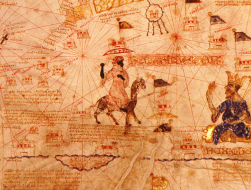


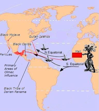


![[Smile]](smile.gif)
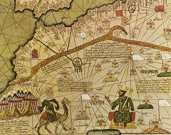


![[Razz]](tongue.gif)


 Printer-friendly view of this topic